Please enter the Password.
53616c7465645f5fa7a856851beef6fae932e6f46095d1ece671eb86e896f4d5ad4e53c1f02115c398269ee07f77783f75dd3fb1157ed256ad99c0f6fd2ff54783e9e0d23f37f467c159d3d875f59f78880970c726a3d33e78b9defa38eec4b0d67640f08011e758c0898ff96aea9d3d02e74c3db71c7789954db4b10c8ec34d45894e57d2d2514a6ba5721077bd7a7627712dc67f94f679e837591eb928a3886c9002c5888f52ce6d523484d87e4f7eee73226b8d0264263c86455d1b6c123771090e917ff44f2a835493fc9b5389c7a240c7ca940a0c4bb76df58720a54f5f32ff9d0a33317dad1d81198c506b9670df62eee6648a160292a4d0986f497364229167f745b058187e1c50fdd6673c4df39ce3ac3b903acf9f964b3f16442a4b654ec85a73457c8758fb6751385d58b56ac6f19d3c7e57f69cea2a3d6b648f2f26dd6409518b7a50f4399d507955b129e727cfb9eb635de1007d33f894fcdf7387fcba2e46ecaf86cdb0d4c09a0f99a69cb6467423a2511dc6b7a9f85e468986954e2166008181bfde3d322663e040e682d5ea2af2059df73231ae748d848e05d67fe3f4c4658eab98853d82e83847d6b865243ce5330b396a7a22a9a20b368c45aeb1601649bc652486707290f1d76cf42e6aca774076f6dcadf02b5f37cf21eba4a3e836463cebbbd791c13754ce593c14a52b800d7de06686c814f5f720249025b9174a6acd78d6b688c49ffe322933a675169deeaf08e45775481be44e23bedc93a6b6af292e623e8caf3c6a2bef3e8ef5fbaee74e07e545fee3052af8d4811ab917c88680a3ab099fece0e2083020a5d4f4e4ed4005b8a64d1d3cda82372be91df13ffd79721483fcc5f52347a6d44559b75836c4f83ce1aa6507b675ffe5c385729450eb2d0603f8a15fb2efb82a6a03af797beeaf3d216e63a087b47a4adcb61b465d536719e81a3c40d9c10b8c4325408a143e11ebb8a3de1cd7fef55afd69c5c9b93cf5a21dd28e04f6d2ff4c0dbaf8dbda260191b61398eb54571a14e12c5f95fd6044a3a590c20228948e4f7e402cbfaa649c97020c729067506e9f9264ebc757b978a48ffa607054901b4b9bef94ff6c99aece4cec34d46847fa4239b6bbbcf9251e7f5b363f234b64090c8333124322bbf1e341934b8c4864a3ed17c3ce691ffadf638b20e9cabb04894c3362706a80b0c5085ede9d020291533960974dddf07ea0a5f6b28bf5da43692cb98fbd2948c977f475acd61886f27d7542bd3d6fadaa1dac357a7d1ec7e16d4139c6438f0f7b4740984dab4654709c84eb6a0e1f017dd56f463d97c68c02d42a3baabc631a7ebc80c69460ba271cb745d70685caa76749d5e596d99f8221c9d443467b3c77b2ec5422ac5856b3aa90cd77176810fa66341c15229ef073ab0bf987cce14865a8a8bdfa86a7fea10602b800b645591a1b3c7d5072d359b71eb5757b54f2bc9f7d5b84bee15f54217f70e302505ab21b842dd5730aaa451ba9c9825c89afeeb088268518bed51052f989288095d604ada57abac8efb7306b84ad3abff2ff4bdf58c0b3eaae9e6ccccb4e7b632ba8e4260e6be939a5bd69e0cb6eeeea94d6fa841e908db68d34fcd7c83a723a22841a2c2ca8f4935706d1901e7af288ec0e771fec5deeafa0ac6a0b134aef7cc1df8782dd1726e9d3f438d9a0a133d1814dd918a444989ab44f72c17e0220affdcc62858030e83425ec01b4aea60490d2c92714cfe99b5a41e5d1dc073bda5fe3909ea8cdc3179061e4d8e47bb9bba271b67837f90537d3e12f2e7669c94ccc411f12a7db5c519ae864b8374e643e2ad46911dae07ee9b2468b059d433bef241e1b678d28c6d0b584df9371f62de72fda9a4b5000802856138e980d631e8235efe1c866ca650c50f00fe43e450aa02fc635c1899b58fa012903e0edeb74110fd05114da9dcafb7eb5ee247d131cfd5b493ab23f94671a63b3bd28b96f22c85b8c416dd1d2981d50b6fa268de58584a65ea627559ee8752d7d683ab21364f338cad7454dde8788a271dcb72ef88a574c9c19f923be2ef2d06461fb1315a2097fa7075b1ccd2b1b0ed1fc8fb3ae3c5cc21f65582911ce4efbc567afc8f97d6ca4f2be2c6e254318d71bd4d570bb57b853990e4edce47f514b930b8a33b285b95fafdcdf8e28267c41d9a605ba268e6aff19d638412c222e5ebc7d4fbfb504489b7b85d21c5fdb195954f1d6f731f2b2600dcea3643c41a7ec1042caf7e74730562b1dd7208b5be9e8c7f4dafc21a2276ea2b85f887488f4e6a447b123028f19036cad78bccb48082684636011ad394e696fed657c3620b52cc2c157bca13807c96de40a411f7d4215b4028dc465b609083d06b014903b810c84d3b8160e2c0e8b598d5b68a9b273a507882cef65c29e19acb469e11fb05752bed8a7ab0a1e089b545bbcbd44f250e342bac4623b602f8102608161acb009156f123e929ccb900c83b1360bca2452c06690531bd23b52f19476817c6ec2605b61e31e0b1e1a401cd22b9484295ecdf1590fb11ad96e0def37e162fe94b0663364418ccfb78a56fa866c12f8a7cb15215121bfbae04a50858a1461f04973e84ab24b64d56640635158e6107984aae613834382c011d15b01058101e72dced09ba0252c54f6f11566d8f587904f3ecb0a9a42ee2027a7a78c5ac1c1a3cb5badd69176fe6573e48caa790aeb4cdb42b0bdd59f6f82561d4d976de01bf943448e4a0c189a46cb42c0481ab9f9a0f70cccd1ac248317fdba044d8ccf03179b284b10799f0bbde9d5b88613f259a6dd4ad602ebe9ca7604fc1a268aec17536ebaa76fce5ac2f76fe3f1439d1202417211add1d2aa89c3151ce44e10215d03ef6b0cefcab864bfbd07cf63360d6bf658d88965a9035b2efcc81832faf356d188fd1043286650b5e408dd58ae4d602beadf7d580266ea9ead8df210f6ad777093c548216af7f1007fcab0dc35466f350f0ad6a1b759cbbd9ced2d78251ae60af0f534800fa6a8f7fa221dc792447d623738f754d72cf6d5bccf61e2940ffc4cf99bade5dee6a8e187afadb6b1f1c57626731e07db54cd749e1cd2a58ad643f61782f1cf55d2e5c5378746feb66d2e157b6ee425e21141d672a77f9021757b227b7149cfb7a96173e4ccf15de0b93596b5cfa50f8e8e7334cc45706076dda82413812ddd18715e694e3aaaefb0738be4dc89abdd46f4516cb3bbbabed55bfe9e5d3ac58f9580d0fcbac053c1c331f0f3002a4626c649d34694d50d348008ca982b0239b3bdc2dfd8b1b81e417c2e082483b5637b6cd75733d083feca3eb7733b8eb8e231f39694da0071b5436d16642645f6e77c814bb5b3840a79e782754c47ecf24e01449195eea1c613fcdc7d96e8d1c9ee98914a8c6b4e8c28deb70c8eeb2d10b8f3a72bf11884029f8275d97a4e1ab091d77d5166ca9c5e3ee62a7c9a394f21378d29d78f9e1af761b3ba32d16e8e6f6cda232095b95c6a0bd456e2c80d9f2e2ec5101b928f702fb69e95e864395de4b44fadfb1f2110ecaa5b9e3b94541d9d54710fd9e590aa26b1ad5bff7f2405e490bd372aaf249879c7de95f2a15adbde25e65bf3b0458782ed880720c8d2f70584968f0f82e03bd0a3ebcbf44e546bdc745a78b79a6588649187793232a6deaa7206b857acdac43f94a8f40e2a82d1ba3f1bd3388d98469a14514e9e9dde5f6aaab5f82ce27852368cb64b65cf03e28967f9b88ff6f0e94e704851c847ffe46fa159ae2b49c7988c38a779c89f601272037af502ac26459834baa1f037580234abe532736dcc4c70cb8c474c7f73fdf3749b3144a46c9fa7c14d56d672005803a122be217534cb485ab662cb7855b073511a5b6a13a8fd531a002980b81bd46275145538a5410fd165e0279222b1f0a48940b579420111109bc8b5fee57a54d88ef79dad06d2fa78fee16b9071b273a6a22bbd0922bee9ac08cf041e62e4d9ec40eeeaabdf98fb6adc2a9730ec5603c7a1ccd74a8d9a2459aa8026e6a265db15550c966239ff0c70c124ecbd67cad57bdda18f15e3903dcbde83518d90943cb0a6f8c005713499ed63c03e666ec6c99fe874f84d5f5a61d6bff23c210665490e37774d10b30703a570d8f28a120edbfe2cd296692f9b6cf8530786ddc01b88adbd944f783f66f9f4ab121a52527fcd833feddbdb131a805477ef221f05178b2f6624b0d3e802103a49839dfb4f54d1e105b0935f2df46d3ece43bbe5f958f3d6402c21a647a9abd2cbd8dcadfb592a361e91ff94b5bbcbdddfab1183a63a1dbe0a3f3692fda2cce116858d761b4a4410860c01e2cec4ee2a87f0d39a9af30de61ff73a93e62e22a33f5ff728b601255998ad17c83ba825e698e59e0a783c6a49a0ced0653061f54cf108d6afffc1891ac6b8ac4e1b897ae1c412dc6024b840fdb4959f3cb466e7aa7951d1439073869ec66916d66ce00df2e109ae8dfdb461015e9c4b50c7e1a9a9bc2813835133640ccdfa579225d80606f9ba9bd245f5b56a859b6deff0572c0b023e38d262e8d89b62a01a67e4a2c70a6aa3f46f4892d9499c9fe8ebbaf35f48d91b87522acc590618ae14c1c85b12d9ca724c6bbc4afee971e56027d504b0e993906e4ad6f86c8f859a2c2528752c55b4004173e62a0cb84e275564c24abaf43232e0a9289cacf358714cdf563aada164a30b5157d84cb8d020dbfcb6f22fca0d3cd6bcac030a17493882264c5df1e27bd8c3fc4b01d5f7622052d159b054a2ed1689c50fc3d9c83deb29280a755f7e238d3fbd4edc534f0db2626f6c9b7204a33437538b1aa77e552f40091e7982cb86a6abaf9f02bead2ce3f6a8116c6068a120f9a6c52d22408c79ebfd65ae48e9d0f0894ea5674dd4767a10b3ba0000db6535a07f54d1abbb8ced9bd92649111a27626a8e91f17b4f08d36d1e78ce3d17e20190b9158a0d3bbc7558f08547d561e02694711455b819dce0589b8fcd70135324a7bbb37a35c24b26f1b62c204cead3a055e7dfe8c42384f0799a21f9d4b767b087a03162926a6a3f259ac21324b25783a45059d668bdb3bd248abd6ae0a49420eceebe3ee954ce3c9046f2516ba38a9f029a24d09dd84dae8167db951225a3f42a8068c5bf9bda45f0c5306f4f758338557abc2ab6f9f9eaca45ceeb803006db818463204276dff629a9cf84652dbdc58c41ef71593432b4f5cff706433645b119a913855974b2b16764fa9c90ab0b3f84b7e274f223d5448e2669877943f66f8c4352124500812e2b79695d9dfd3a531d5d12ede9eb5d4dbf7eb8f4433264eaa7b8780f06a69c3d784d3480ff7df22987fc1eed3a56db9e68654aefe3e2a3b55de8409e6f225c356ecb288c12414226615ce1000b6a80152631c27f98e18ce5fe23f5d26d08642a02f8afffaa7b7e0c2b7d8cfbe2ba91e8536a1b173d807ec5783fa8fbd3a8e32dcc27d5355bdccacdf1ec4cd28ec5ff6f8aba38673d4281209d60ea5030867049ecf455b1ab651c3c6179da0df3f226eefca97fb57fa0e16dffdbf04a3d14d037162dd7ec6c60ffb7fa2f3943a1875bc2e6d7d1338887c41d95c20e103812b02c53ff51160d166c7cb3f9aa37887bed720d089d5ac8973b0cddd6204f79f9fbe22cc8fd50b7e7d00601183b78f66b7fe85345b32f34a59d9e5074d5015e14762593673502654dbe4cb6a99e1c2ee5f556a4176641d19db07af3ecc2c0579173609b177e69c40740617f2e17ceb4d76b9a5fd48cfb9f24d441df5680843fa798515d570d86f588e3dc3f1d0cb4d60bb615ceae02eddb921eb1d22308ab36cf6d466d834c1166bcad69bcd4df46e89cc1477186cc77b8abc888c9594955bea9badb7acff29f9fa379bcff75d4b2d08863b24406a62cba6343843ddd609b22815300bdfedc0cf360c5f98861229de50c14ebd0a261030123ec0b7707d47afd2a20be45448a55b05c7b0447405e2f2e12d913864c9579834b4dbc616b192e2722883cc77e45fdcb5a94553a49c6a1c091d98ca0a63b67011c79931512f832e23ea4419507399cdfbac6366b1df1957933ca02fa01e03cda79be2f9cbda475d0b7b1aab426daad56b0517468ae0540b8b1b4652f3d2f1553beea2106b928ade17a0ed0577d8d16fff791951dafb35f70bd23b644e9e3f81c311d4f280fb4f5b0b948b2f6136be3f439f548c17952f75923bf8d3a8a9f42ebc6a9854d1e8f68d59a6cbb35deeed981a3f70e9afed73bb37d47613d29088f4f9c7fb37614241dfa6a3aee079e571a231521b06a19b7c7ce5ecf2f014227f374149d39dc3806edc243093569e4be391b78845e6c17d3de3531208b92166b26162c3e9f5385e8ac6eef60377f4c9c121f4b075dafe39ed5f2ea843d6e2b9147acacab81fd76164574a3dd18be06069505b8e2796e9272aeb3fcb8d5fdf3995a9538dcf5f07c1c05f9679f7f5b523515af3f02eeef9e6976e51e04a8abdbe9ea5ef0a41549af172c6de6a10b3199944e97481d9be13b38355fd419fee3a5b3e0ad9789cc537e131a4629fb1431f94b896d7b0004e91ccf7d2ec2876694f6324c91ff6f74f8d195a2d12dcf92f4a5199eda539fd7fdbeb1276aec4b6f0531a6e8800bf00f1ac9f6ddca01046acd90157df9831683e890b6bf30871e11981495e4ef416bf21d21e90090873540ee036031e02460feb7a100b20fc170d795011e4a31a8abe2f881a40b92e873f8f82f78d44c78ac07ef0051caff13695fabd40d166777eb9c92a17406cbbd1a7567ae646dfebb386a5c1d81b374077e71fdb216e38fdafc090e3f32ec469168a33f6085897802eb72f9ee8a9b200e5d85c9b26f771020129fba238302316fb388bd1fc6aa3a86b81f4d69a93bde060522c7f4e661787655e68009ee063a94990bfa33ddf17c2d0104716d31950bc66c9db81c85405449ef601361c294b2e0ccc58cb2f6ded80659431c31a21b1ae9ce199f438b645d0f2671d626ece6d584a61c6552ed1db0e83191a47c6eaf27f10ec12d78479cdf84f0296f683228bd6506b17689cb08627850a3d1c00d834f6aed20f11af7b1bbab60b551fb8cea5048f0dc276103d875516c1f9536bb106e4c4872be1ad2cc61b6ad8dc6e60bb960c9e745eea09ea233d49c35c0271d5e06a8c63b18c4c3543fcd7876e93e0892b70abfa3f0c4ce7e5b4080cf64e50e481f8d6257529176f46543aa713b295b1b06db5860961c2d3e42fa10ccea40d57b2cb66a37208590bb274e68c5b1488829173b9170de50e232819296d955f6556fc5cc636d82bc3ffe5f30e538356a0f743f7a2e5ddb3424a137019a7638122373e9275a7c7c571ef18a20e79cbc8abe94fd4035811fd529ee888483cbdd167fa7c8a9b5c5d8b3ea4104aa1cb9a0d4a71ad504baed5943600f94d3caeed535bcf3c8bb193d539406271ec8eb38836d702f57db4e70ad1b843a3770b008cac3c1869a83423756f200d0214ae0007d3db0bd30e5a72cb58446cc1993a8c948fcc2dc76b2096dc1afb745913283a0d660e466b3dad2081fc68aa6de6ce08f46b7302337417d4599c44b929974c17dc3fef703be265627b033dfe95cf7e6be8e48d3c144f537e4139cc1fb64a96b4c2fc393f0b8339bd45f59a7ea483570657e0f15af66a94e5947f12e9f15d0e04b7281ca0263a42db95b40a0130cb947e1d4ac1690f4f7539fa714bba2e5385528a73428204677ef714654e18af29cfb170065c9ba1eb11b5656ca11a5302f1a8589ef3a138361a015135be717ae3b35c63a089bf8977bcb47e4d17d709f9b35b38b894d664f9ad9d4a445bbe8fee9205dc72ef26196a53602a43d8c9e89a0a7e75aea7a317ec9d36a48ef5604869f8e6027d33935c6485cb9cd2df8d1f875d2aef853b52b80eff01e28fbd307cd7f5d8a43c0b89981b283ec51de55321675b841a257ed75d1aa8cc74c29cc85035d5b3bc7d9486ce29cf158ce544b43d4b83ed5c679d2f6749f274a82093a04d136f1d90bd80ec52556f2712190c8fb0a8f70a606a5913f3c00722b40fe643e232b11722ce35f2b63cb4591a1e7028f527a3992eb06d0ac3e5508551d977012dcb791aaf1471b747839215e04a28acea5c3f04010aee48d1c9be32491a5adc3eeff888887ca7d3fdcb99e7b286fba7982f78877205fa01e7a17ddba5cd1a225cec785aeff579b7682aa5fb39e87bde4c90e40907e6039d7aed74c8d3c610342c558753731ad21aa1b3a60bc4a5c25ea40f1fd0e2cdc4bbbedb9d88b48c0490661fd6b3d7e468db771456f6b0c6d69cb5e4751b7ad167118b3cbfab7e7fffca06292abfe07ea7e6fd0a12c5408f040d54d2bba0729e89b48cbb42bd10cee85c5ea5b6e9033c0aecd09952249c9d6e819936b412790eb2dd962a75d9bedf9d743f577d6eca283a7ad7537d2e31dd1083494e47f342442a541cd42f5e83ef81d4ef2b2df4eed237e580da6a8d7aa1ea5a72b24b822f87b66aa59b55e0ec66e3bd7561870fd99f1ab89926d8d9ac6b6966e5fe809d0c7b59f736d9872b9585b76cffff4ef8e1370bf49db9c218747513abec69231de1e3343445379c51ea5c548c7750aefbef06e45c6bbe044f567f14435e4f8da8da7ea381c3f98f0e3b04fb4b6a00aecb91d21762a0a136dddf9f40ee361d18a975eed8357395a661ebb19968e34184a5702eb314e39e9dfd66c052e5a699f5637c51f4d559f2b3724de43ec0c08a6b2f4279bbc633d463736477287dd3017fb8af27d0de07256601e5ad54d4d5faec69cf0c2590a9ca4d3092b36a82807579849c8003d8e60aec2f48471083b0e938db4d3dd4f08b7fd434a9017e8ecbd744faf0afe0d51247653147ebbe7808ca45cbdaae0b174d3a029b30e81fcb775c3d564578de664ac5c83e76038946403075b58923b879e38e5877411de8dbde41c7766e88b2984b7f8d35d444b37b7c5bb1b92632538192e668a5dd8128aec34c013d48c2c35ed5c58438f28f90f8bdc33d8b524dfb9121b01fcd0e8a43480bfe3a7863d0ce5da4164efa53e4c19aafc36659acf3e5e1b3ed7547b21a51c9a8bb353b1bac1474a6e5387d8f024b224e7787f2019cfcc412559afeb4e4cdb94141522e3fb9ebf7cff24bc2b63c5882383ed1461add9b94c728301ac5c0402d83c7a439c8374cbc0f4b5eb152de755d1e1261569448b22f281a2e147c49268f5037555780c099ceff2a53ce8621526ae47e441e41b341408696374b17fd1749d7a9bece8d3c20f3aa5bf2ced6269e4518ed4a99c4d20bc6702e1abf76dd88324947c06938acf5d324fd28cfdf3e52db65684670f2e98121970877409a25b16b19ff8e324729c673f9036f8c96fbe47c258b9835522f5717a7b6bf559c8c82a99b5aa5aada5d0e828f42e6b8df3479091ad84a2dce71327be66c3519470214a90a4d7fd4c86b7fa80202282fbc7888eabf2f8b5ab392e65ec116f1c74a62e761ac520abc045dbb47db14b409d0d7735443b48ab984ef768c125b051299af7df8dff0663bc141d5f53d791d44f801eab321cdb8f3ab0c81c3581db9a7b4b1b501eebe400f4a25dbffc75e4f141626b46f5864db78a02e5685e9cd4fd3b71700c4ab401e29ef25b2389042d7f38e093ae8c9639ab73c0bbcbe5f64a5102e34ecf7b00e434d76a9bf8d44c0d304a8be878bcd8f3a21dcbe8e86c05693807e8c1e753eaedbf06b0296f2c565fe01cefd77a08d51691d1fca81bb6a7d06967474f1b91173310da844ea8c8b2032b9a6a8f1e02db8801ae324feb69f4659c164541d5256f2767daea1975ae4615b244041381c5d56e62a50fd6a2879c527db7462286461ea7e705e542e9081af687387b010f6abd090ee87950ada66009d71f2b476aa2b26992bb5760fc074d5bb181e24610f9dc20e1e8a398743d2377fbdc97464bc4a6fe4149aaac73a82f593c6a5ab7e0fffbd8dd8627dcc6e4c648296e221210a2b830c954ec65a5bb22932ca22383e688425ebf0fa096cdbf644300a90d4e3557f5b52d5a3090309d05987c637e483a35cc921c6545343b699e1436ed53dab27daf56865d03822544accad31aee22a33ff93436dff4fd4c70ee251a6a2f120387555b16a184d64c431649b795826bfe11439bd834c8f5a74d23dff36b15cdd2184e5222d063a6e0fda334af4435cbf0294eef4a9afc5b7413f3211ef56fce99c79d632b1ae8ed2e10937f9864539f5984caa8b6766b80c8647a8ea5a4033c2d30e0f51eb665bffe7d3d9b545aa7d12a34ab3da661bfc3b23af86671b2e1855f978a779acc079d17c4c17caf0fd534641295a5a6dc607220d58e445c07b2374e67d4f693dec7dfc2a05296d6159c90777786e201bd74875a6667e7c9b106e9152de2a2feb7aee050b6bf56a4e7156424cd6ea2ee9914a7d72d3c254e136e8f3335bc21f64483506631bfc5645c06ecc94be07c35a00848e23a31cd72abb359c7d94dda3c9896b6b377a618c11529613184c6cea091a9019002d64ce3d53cc5400a88d662e86c1b64c946f2943b379b2bd652cc5f5897f459fbdca0e8148ab9b66a8b54247745700fa3b83f1c359d4485c1b4e0aba733cfeb5c742291379529008ee69598ff74816af720c04b26250d432b060c952722ec8db14f51bd250f8f5772d8c4ba10cf26e6254ea625eaf696652c848cf85ca36dee73c42d1a0249e0a230d129ac176dcfdfd078ae88a293befd8bc3e50c91d1941f6855f7fe4d28e80e80892140cd05022740445fca772ce9e4af961cecb80efc3a7186010cf8b35d80505ecb3bad8b37bc0eded7af36b2b2cbbf253614f09a694382d9950d54913a4b9369c0d449b47491d2c2f72b1c4658f43c37b59c2dcb3a141ea805eb01859f7812f71866d4da2d28182e1fa0fed1cdc43b4ce7f1a4f810fbe5233a8be7428916911f13128cb7b9a7427572da1bd00cc5602ae04e799f33877454aa2ac0b68e9081a07f58cb7ea9a767ec62623c0551df74e509112a6d6c57a68b752dc51d16998b775fb5165e1449b97aa51ead2e453fa096862e891b7ab33cc20bec9d221107721a404030ffaf9faee0018cb62bf92b1869dc7782d24bbd525004565250f49a004b446b89473847a5a7f7fa213a594f17ccef1a16f89f552bb7e3e51be1a7e0802a44dc12c61b1fe23ea8d78841b6ddbbbd473df162340d7fab4f7ac67282d7f88a53a58923cca139787e3c7ed0bc80947876db84c7c8697a04431bd8025487ee4338c3ac7b7db87aa81a49e50b19376edd4cd0ef49f9338de2bc4cab3b304de1a05c43fbaf72cac1cfc5d8998e82850007dc21f1d18d5d990f1dc1898ec9abe5d6eacfcead5a228c9f7480fc750fbfb5e4eb6b62083e54a9bbe75ea4653cec6df843d1757e733c58f058ccb94bb1dd868e446cf00c1751d63c63754ac12fe8f9bd9b570e3116e7599290957557fb36f10fe52c739e0829bda3c22a7feff69a61bde32d4a44f6c6a090d38406b1fbb67bd53bc88e72a277bff7aa1a2aef664f41762c6fb919577301dd2b0c1a14629739e20c257b71047bffadbe6cc3369894b78f2a79430350d70e41d750b21a2fbb607689d75acb64de400f2772bd087313724fd9fa02a93efce9b624c3ff2ce4d99ca182a6f1a504cb5356bc6095cc3f2dfb5e0f9cd7e72eed1ef1963849b9df2d3908810bdce8ccf00f7ead6297ef84393a360bc880ccc3ab29af4568446fd7e30724e2ffd51dfc0299c7ba15a6dc39ba5932108f8aa3deef6113763e5b13ab549302584ec64a74909cbd3460d73388508925a6d4326eab07d96d118414c6062a7c5b067df46b227c0bd4501a7d6f86f6ecf8a98bad3487d2648cd9a4e9a0572a538298424b99a99c72a0e2edabcafc36050c062a3b42eedbdf6c4bbef944bb4062dc9e225e7d5c54669b0381d04048d355353aa3506f91825bd196aa0ac924930757a2e6af9c7c638b117712eec7a547adab9eb3221c11d6f79b09b72fb1889c5c01398b1954b212d0fe9a150cee61443ee9e5a6e4de6c737aaa74d686d6cedcfd7a07e54337096525ce6d150ce85162fcf5ccb9cac068eb12e1680924ddc3b6418182dea94d4749dd1e9f8e117c67c75380f6871cdfd085f3b94f7f0182cb15bcc64a14df65d90f20492f13de164a544566c3dbff81e370fb51cb20fcdd74672f812d4e9b7e694764da2d1fcdf24d0f24326bd9d78850043cfd2387fb6a4e49087b8ae708d715367fa661054b2328baebe2d2f54e61adfdda7c872fde37beb484fd68fe22abb2cc4ff15f23c01cea6c194dee900c0bb0d3c782c687dd668cb99fe4a7a8963a6e6fd61ae17ffeda361e77b72c9846351c164afd1685b75c95be10d3fcca6237ecc7bab831550c88ac88af3f4f9e64bba4bc1a28a3cce36eca5176d64474ce6811ea7e6994658c8582de8936a20af0308474291c98d048ccf17ba4240826b9116f4d44cfd280cb6a6a7eca8b8160e7bb3d43ce48d99cbc8c822eba6202dc9cf78609d4d088514f9aeff0fad50319436410e8425eaf56d49f752d08e97f7cd36749ec780bb16733d531baf5bdae10e89b5d4c0380d264ec47f97b3709f643073f4571a1047cc96732d784ac92bf9f5ca4005fbce26043dc4ef1b789584e08a6a28ff543ad3e027a570293c63a081fa26f1a4ea8b628390beb50062617e8b6e3cda3a583b6df00fab3972c8a1cea25c0b55d60a457fecc5c80d7330005432ebcee883915bbfa2e9c07adc157d60ebb4a959a08fc66bf7c307ad4efca3d2524aecb049f4e101a46b6c87dbb48951a7bd1f6a9f362670f3dfaa4eb7b064621c2a50b5f1117a0c980446172c9ea520a25143679c8bd8558d1537ef222ac1a45569ed38a35ed0092eef8ad68cf9fb23e9c507f0c5aeb4db1ba43aaebbecf9120c7f70ef63731f44562ec8ab29e0bf14800b353043d1d579a18f808a649d5d46c823f684d044c79aed6caf8b77868c83f9161a68f6f5fb85557615d3ad1ae3030095f23f21d7479bd2a4fc676175621a058bd40e3781f1d1c9b844c4a40fb50ae95a3cefdf90ff5e801eca9529a4632049dcf0bd5301570dab76c3605484c84d46c449a1eb2fc53b1073c0d87114415cbff42c71711151d84c4d3ebee0207b38465c43036af98426f4eb67259ee60eb506e0330616d62544272d949f42bf795ff652536d8b7a7afa08a5762d1ad690d44b2775bacb5c410b7e7374cc06437e82759544e1569f538de5861a4f9fc1eef7f00cf344a5bedb9b8eb32c9f54690c28294f11b069fd6bea4427c3394443d7ef25518d208e5275cf9427a7f8aefb08054f6291a613e2517a0242f458063bf3f126de205044d1402929b3cede62c958fe68315748c801cc911a3adefe4a40ae04a09c1849d11d653923e5a0dd4b60ebc57954a0685588b19369721de39b5292194208210c97ad23c596037520f51bfeac4ba2e1ca61f1b541b299612202b7afd42298f48de5a47886b00b5aa82df702649146835f840e96c5ee966eb003f523dcadf17235aed5edaf296ec9d84a421b10f12f4153d28368d819f9efb456220468948c03cf6d087123707c073bcd0141595ff0cf113f77fec63246458ab1dc3f785b7a55c43f3c993f8a6d8d6344383a98d35ab7fc65d1e3de0d34485d5ea6ff7dde7c532755305082b98f1bab2917b42d4486503ffc8f3ce44793fe9a1828294f3cab24b5da999a1c84d8465c4e40c1cb9a792976614c91b3f791401f0dec4c76e0155e67634757537f971e11aec63bb2aed58bd22ec0337e5e55a16f237a16c61fe6afafd4557a9ff14a4412c394b92b439789a71f3d9b5d617ae3741aa61c5172347e8de79bc46849c2f96961cd4caa2b2905c79f016a0f0c2adbee985fa9a9f6eacf680b263301f9007572ed5e1dad68c74aa9326281650f6594548a2351634b6fec43a055b4b3139467e986a477ff7c34b54fb6444e9b2ede4461800ea7752c3b9dad085e818895c91e0497b0267f5d3417461f3508c187739eecf2ae8de2ded8d3c8b2f0e720ddd9cb1ee01f79d359f58b6444bd210ed9d539ac7644e4d097c3f73d755b3e4158a18bbe03635cfa9db98465e1d963b1ed16bc7f163fa390697965704d4179e2553a726ce39f089833c800ce43eb8515fb7271d1fbc2defb0116c747fbf086da45e9b6e8959acf6e619803ddfd29fb3941c338587692ad1a5790f3c2a731349a4b88c391411b866562e04b44979e87e7e823d6c1829333cf1a9179cf861ddfd985d1e43cb2120c2ced7961ad759421fdb537e4f845e7c0cd65f7ab3e2b3c69d4778a34ccc2afde6b5aaf2a8b30ad669999fa0b041cf5221a26ff6d167c647966a5fe7731e26a1460fa0a2b230d1b5e1ee1f63486be6c6d39443a8bc2ef89e9eca713e776cf58e890f3275d588dd7bca16ecec2f6110a01b614d76e4656a985907ec7adec8a009bf947f493d58d78d69b48592bbadcedd9d5517a1b595389a9a340da4fa93dc4c198813082f2bcb94cdd699fedfa2c116d256b86c906c3d3fee7cdc48c22c60654d85052d41aee1b5f9c27bd0e6f0777a95e3478a5139282a39f076d4ae2ba7fd971a0d02b99b1f8ef9cea48166f26529320d1035f9f43f00bd83ca5d0794becc6c6bb5def5189fd1304d6b5eb6fd7791eef5a705537c6412065d77be1b03df01cf55e8b818e61ef59f70198279be0c27507cb2fcca912e7062e144ca638d41810997b29b049ab5c4c60b07bc52b208a8e6628e1badbf10cb97a645a40696778cba55de8563b9d836cc2f523744a1875fc7b7aa913b2c9cd9f2e562c59b4587687bae971af6e1a5fc6a971cecb5bbca00d4a80662db0fbd7f163b11e41998247e2c3c5c491c6312e1a9ee6347b7591df178edd161634db1086f6297f82a76279fa19bf344c906afe092627384e37755d1a895bee771ef961436e69506b1725a42122ca463a785478ebeab86d379f473c143fe94317189ff2f21bf17b976a22f4d7ec54533fa534f1a41082a5edc0bd6f8be0657a0d65926318a1b5e86f8b1f1946b6a866aaa9197f861eaab9cdcf7368a8223ef2c54a757729000214a155d17833540a1a0cd59bddf070ba38d800d3f771ab1738bf91337f655b8ad76843135de7f243aac1d1f0619dc98d68e8c1145971449f142f31e5a3b6f46cf5eb007ff06fa645d6ca27474c52ea44a443b1b791a96f75e8e1963fff2ebe90ad0e2b37c89318734dc92b10790fe6421769f0b5d10174c0fce81b3f341f0898664fdf563585b50edc2522d587c424562286e5b1d73d6d50991b29b4ac72250ac7f655ec9be8367360a2254f5ff78f560201eee6e2b978eb22dd5cb8b9d79bf62bd85f34c3c2ebbdf062b9b6b3916ccb47a72b65bb50c7928c00ccede2a649cda13cbbd823e4b109a234569b220dd771106fe5c14a5e07cba446cd81e0aafe41348a752eee0b6e98006253c0750fe2329cda196666b0fa2fff8ab4979ffb91b792e180033f8d72ac241449601e52dd74ad44eed47ef9360517254d7e9ff366867290b250489cbd8bf9b288ae2a273326644f4c25ae17f6c562adac3b8388921a53bfc1dc0e2395f7f0fe3bc639e478684172a6bcecc9fca0622aded98a89557e7cabef3a243ef2b4c59af867c6baf6ad41e8ed9c9151828adc7b1d6bb81ff99c5568df8cb02f5b8105fd6d4d08dac07cfc9bdcc26390f87dea51be796f0e32bc7dbd0239715106a375be116abd2e9b270a7f5e01ac637ba60cff94fc13b950dab431ffdcc4369a3e9161b4c3d826039b4a5b0801f39150bb8214c46ea2d2876fd561c3a973b2f2ce8a00e980fdb8a93541ae9bf127c6e27bb290de0a43626d02ef943398e80a1f423423be858be38c1eae891489471f9b45cf1649a8dfcc8af4b6959e979f7ab62f8d51a5686fa26ce07fe505c8c74edc0fa39165440f5a3aa6b995ad24bd08824a277186f3610d9ec6908e4fee1fc2dab1b292bdb35616902da797b6669dae909f0353e80f3941faf38179c7317451115a65902a5e9138b75dcf3fb7259401862630d370a430469d96e38e6d22f2be672456311ad36fd7fd78980c82f5ef835f7f05b8f7c14ba7950a708541db7d4958ea58ff55da8aee3c70bd71d3bc65ccaff2b193028eb0e7d84b7644bb93dacdff1e3c56769e491003c25a9032176861cf8bd5e856ef201ce9500801faf5373e602941a18695d49596e8309ecc20b234dc771baabb1cf52cb88f7db5e58f2c78ce44d0f68cba63d2523bc16799361dddf762d7b322526405593ffd12ae4d97d387d5e4c76114a7cc14a54858e08de965099a5ffe6dc83c330839eaab51c5d9f57a2646cb6f9f2e156ddcb107682bea9cc316c8f4639a282f15ee9c9349dcfadd26d842b47357144e9989f536e83760299541233927586c3e1d9f88e6414336236c6bf0cb95bdb9ad77c3d5d262efbffa53f22cac126434e4b7dfdcad8a0cebc5fd89c1ed3d71d85fd0dd9668453e6e51382185a294190029ed381ba34cf7eb340b160cbafe42add3cc3bfc45136aaff0d44e8266bde9825fc78a76e4218147759f55be8996bc0e8d9856267d0c166ab985f094682bdf9064ac1f1456634c0874ba204722f19e9ba9ebf51435d2ed7c03032e25fad1e3acf10dcbc9a10dadeb4004f8a326734e5dd78aab0ac9d1692a2b6814246d3d14e4d3193379f33c7fbd08330a6511169a42fe9af1827ec80acca8d6b4aa74bd823269960d3d556470048404b173c5efaec39dbd3f8d73d6aecccdb4ea17f6668957f683e3842c9dd0d44351861d231882c9dba8655fe0a38d066ae1fd29cb20c09b7c98d66395eb09bf8b637007f302d96675d59cd9961fd42adaaa62c3b2cedea1ae1da18167e451ce1e465e925837f9c5340547581a2e2b05ceabbbc77a708ba33db2d748a9743725b929f14b3dbbb674776e2a01c5d098b2c9ca998cbd9bf5acc6fd5d5fda1be6c3f8ffe2b69a743c02177315eba68945ce7bd1fa6ee8a4f2f84459a194b41d71ddf6cef51b89aa9304cecc86a45714d2fe0c5640295c0d4df59365a20bf1b320faa351f9f9b90a1ae05b3da5aa026a2261f7753ad50dba50d8e573c630c9556960faeb9b3f273d71caf58747484d5293a15f7a1d8f484fd8378b5736946772541f810c7a357037aa8dc331c5ffffb7c12614f36125cf119c643ad02c22d57cb2b4527309704088a3a089ed4cdc2112ff68aaea5c340e7e8f99cd225382752528d55afe02b5a95f853ada459108603eb0f792f5cec02c96eb30bd5659d30e154eec5e69fb655cc7803b4cd783fddd6c8613121daba3347896b54daaa0aadcd8faa888c573cfa61bb83dde3d6719409687735f1f2b9f5050e484a5dff5b850d275bde6751b8ebb5556c5d18a701d57b606bf49fc8928a9c45e61eb2a8ea8ec33ea00b9b5c7d0e869055f046b61d79f3820ecc090d7aeaf0bbf1065818f3e301377007c5567e597b1282f826aef3c8294a7d54e3ffa297c7996bc4d69b5d9c9fa153dc1ded7b4325e762d155afc19ac4ed35fe6884c88e3f1546a99b99400acff63a9173c1e22835010a19dd02a60001b64cdb4d6c75d02d64cb1d79c4caec86bcdc1e2addaadbd0bc0b31d9995c94e3f69c46d83267b60fb8b63826b9e88de46728d29335178f8584c1e35dc782b0e16d57df5b2716e6404c43f372ab4a0159155aa149881c4a1023a0f7dd3db7a5089cb6adef47a07fcd2963e1bbfb9affc2b20318d835866fa378d9f5ba5e05360f83019cfefa8413802b77211a8f15036ebeed76bf86d470e1adcf5d81b2e742fc666810bfc58a0fef322a473870dc30336b9345a157a62d18ce902c4b94ae221954e8244c0bceb7fa443d45b45ef664eab88e07048bb90922c9cf5eedd2adadfb46701af2de343b7b34b47d14efb405f47326220c9b64063e75466d1ff3338b6f52bdc3acce1b102407acd846ea4e58531a93c38260b69dd0472f915c0706f00f0abb286794a583f5fdca83c7d2fe56d194543b0632764d2b14ecc5d994d728badd760c03e3fbd4c426a05ab3ece4cfa15eeb59aa4e8586b00b5e9a1338491b6d02e110d61ed44cf450b0309cf394989bf660ddb4fba64ffba38cee5e83dbff9b31d66ff66f2b2b6aa2d8fbcb70b3f39dfae0817c7f38e44e4b75e1baa63f6984a086a4bee7d872cc4f1c8fca77ddf581bcf7de91105298ac75d425190267c70b3c214d2983ced79b20bbbc2d7ea4665d3bcf8ebdef5369d3c5b8b7e6a9987d0307f77e4a3423768bf351128a67458e6c205b8e53211ea253d1ad88f0f995118b909ffb94183f968f4ad80a10542287db3109f03dae6bfdd73fe9b00c501be6b8d1ca0ca86f7cf43da31ad28cc8fe33eccc7be10f070ba4eec6a6fc6212d3b73da08cb214810eff5e228401b7e0cef04f2cb64868ed7651b6a547c4098ee8b05da38137ea66752792f594b06200da913e17b0164ae10086b6c3254f72dd18fe2a3fa2e1802825fc1aa5f7664a07d4c9169b17e997ce7918859b14765755bcb0da6dfddf15994b8485f4c127a8c37312054efc7f867bf38db93cb3b5be406bef75205f95007ed6d5ef89481bcece35d7140f6fd6696dc55ac77d9ba548fef540a44984f357b5efe67f987d6fd8d2b3f350271910818512aaf09cf7e8cc9a56c86407b56b40674123f68a87edb7eaab202a53753ae8e890ce0d4b6cdf93533a466b51d42616bc576afcfc0eae99717fcfe723c8282f4aca3b97f57cb4618f5c211441d37da2f9178abc6123b6a82d8157dee32a62ff294cdb9c3212d151be477d64228d51566cacaee9d1a7f3bf3c1cc59649a700aa21e858ce8d0117c4cb1bc98eb6435428692f2a39a418c0b0d6daaf6e5c16a3b11d4f2925d014f50d7fe4fc1fed790eb8ffb491c9d2a5e4cbc4bd34744194ccc712947b8a0a048af2d0506e7f086610c6abcc30989f999eba4ea703e7e44cd7c24748eb201f5c5a8f67c3aab73a35ac32ef381a0cbe743770e084f3f8d18e1a1028a2723bcdfcb2311c90b670257b2f6851c3a6b3526adba671f8f7224fd1b766bce3181b094199f020a49a0d6e6944aa1dbb2cef54541d612346e026f9c1576b4a0b5bc71f5bf358dfb16b7c77287a5a863b97695260a6a46894f051325aa255b515edd651696f109809cc4c27a59a316743cf8aae1f2ffc10e67057f1d3fc897941b018e4d5f8927d134b95e60be3368904afbb1f629745b1d7a50b8480599c336eeaa689dcb42c3a1b326aebf7c156d532ebed7c2d42b43c0c057ccc1f23375b45b3e48cdc9774dab76a44dff24915cab051ea3728b86167ae6dd5287334ca6d74d7554cadef6011f28e384efa1b221f02afbf275afaee26be408f763e6188cbfa3406593cfa99ec730eb146867e1c1708235fc0a03a4f3522844c4e1df672a5a76bf4e5b2301166f3adf4f8800ef98cd06e3e12c277a158eed2d9e52fe26a44a00b2c53460054aa52033228a47a2bb014268b7c5cee8f2500acb5213fd401601c01ce6770c906a8dbe21f15141a5f459b94fefa16d71a63ce94fb5a1eff7d751939c4837327b7014d7f0e01c877cf136205b8a12f623e5755b6b32d961565d9b18f3b5127a614bf660c46403b2fdb6132bfc549fd8c7e1b2cac4eaa8bacaa3c059d9b7889ce13d23507c2615592246a171abb7c0516484d9c7cd442d8cca1edf5121855d5749fe66bd2cae9a5667e39c761862237fc1699e817097ec629022acc03494a79d43c0f253dbcf9b7be7aa153a8003ecdaaf7c4d69c6f5c18cd8fa0cb4d301596a26e1bd19473c308e1fa392fedee753efbee0f27ea83c9da58e709301a6d5a7c47636779705daa99b5073ffce32304a4ae9c59aa67be54ed34975ffa29d903c6fdd446f2afec22a0a5350e68905ac419e36880693df849c41cabb7ea1738c3be7232b00873bddefae7ae883c2d18b87ffceba9a2d85278d98e27b75ba6e9c0c2bae0bff1bcdc8490405e0ead9c766bc4e1006e511b95d6f2f049e080fdf074782fdb8eb997b43ede80aa1db092d7823c791f335ec05c71d9ccd2ff049abc4b363afb8ec7fe1cac8d7fe42a90bf01e94bedf321b4a7ce9d71b04acf6f918e04ed3d190b1ceebc41e154cf8909bf2419a95006b671825fefcf6bb721acdc201eb2967479011849d22766012cbca317fc77351c712ba946e7ba61c7a7010fcf1764b5585c159d726167774b7c3ea76360e01e8957428e771ba6009e8353cf276f37171ecddc378cd2085d0bc3e9f30718375e83383cfc88054d2c06a169b7bc480a342a3533fd8791a3ceeece6b6810d80f12b8783ef059fa2981dbf0957c4c76c98f5ce76c19fd8624068a090ed5f5adffeced9aca46b45df9bd2f2d22b2fdd2486d3768e125f8ea74db5dd38aa095d649ee850a5f5ce3aac85451b22d519ee071d363c0e9ab00a7ba01076b5c29eb3969d8f2d87fc203d765e2b3210de371cc55e0b8a667f28f9cb5fe2db6a3f1259ae08c406bed810979ca46cf1ecd3c1bd100504c297248c336ace4d702e193876d0fcb622820632593df24cbc6d376a4feed33fddca7a4770ed3c50feef087fc9e02002304cf8389f882dbc86b393c970fdd008822ffd1193aecc6a60f4b502a98d9dd65f6047767c692cb26d7b9ab36ce8e0f5cfbe517eaa5f943c0a8dbaeee0e09e978577ffd9d7a6ff6a85361e870405452b83491c920c2658bc889a82851ca5beb7c6a3c969ac3e66c2a68a91a0314b5ac1646dde5255e774251a908e0763cdfeeaad6acecf82176ec0fb1c845eb5eadab394e8ec1638020265e40f2c79c63248481319be1b4881d25233e6973ed8aefa3b967d5303bbe2a8e6316459ad763947502ae31bf0ff62833a465ecd125b51f78c6533a33cd9ee626c1080e8353aece1ee4fc3cd6496a45ff2660003e420b63362aa08515f80f6f0fffe721f9f6297c627a715872eb31c1196f4f3c1265a2859b083878b2149e940b66fcae9b670a12c0a0e8cc5eb9f216c5a16e2ce0f3af4a28709d681ed4fbc453f069b2624cc58ca3a83cfa91a95729d7fd5c78fefcc1885b03ccd1c39e8ef34887869349ce022bac7e94453c0b506309f0b494471fad860c01bea49c0f679f22701d4e9ba36bb150f8814aa472c7afc6265752dd0c20607f7afc35d62b7c6963368631b61f20c6ac2e31400582e4c82eca5be459ad277d5d0195e800ed40190e266fd942fcece6a11694afc33d34959413466b1f0f2aed161994abcfff584af09486bc4dc5055205b7777bb8a4b7a4fcd9f998abb3a8abdb080b053d30384be278abdfe453082a9cf0fe2db6e7d2ba7a8243d1c042b36433e2c94615f36437de74bc06fc3af201600ff5bce6ef326e6cd72451ed9aba1e71cace746edf5939985447d89f84cd0fb42364edcbb7cd677028992cee825341e5a1a0c7a3ba71ef4c297bc461d1e0f6afebf721cd9534922fc016d0402fbb024f6a2dc8ebbc7f1ea851e88621ec3d3aac26e1f1d6dcc0d7eaf7b578dd94d26d1b0fe63593f3f98c44abf7f191ad40741da3cf9f85e68d4d7a9cbaacf20998affdf8916d202ee2628aa82668a5344ac6981a40036d3e34744365acbd1d75fda9f30321689449dd583a68f9742ad8400320e57596f8083b3cafad75a7d30b52df03671491117b3583a8179534448d9c9d1030ed986007b311e4d8c3a2483be9982a9e46afa43c8127fa1185c3f7a4ebb618bc6fb4d527db2d04f7e0a2613bee121efa1c501ed989b9b6668cd43a9f4760153fdaf59504716596478665f883e96380992b7faa70d8070240bbc45c04cc981cb6e68bd52dcb593fb7aabf263ff30faa1618979ac885d2db6fb383f7eb02bb9d8e5462d0f433c9b67df610961b2117ee0d59050a7402e2e3b24255b5e868cf33b37188b707c73b3f5210f5dd7dad7d2688e6ff573d6c41fa44801827f18913bc4647311a1de5f7e21bac16c74a48816694d5f23ffa72291a4e9f9f8b9c01271fb0bff7f750cd2c554d5f8dff2230640170e1c5296c824b24424934727e0ef5976566225b22ce957566498671f89000150c22b5e57efa96fe428689dded9e0546e0655606bdf4e1a52dd5c0308cb7af62f7ed24ca5b2b46f587793a92f1825b808efc4b6f634f269386e963c086dc348a64aebcaeffca4d3bc30a86a933228399a263accf089a42320c1939e85e93993e1b177eb9a49a00ee91edb138e54e95d4eae063b93b0e6d35335b337db2afd0b5d8e5f6b7ebcabf4df4aadc6c07b79439176efec35206ccea783ccd697d71ed35fef597b9a914444c93ac65fbaf6d7a74c9d2ebd3de8704f322808cc24f95ac768d759d45fa69be46d2c52f74a9f80b095e2c245f42f68d08045fde19fcea07af3ce2ed1da20399b3fa7def550590176ec91727042b35a822cec101bd6274efba97bf4b5a7150ed1f9bb9daad1d61b7d320f1ece15a422105c829c74072ff393be548e3fb2fdab339480be0dc2cf4618f870cea17441ede4fcc883c7a2ad3bd6897d87e9822298ba777e523eb14577ac673a8a88ab6d2b9abfb0851581588667e4643dfe437f7899332b63e28343cf98e2ba7b5804db88e049e95a9043c0f168a0b776a77c0e441e12ae7189368280b30f8eb4c7d6a901365c945d42f2ca0a33a064b0c3a16a85391051d5caff2ed591d66d69e49b94ca897316b4ebdd4b05d523d65f0378b22be316c3c645a384609c96b1377cefa73f52078e7ec0951f1b9da41315c2e93bb6ed3e9f1d0bc8db19fd63b5ed69d66c8732746fc1dbe335c0305ad0642485d7f25eca216f9971ef9bfbf1ca13e0419cf32ed30df3a398b97f3db7c2b7c73d9ae68cd47dd95c318db4248ae88bac3c29bef6e83aee108658fe2c470f48629a0c0d890f51131f78dbd13a7e22385f971c7136b7007133c15ed0ca1c87c688b619d4300bcff0c149b8dc4a85d99a74c4ea403dda9db5b16192b7b33b8a63c1efbde65edca1d05f99cd4d6861c9e6ce8b21677616e0de5af6154506efe0220b7583eb297a88f6823cbe87c9f3d2bf44877943076b976c70db47c2991008e123d9156911a10b7eeeb24e40951cbabe0e4a522c1462a8a15439867a67c0e35a4b28a3f541c3f3dc64d152c7955d490134bb7ed6b6367f994829aae58c17c4fa18f2fab04755a7c87dd498ab24d6d1d9fb7e0f87cda6ed7e2764968d721c16cea71680a281902c11f5d7fb7f79d8a4f5d988027156582eb2da18896cf1e2ab3f5f73e08bf2f51ab7fecfa3d1a23cc8decad157724483d1c1cb3ffad9122c4c1e63858f30fdaf838727b4a888364b26706a9fa7a4603b667ec5d472443bc9fe395ec6615556a36437e5df379f09992c98ea11881dcd132e11875f14c5eb7aea02f7a70af79d3db53dae39b32cf556f075330161e274f751d6f741d7fa0b4d053201c7b42878ee82194bc4f367682aa7a72da422f61b29e1ac60ccd011ac62392004e24bd48fbe5090552474fac4009d4c08c0cc91105933188c95ba6dba5ebd12b8c666ef491ffb61438d637c9182bf3119e4e682c186df3d8f95605d44fb164186f30a980e0aa179e45eada02468ef4ae9e35bd71c83e49c896ce0dbf539f424a4ca72f3fb80083a224ee8069e42d165a92cb89d16e5bd95c28a5ed723913c4177b6b8daa1f411d2fd15a8ff63052d5793a0dd3258afa0b8bd935463039478609826fbab7514705f0e568ed2a60a82466cd2df54107d9d7aafcda50b89befc8e2bc92fba40201156c4cf07d8be35f74dec47dd72ac815d5722b609920467dbb79dc0baadbff613822b4fc982dac260d0eb56f29927ac10f684876de705405c4b7a51ed3b6460099429dc175985be06139330dd7187da219d1ae4b16aaec73b2f3c2d3e564df46b4f941cede22bdcba55a249d9e12a843ae2e814d971a315f48be5ad78dc4a16275cec9ba27368ed9acdfc5a1aa625d6f9ea59d159a2fa6a9f1c5249d9b7d2385cdecd0be1291dee58ff9f631d136de05e57849baef38bfe2c4d8b193de2883ce30a85137d57692cf8ca03a8c0604cf817cc103641a59ef365f1f7dbad566eea2883173eaf17948921743b834f5b3be0fd673ad1519632cb7915f4852b421953658249035f288abfd80d132defc3e3ad86446a1f137fbb10192a06b0d1a5a1219bb6460feaab60044a5cdb0bc800339b066bb50ef6e42987510644c99c7b911de405483122adb145a2e4161f7b9c7a24bc2fe6e818eff3b08beb614b7ba77e79108a1f4820d4f2de3fc74b524120e7005264a0d59a254cd602f8bb52db3ce59a646d868e8a5c39bd122473b73827d4735098f6ad613de1b33283cc5905c451dd9f19aa911b59ae3b82b279d9aa2c89f339c3544bdf28c4dec31f0478375d16fd5ebfbef2dcf8a175bf1163f8c668b9a1411f59478108f7fdc1e972f4e2445cdfa4d09c54cbec848312796c012595a2fa8ef472c1ab415e8d4a643204355f43fc1d4253323aeeefe8b8aeedbd97252f8bf2c7e74803344be5b492d74f41fc9c770f569743978f28b0e893a517d229f819d9de7a99ec0bf0a45e984cd8ad8a17bfa3357ef2708d20adb5b790c2a091f8cedb22f89b51bc3b101f21872fbc0cc218591041f081c49ad5d63607f16e9f6f9c3a4cad577e3e6db161d81f5974af51357b84fd406a0c942bdda53528a21c653e80b1130a40dad9c829d3774f2dadecbf90f25b047f5143bff072ecf9ad5290ea3f93b04813d18e558333b29ea94c0db62e105b997040c04c7789f158c35b5e5548102fd66c20e8a01ae9eb8a9d2ca8d3c4df44ad5163807aa230ab2479d151de8d3b30d85080da1012dbcf162fa96f51591419666bc23d81c03e70ba148fcdeae146feb4b82c68f98ce2c2c7b8ff33e0e7958c67f105ddf0a288aa11b0579963c00b0be78dcb44852d55dfbc92d5c4eeae01e35021e06377e2c73c8325bcc16a9ca11a2be4378058b6f546e4e32428482d3f083067348ceaf3d30c8f464b4b3600d5e2abe1fe59df52d3031ce3ebb8ccb0a210a4c550d7999f2a0b86254b4a00b74206e7249eb1896671c2a96f342e3196379d297e0c6600f1cdbca690ee45f2adb5df980b70edc96541fddc43657a86740ad87db5e3e5f14438785439b99863b4fb400236248380e68bce9a52d953af90d926014476209d353bb4cb71d2e87b68bbec7e7eaca322b91daf95139ef7f202b94b5359bc247c4f1bf5c6489525fe8cf2fd1c17cfa9cd02834e45f78c2e06a171e4e8e2e17ca643cbb5960b9cf9992f6dd4114dcf8018d02fdd5ca18ce540846adcc1c5546a527e81b15e78b9c28cc5a3caba50768e0e21e8e86211f35f6142cb7e018925e34087451f58599bf370c6c07051e170c83cd7ad508b82c9a302f55a7eb1c29f5e726acef4cdd8c4c9f5bd9b5a391cbd524de693f8d3decc766340443e9900d85ca6c609ace371e87de45e60672615c91499061f3ccbfd478e1b7eeb8f429c4a19fe5ab1ec2252b06db14ea818f31a52f776e84f5a9d9a0c935f7dc694fc6ffc6efaaa2b3a8ffbd90cc3f958ba59d11855fabc561c7a0c5cfe79f6522f1012f240d4524f684c5e3f2aa42c050eca63d6a943696af86a06bca08a7a4976c2f0b15677be4b35d7dd27dcaf9117a7133340a9242a7672d8b8f887e6f105111be0e63668aaf153c9656ea142a0aecc3a7e6abc6532f510ebeb475315306c72629c582ca18fefd60be868310cb42f366f152326b5bb9c3e66ef28498e46830929513893b0e57084805db3ddd80b66cd401214eaa0fa468b207ee6558e69035442504d80f14950260002cbf09a3dab432dfd41a8dc9954c765e84526912cbb5329b1d052b476675cb023d86838ba004f085ecf93c2b8bb6e154471f52efda72e8baea127afd8d2e20a490a69380b9771bcfb3b558c14823b1df9dce9f7a5ad7bbbfafac0054669698a17b52b7d42df0e35e6deefc9c341595ca621623881e3cec87daa7739e2331edbb8ad1042f3dee4fd09d39af10053da5da1cb7457d82b17a4f33de53ff40937bec0645dc668adb3cc981f50543db14ccb97378a4a4daf32635ad943385e350b20cbb025b9c5b23475d6e044fc6ca10bae748ef86f34f2748a69af6a4f41254cbbe4f5bcd672fbed370991a4bfdf150084382af3c7603ccbea2f804a7e1272fee338afdee3e58b9d09341656d188bb640462e550b5d567779eb97bddf50989bef7c73d361566759b9c07bf5ec3965bd6981cbb0dbf946975a05da176b255f60064adb85ff69d947ea840f5a5ca5f4fdbb4474da1fe61759b4764d446b46de6aa6a61db619665d20d621a44654ca6ad4f6144bf6973fb7a5d7e09b94d22f2c6d82525093d4999ebe576ada1c419b4889b14e17955ce52e65540b9ca9f0622d16899559df3b05ce5cfd358ce75bc60def8c4442ab16597d8d49245b7968ecb07470d5c1b7ed09072e6afdbbe02ecbfabe814dc58abed088da2aaa5cf9a14586855528f3d1f4f32acd4260125791c1f1e6b27dbeead4b9485446e9a769f4d5343b83dd7fa2212efd8d841511cb8b1b31de51b301001637dbecae79528a7a57464cb3f6ab608cbc1f65c66620b2abbe6d529411d5ae44de1d38925c4df633249dce724f06b0487d8eade72befcdf0bd6620b9f0234b600468e322374524a560277456e3600131825f0332777bb666c3ecd645aaca63ea6b64a1fe8e657fc75c921723eba2030e710276f01fb590616dd776510f3e555d2ac9de7d9eaddcd9c949f8020ef3de0c09d17f36958bc7bd6b2148f8442c9ee2cf432d7932913557dffa29746385df8f63ed276ef118dc9408b4cec4af0e8891fbb8d20dd8d2cdccf7aa1d97aa65aa8dae88911392dd2c1f34c9725c2c2af74a8a2e2a88f713363fee89511cd32ddf1aad01885cc36fb32d0cc03ee49d397736ddeebaf66260d03c103c6365d4b35a4b521e6a7d0120a83f28f1b2fb2ac804f845114bca8011ffb0bdf69256db5422191349a5e011175eff93cf3cad2594a4d0b30641e18c6a461a3d22464ceaebd1b3109a394c7c281a4f528d38a714dd41496cbeaa9dceec81cfee8a9e94a748c45e92a89b9e4cd037a49df0cb2a7b37816dcda94e6640f4f6872b6437afef67f598758b456bcfe9b2d27f24941c2d321fc4b83f09d10c44c6ed8c0ba2bb3d478b0fd33aa8466b40969a76a5b497ce08f632727c55e6bc00b73af9353bad2d574db769cbca0483aa72b71edcc5524d590520529c517dd455e407050bce7607a78112d1746cfd9be0b0568c902185988d5fc3888220791da52f9615458c4526921f5da94f2c13c0bffd03272015ac704307ef2b266b284863c78a42ebbb8abb39037015f3ffc9de8033ce637cba9db377cca926ca28010c60b7a7e89501ae51278d352bab7218b3f9e3cc678d011df8f871e3f496eb6a8ac8e8c7d6854f9d1ecfe8c1c1938575a9cbb29c7969bf3f5c217df4143eb17962c5301809a60ae79656be1a6eef028ac0b9e7b79795b7fd4dd920d7625002b840595b692cf779f7431276ee56547d52f4333a2f3a7269f3059b8b413cf1d9d7304fe3f31a9756aa1aba30aedd52814f1790e5047be2880c95fc2a7d383553fe6c7803149b4acd30ce02c3a0ef16825a1e386d929caa628853528b85239d87cb8d9be7d15a39ef481d619670f8e6d67c19a39eddb39635735ead6f5bd6b4e9531af23096efc90508b9f9c727bca853b2c614595b7db1c95064675bfa65422d5c5eafa6fa8b9dbda80f4107a1886e924bf9bff9c648628681d0438ee37e79038a6449cc149f2495bd0293ec97bf4509795a78c38421d3a58985254a9a14b808283efcfe39c62a84d690bbaae4091a91d68f3d1627a317870c9d6f10c30358b4cb758486bdebf557577c70f336415c761eff384617a69dd9b314b6cbcc0d4fce2c6a0f098e6b2198c621ea9b891f6b5570e8bc41bd1fc16a4ccd0510fdfbd532652c74729124c1e43c06b5a434095572f6f91cf2f4b666726d2ba52ae2e06e9ad6a2ff11e19583811ae84c40ec3ac6dec356a79d397ab5c7c17f1680a72d3086182aa2d8b0120467ab16927e11229843fb6b367860f0d7e9fcf45abfbd9d2d1cacad6ba38035badaef7868adefa861ddaecb5e37171885e38e1dc9f4e8e271d65fba854dc72d48c3348dfefbd0e3452072c6d446d9c070d5e12e8c445cc3a59ff4de3c3ea908984e4b1dfb082e041519120e889fd91663e9d6e73c85e1df42c860d1ac9dc23502b1484a7a46f451e466596b1d2b5a36b3e3cf99570175dfef4466163e05deef9c50792043ff8ee33fac259ad1adb071e24bf7af5f130e5eb070fd91a2b49566abeb58d1be47beba41f5be305bd68225e217e682e75a12b3eb359a863b7ddc03e10c4041e0974badf492cda0e4a623bb1af9666afb39e6a25d8c3b338780be3837f06e9d0bbd6caf097720824e06aebc82e7e5f160c6e6cc7b0ce82d89e684fd587eafcf19c67c7551782943b8fbbd719f773970e1acd1866a1f002af0506e94ea92c3860ad7b85bd03d3743627f1a8fbfdb0966cd4b85d551a8b0b84f9a87b10bde67617255fba32f8fab6ede683ff89bd767c90c63f6a9fe8d9a95abe9b228acdbad37bba33c513c324469701fbfaac4eb14a9fc4ed84038817b06605ae67994d679798e67ebdfb3d77480acb5f572349262551cb28aea7f195494dc0902e95dcb90c93e5d5f57fd3caf138f6e8058bf600f5037517a284a23d60fbd9dec6bedfdfdbfd4e0567a57416b09061d0efd1bbb59c063a941d6cba5b9a06e9a5ca06e55e369c238365a6af67ef553ae0c26758b3a20c42621ccd94017522ee8371e8a1ac98ed1402692f21c1956df98b98a36a8ff99bc9b30eac51ca08afd009a70a52b27f6bb06dee98f1287a464fc977956e137129d080e39e3d81baf21c1721502e6537395baac84af7c616cb60411eac8666787cfb5cc2c1ae111bea05ba96ab700fcc969882baa581de061f373afc4894c22548341d7de0df760657f481d0e723ddad1655b2ed197a0860ef02befc1a0fafb73e693ad0c3fbdc0d323ddb0e1537d6085d6c48d43f5b3a090f0cac63e27c2d83b28629252d7b142112665b7a9e5b173748864c72dd2f0449877113845bc5933f341e1ab1cead013499c714e7b569ff52eda665db67c98e716b4c482b417291cac845686da253894615faeee18d79555c428f12205eda0c842468a27880bf3fdea68b41a6e520b04359da7c86d92120d1f93a1c9462412a22467c235829833d8080c4932e83de4dfe7c4a1ed5a8aa7e682c2d8b21080b5d63c4772d3bf9d8a695d9fce31fc3097469c13e637c2de27b490ead3400a26f2d3c68966c7174bc332bf342257097e9b62138e3603f24c821c3de7c8d3d8601185b466b21185000bf94dfcb27063e937845b915b35e1787c6081ddfa8256433304b3a66e24be5442f5c7764e1825b47fde16d0f75f5e88df261c76653b16cab1767e80595f67e31a4a0c32a5a8fc9db13424c3e89f2e56c5d01c97fb15cb286dc1c3f355646f530a27ccaa6d4504ea95fdd182a7bb331fab2d5dc934ff0089408bfde1e37d285db5ba20e36abff0305cfa0ce5c1823c0edf2f7d42b0fe84084f56bc89c6c4310f632a54b50737376bb5933be7b3029719cdf57b8b405e0d64a3175b49361b5508a3fe54f9ff22fe5038bf0aa583c983a992a83bba0b9390f8b7c49d2de25b85d57443e5a1d30047bf727001c82e7e6099f856ec5eb34fd7464747261d10d36af98908de56daa54fa7c3e35c97786a4512e940c5ddb65c2fdb574543641720bbb0f1ee307f376c74d69c18b46bb5d74b5352abae2f33a55f7772b4c93b35fb9daa366e13316d3223758890db8905ef416cfd07bad09c5689e0590ed9202c97180c4337cee8cc05b18f19e59ed8ab589a42d835fa11f095ab290ecf1716c52056e81b72576b84041eb6d143abde588f22d7c823d3911029eba6f006fbad667d6ac58166e8801a6fd33a300bac451e92de3a7f1bd3bfdc7123320ddefcacc6ad0103a1e548202e48a443700ecadc448f2f541ab14590fcf22a8ccfd6bcb3793fb60c863392c181b06165cb9d679d4c77da43f5f8802ba97df2f502e0fd539bc485c44cb74f3c86cd3ea5eda75c6cab4de6bae38163d37e32c11c64820d4db111620de74ddafabf417e6182916228e67ad02181a3bacb5adfca20bb5add1ef2baca732895116727149cbae122845fbc8e6520ca245197a4f9745f39ebb48620ada0f6723a5e0763a96f9c5ea91737d190063c439564ceec08cf27a14a77f41d0233657e5c9fcd55d056efc3df1594329f422e577126d7a7736223ada87f4d0bfaafe44ff8a73520d839aa65cc94df620681b35ce4273f94c769af4be0f5e6b7f97bfe674141804a307e0f16d52e51b99f8c31ebea4778e0a9f617d38d1ac87ca1cb8de7a11ce56c54b251bebbb8f11341fe853d480f0c8346539420e90071603ccf78a844bf370b120429e1a9745be46d8a76f103bb5e141fffe8382b8ce195d510b4ee03a2ae5a82626dda2f684486e7bdf18f0d240b63e43fedf27fc0ddc54fbcbc7a7afd2dbede6d225d7729f23f9ab40e0c2f56a12ab74139976213692ec9c85bd597eecf2825e0e5d8aae3ec307527105084606eb7341bdd830626fea541121e1e51fcdf0799a396da4fbe74c571388bd35d01b1f14cdba6a47fdd02e12daddc22f70a2300134b696bd36cd4e1d44bbc54011d59aa29d60bdb8cf33324a3da83d86ccfa0cb00fb2cb4d350616b964e3a41454404e9c8ad3b93520129fdad1467cdf070cc8e259ee2b77e09a687ae80eeee24862cce730e5379c3c28f55a66b3ae4363b6cbcdd528eee52aa885e697b62cb69a283f4a55f70883d8049b5f09618fdc5a0dcbbefd6f6f3fe0abd996e783dbff6c380aa28e20b9096553f07dc1e0a1ece67b9f838e6ff928e0af7334b20c469a67018d3f53a980976f2b89b6e4eb011f70e5013d303809b0393a434ba7e8640a56a4099367752eb898c60687e7be748eb4c64b8a498533e6069d408358adad1c30ea7981d3ac6f03962b44fa185e4e4c0fc7daaba9acd44ea22b6b6a0e5a324c156dcb1784883c76f6477ed193e514a08aeba1d982deb1a1698a7219b257e40c7bf1f7f782f7801e8979c2960825f728233cdd5f7a5dbaee08046c41fcbd7bd1053c465cd278eef091d90b4198cb8eba64a2f688a2f72ca8ccf1d19f9e917ed9ec9d5981c451f2b4635d2ed7b5752699dc3fc58a1a0681e570e5e17d80e6f0b23b22864e951ea071691b6fe6bf7735a6f7f047df36f5634a082e8c60e32ad14506ed07632c7f9cc7068d5b07d74736e519716c8240ac43f1d13e0154028b4b78337df5fa03ade70b0f7a54703729d263df634f490eb53d086b718b23ae5c6e6b99f2254ce27fcf9c5052013b76ac1591be12ac3bb6c7c9e258e708e246543e515c07a5d7f16f34bc0056a37666e9f365ceb58c851238d9747485107faa4bd3cf67ce5f5cf214306c4c987be005d4017aabc2d6e57ee9c1792e9903641efcb8ce9d794f51df564ff1f61fe0e4150d029a363ceb636d9c4f31ce5cd856a8049becc57cf4394f75085206734de21f4ae1b8e9afe5e56e40a4c3b2cefbad74cf8cbce46b295cca5210b7d492074ffa5b964e8806efa04bbcace70c9f5f5adbd514f86fdf09e9297e4f24bf1fa97b571a29489431f229748bf06586f27046930d78be65c33e4b30a814e82183945a6659369b9c009557d7ef847656ae577152bb5d30f4265b2949f581c454393de9bb25e1dc425bbb9b2c6ed05d5af4ae7ba39639b3e29d898efb5fb57d4388e96d800e2b2806ed6357ccf0dba771347b3d0f9883eb67d2619468e43bd2b408b523f40f310ad8bf16ded2a0a354edf37f854860d26b3c777a07554541c1712cc0571a1c333c2390b0e5dd23a1a01f5dd7545805777844a13dd3640164ea9d68aa786f5804d33de7853d9b005e29c5ea265b81e7d253936e80eedd4a99c98d11761d061b307caa48967cf926672ebcafdd0102ef0dd3d119b277c4803eb328ae5bf00a3c2afa22a0543c14520c4f433b78929c44e72179d9c71d7076e91fb1cf3629a7e41dda5f697390dde37afc7dbf8e62c6db371c3c0f64d7d63ad583c56b987b418251c97b456163a5be2f1d74d0c269e435f3257f5b6c754a6e4d17e227cc46498b5f41835837dbe2df5af693d211b79d78c04fbed940b4f3d5a843c8a1b3f8f1a72d82d7983cbb7df91a0ad283885244d639894e8b160c007d926359cfbde0f3074e29230eebfa8e3411072535f0c7462a7f72a1795560a215a250115b337dbc9cbbc054e29d22c7a269ae935e7c0f058136818c0c4c4767a0bb91b845fca480a3227587c85a2f83c7df64016da6af6b6712ea24a591bf1d7e36335eae1d3b933e6a0676afd29c3647558c3ed1c885cea916dd493bf1be834176f73a3e1042997627c564af1477553eeae461d146e24037d9c9ab1d429a6107419e5122f795865ed9eaa71dc70b801b0a7cd67757c9147ff66c52cc2abd4ea986ee06d7771dc2b844c2ea801c0c90d31496181095e0f7b3e41b81747d367fcd3ecc4374b374d6e6c69e3c380662a4c038b4a15ff1cb1dd73e525e6fe54328d5bb179372102eabe6eb5796d4704c5397114a90bbc3de498ccfcd91297024389eba5e8ae6810c0a16da4011bc24af7c88c73061847935aa1fc250f3b4e2de250c759a8b870d59602389eb48975d1b5f01a9b9c24ff48dbc59a45be1db2d67c693f624180f897af2a1f05aa58d4d1bcdf50345cf101b1a938dc5fa75d6ca57a9a79f5550e1d35ec04c182fde63784d38a7b5852ac228f6e8af996981c1034b33947158902ad52e9e770f1289efe4ea0a7a93b8b143aa069cf2faa36460fc5a2f9e2c772193130af2062a6944be3ef421ab71c2ceb27a4bd82c06e86608ca26cb24ac66106f66f39c39175bf5d6556c19aa81647b499d7d9ed29dbf488c08a8df0d70f68d01270240e1ec1e299cc3855c9bfeb8af02261ffaae17d49cd9e4e0cc070795a322fcbacb9b1e09c88401a34425d029cc7126687e453a8ea120de6fa5041bc51e6d3d9d26c4b7d5d2ae831c5a25929159abc926702a6681e56948fe7635479342a1beeb19837f67edeed443feb2cd5d7f049c915133aa82fbfe1d22abd90590a8efbecd78e937f673fad2b54534c93a38cb106ad7f644c175a7b17f85ddbbfb88164941478494a27c3f2e497b7675b88da7340d5a9ae4f356b097e4d9bac63a29eb289d8360804371cc2da07aa8f1ab5d12d70cd893041318156d42122f5a76d11fd0a08683399775d83d9a3f2a1a31c9b438a96d81b299990a0f5673d7ee2bb4fb21c5bfa546ad1ad660674ef4bc1a47317b22f83759a87b3aabc91f2d4d21c68cdd5b8bfcdaca82ec619302528f56dbd06d8f9edc279eac03cf086544db9f000d9abe068c141c64668bbd0b3db4a3471bf07a2c6a457908fc1d1252b9021f3857113d029c5a72cce7421d181d23cd9b62b3fdca9ef7d5c7f86567b0bf6cc9440f5c99aa54187a2eb05139a6b30a96b6d68e5e0f8eb3e46a636422a9870457e6165a16741077606890cd24e18aaf58a1b36b8de838cac368227e44831bd4ec79567c0fc9bb4565f1d03ed96267197f67f681f0a504403e7b915a32c28f6b257a562f0c85a3928307664549c10f0b68d477061e2312dffb7c55bbc3c5d88d273681031565abd46105f9f506ec7186a65c1a68e3810b1e2f4d89a5c5c406587c6841576f70e2c7268fd3e0529caf63358a79aaf107382b5188d17331d8eb4bbf4e76632256664d636c9a2834bd53201fec98b0daaf4668f95e9e304b4d67c71e1e2bbfc864cf2aa379133181c4883d280994cf1c24228db9378a9918d1f4716b9f9c40baf58cd3b27f6304bbabf9a09f43993fa8ade3e600f3c00e433b89e217f395186fe01bfc75f354e81909c0f0a2d7517a944c2148be8b1dd8cce48e726cbb2316945c1077d5b9cae9461e611e6240334bb945f5b32903257df512c4c8963cc746e76af8513837efb1cf136e03d411e5f3a4eb3e06669274aedb17d770c372d71dfac659732e1690b2fd2730531e882308669c63b83bc761bece65fa8c8b4675b1cf7a757802d4b35be84dc68b548afb814ff168a243185118e62692fa9c62458bec0c708d3a2b48d37c796d62ddf207fb89b17b4f477da1dd71adbd710cbbc9825945141ccb11373d7945abab4f12151b742781e38e9aab2b9628ba6372e23c0d81bcae82c8c0961bf86bae09460948b4e3ed4036bef2f7be41adfbb8dbec003b9cfb760b4ab0c1a24798b0ea33097fa6615ed1715834591d8dbc755cdc03656784f6a3f8195a7c096198c972412790b28c9f3aa681822ae8046ef1ac01bae4615d564f4afb2fbe7248db515608fd9a1bb16e4e5ebd815ac5e863e25381c5c1fc98ade414a80550a433c4eeea83b28a6e742cbe881578c64306e1708d141b9749de3ded97c2ecde40758e9c674e7f33fb08b5e2ab4ef7387c7274f12db804b54e276c985dc5fafdb45cb284e7dbba52344d432e4cd1642120d16e9dafc4ccfc8914b085afb0a510f92185beb4b9b190734ad983074218427ee72caeecd33cb70c7835adc8f7f7706de6e1a5930f4b0c48b7a24147e4509280366374cdce3f4ca62a0d46827389ff3d3bbef413d0e5fc5a27c119aaae78b8d08095462d544fa91ad02579307f58310ce65fbe0f1a3fee04b18042b2f7a91dc8c50c18993bc731d88f66bbfa6041f24ee864df5fb90c1b00bd0130352392dda85eff5986c0b90a183e062b2f1bef72856cee3886c3376badfd0b79d160c00662926145a6f2ad0faa880623eeba9cb8e2c141c74d89dbf4498d3e1c5e94ab168ec0485ce8a41be48a6f76d06de41353caa3647b3ce4956c4482ff23a03b622e4b657ebf9f15fcc732652bcdc2edc32c3b29ee82442bd22925108f54ca5e14873eaa436e994386ca2bcd8fdef7f616c513f843c06fc0704063b4403ddbe0cba707ba8f953aef1dc1a22325c8f4976737e1df7e1a4e5dcbff381f8b5a987e3719f9793625bfe29473cdae981bf02479ecae836872ab4cc46955954f49cf5a55f1933332a36e9857b8c623d9556e999c71e699c45e1df1d4b3c91cdd5bfa6bd4be014bd6694be53f952860a97fc04c6db178506ef087bae8eb2709f6b264ed52c743003a094e40f42e000d9893a80b9c9d97e20e156f4adb05cdc06f75015ce168710765bb7e8de6530fb6bc10601044d86e2a43fec04e87ff51437c2c1814c6497e92c77d42a76f063105e516336d21e0eb7b3121bc52cb3befad39a22a74f586e19271cd80971daf217b875daabf33b8b2bdec11daee6a7359c4386888a53e5da3eda0b956b3f9da8de834645eef72445c7cd04c0ca0ad8a010d9d1d0dc336b06f55a2874d6ce8ca87b6c9259d11deb477445fb6fce40bb03d7a4ab039323259bd11bc8f5f566bb5c00663b41073d40c46fdba2b9b93be9149eb3d2944f80c5142c25423e215012acbe80ab290a12125f2db6d9a6762d9fca7e4664fadd43d8b9677acd946b93bf8f031e0205b23981cb106141d7db9e04805aa86875ced2f51d1d4777a780322173542a58c5867647a1dc0f25e617f000bf58de9f494b1bd7182d4e9f15e669a914eee8c758edb0885010b3974f0798412cd55a10272ae8cabdaa98026f74cc17c42ae61e58dff40d3141b8179297b78054c08b83a7aee08da929440942d2c5cc6e398d3300dc24fc4a48bf440e7cc4f23c79c1e07d0a4f01d90aafb6f37e5a85bd7997ec6382f765391c6163701264ebe236126430e79ac3b43b4c38b94077c8ad3d79ae97675b4e639ca7a85d53578a833da41147eff6f5247848dc1c64deac47fa6b0061b43cbaf8e31ca8d8bb5288d4c68e3e5bf9e6304e620af1b1bff01d87dc76123668d8e0a4d661729e7f150accdcf83f897d1a0baeb58c366164b0d8ff2e6925232854666c0e1f9ca2e96b7249080b5de4da49e6a10c2a713677bc3902cef8beee0527c6ea10a08453413892d1a92354d0d8220dc4a7a9ed964562ef6ce6b2adb95619bd024e0240b75dca275ee5944b22463097ed5d914df72c80de290eaed62ef51a6e8946aab8be8b7ca2daa9a52b685b494d9e1c9f746b81cc37e40641132ff96adf9a21683c167eacc4202553185465d6e2bfdf3966748500aa2ee3e6f4ad35fe58e18ac485e6c28ccc128a75365a7fa807ae9f8a429358f1b4ed0882c36fbba514346647a65b0fd021a3e5da239b9d7a97ede4f6da9ca20b14c43157cfb2c6c8ccc87f2e920b52b8f009cdae4ae104b5460fc081c24d085473cff9eadeb3016cfb538e818fdebe41484b62e0f5dacbf6f89620d31c115e06c9723aa8169c4ecaa5eae72e15b71d9975e6eaa51ccc1001348b96bdc3059160ebe3dfa1eeed6534c85ecf4ad666775a714c80f486bb86d0c89a455466c02f9ce45ea9adde857cc0483229f87c81085146a4d4a81dcc6b4d264a2fa04b4f4d7d6ff239eb7e3635e866f434107c074627fdb0084859217e120f879bb012a736cf831d6d167946cc3d50cf1714804add86967016d20e3eb0e40769cb3da3652f8d155e677246f44aeeec78649c16da6fb375387ab46e06476b0da0c5b5dc49312ce1a3eaa1b464805e14b4d61e5218e3f8f859533b5bc5d2b1eb9dcd6398cb4c306ff5a6564b9e1ed41da08fab00d9ccb944d4f720afbdbc3174e4ddfd16626cc5fef81fce81ed87f43f7b9bd6dcbbc37dae0b96609c6b6200bced97fa38ca098c24614d487a3cd9453ea1b6ce0d515617bdc58cfe51310703d2d1b3800973bcfe535b0d5041b9054f53c47c8b342535435b62b23af9841b35e6573cc61d0605c81e5573c2080e75101f828ee2a347d826bc85122e793743d8dab0d28a6b2be20c7c70340c1ae59697a1ecf59c09b95bcebbc4e2e520c87ff9a77ee0fea49409cd0e3f976ca2753aa84936169cc745eaf3eee588ea98a624be1b22f5cd8d9c5a9df5d12bf78277440356327d15769f2994de01371e6bdbf4b33561e1635b968ed89b0b031377d65158acf0a1037eba52f36ef321a52cfd4c6a2baa588d22a49215c8ce4ed7dcc97758da2e5780d86975529369d871c82f2d0ac659000d1424fc2ff423db187bf0f6ffb1bcdb97de6bd9c69a0bddb97f3b1449b22d45a8a1a51e13d99dd8716995803ca30845f1c11ef6ed85ca2494409c850c113adc4a3842e7700683253fb29b521daa823a9356215d4940490bd1714182a24c8ecb44f9a2d13998aee836fa405a68f39f938953930c3c8a938d448b49b0d0b2a26d87a6a233887017d3e34a8be49b6965f91ff4f4a8d983accdd9b5561319ca198cbd209eb9a790414ae4276ae253dc091a23a3f49b428f78345585e1b5b834b82cd14b8acc104c8178289cd2d91b9fd54b047449f41a7eaeabaaf84e4b364cd0e6ff3e7e8cfca348fa30aec15a8695fcc055e1c4a40b41fcd0db0ca2b0e1c4b3c6adc5fce9d78067476db092eed05e3cbd261ab128ce61f457aa15cd4758210e651483caa770bbc333f5eb812f082ae4cd0cfb315854739dc28163b9f6b0df4b605496e37dfd81af3d35096b9aae7412ff355e6ae5779df1094e6c1df3063d8370cae031b1297ed112718585443e2c181152415e5aef6b15346e06273a688d35d10f7e32a710c9d0ee58b96d5e149f57bd88a861493976cea619dc8bb72c505510ee5e437ef2275fb067b2c1b196899e0c8c6b741131669ba560f83e711dfb3bf67687210668a9f5778c1a86143a9ab05c1039ffe64e091dad27418cb8f70a178a0c8a1ae634f455290425f29975466c49a8ce5f834d56aa7eb0e2cd87320765a6203ffb1c5b8c9b3b9cec19bffb52e653ce75bd8cabb82a080ebd756433079e492f0b80f6dd640aa7732bd166512719446ee0976492e235d69d89f20d3205ce85a1c15ff5862fbe63850de0198fcb89af5f131085b09054bb2653a38e787c8b4a4d5122329862781298f6e90372338c2684f22a110442c760a3dc011e588798dcc7065fcdf041ef6f033028bc944c50c08bef8342853fd8c8fa18bcb63d9197d93a9cdd955317d11aecd185266b12c39d729e5ea04429a7890d3584e9a25e3366e254d2588423a772ce0578f614da82f53775716bce19f89fafb30f0e23abc700e9a11ad97099d5f8d6d0061c0a198fed32f9a242e0101334de8be85e6e2ef18d173373a27104f6fa9da750cfccc928ad84cbbe4c533fd93dff4dd4b96b5e97d3cfec3e62870cb344afb9994fe2c95945ba5f6a1bc542255033f23e855b3df54c60e78f13628e76bf6e42b3d896600d053b38f69ad84a6df5049ab7cca8ea39b10410bf0a60fac498b05725d4745d945312fa88c2a94d974b716f1c37ca0ca7936f0924e07c3f081e9dd4d6f15f97524e3d524bdc50c873dbf84bceeda1822ae4c3a7a765c73c6fe5a22c9d3ef82ac9227482bee5f4e6fb4b45924eaae2047ee7bf3de3628d97fbe533d2e1b4183bfbaff3aec7c19def283991f72db491a1e315720efa46646014b59c65098c1045cec1a908e5800375ecf2a153aab6be698906d00281ead435dff001397fa9cbf91cb90dd2bb0033a339bbd6ed2ced261edd61054c6c660cf1afe069ba5717393e7dc6e510bb749207e3cfb6a434fd8e56489dcc651c1306539a7aa2cdc91256b8504786901143365e89486528f2167e549782d04ca7814286ca19a7b35acca802b450e5d29c6ea83590ad58961038facb7e3bd9eaf269c1c3c572598e2327bfe09e518068f309d2f71f157e900d6bc8c86aa635ca6dd9eca073ecb3d85795d60587bafe4e7ac58db8aecba0e23afdea3ea7ba507d27d46b2a90f96802a658feab8813c2acb91d69e29b687f39557be4f71e9a3569426eba4c8463c9f01dcc4b8dc72e707fdd42e0ff4f1d0673dab07c493a0818cf1195be7823d9e5ca1df839950aaaf0c11bffbcb9e264005824475899b3fc084a884b472db0b63ef9476a345272ec62543ecfa990d5abcb94e94d34116e3063c42142b7c47e1d65f1c487203decdc0e73167ee9893f5d05939db44006f194dccd379bdea63d5584d215898c40b6f8b929453400008ae95923886a1d746a7a62f06addfeab2eac6eb057f508d225bbf04e1d357a45a816163429b9e660074322512657bf0142f6f752bf016301eba860452ca3273a2356cde2908235548cde0ec1779816e488db3372902fdad86f82d5f74532026b61a09d147b308f5ebe069084f6c76dfedef9340c5ce93fc611428c8735e878e2aa5c4e82d3f824174ac29d75a3fd64732f4468f5b26570037ba8a15e414a00bdb026df0dff47e46c8ff60664373a32653e030749abca428319d56564f1d012919215a198d7c063948bc5456883989f8edf08c1de5f2a05f8a23e3115bf30742843caba7cba243e51746a7f079b99390b66218c39c7aef7dad7e50c3649f6661288bde26bbba20862667966355efbb2abfcb53d53bb36cfca6c1c168ebb86f1b169eb2af1983d7aaa072812533cbf8e0b151b23df17c3f03268c0be553eaaf1f659d31aca15495604e7dd7bf3dea78b6c976fa8504f1607554b1e26653eecf228c0777e4b8ad670a7d552c5cb2c5951e30d292cb7efcf6d575d32ae5bf0159aa71f1c81d7651cb6f69ebabd55a232a45c11e26096873db32f2093871dabc021d2cc15aab5d49818177ff0e360030cac106e58b871df970c888e65ed942a74d6fec23d2793c8a2fe8d3c328799c94c83e405bf7d79520da77b9529a5a11975f7a84f239dc3a993f0fe98071859adb3cb2e68c81f929716e0560a2944066958b1af9333a2f9776b18eba16be426b0fe99463a2192100836a63f06bebccb59c473f345108d7fc442041f61a7edef194b949a1c1fe6e59c1d2fb1d3472c018b0f90bbcda061bbfddecc0630cc8c4ae13c854e0cccbd82004b5288534362fffccecf5d698df1bd6554d6b55766575b5ed4f37d5cad8e144b4d0064119f0838e0b1f9bac65247bebad9a31ba14accd33e5b3353f123d8b947175a618d9a5dd1d6b6182f656a4297adfd3b1e26e145ebf7a39f89cf1acaf6bff65939ecd8915a79a174e131dc7342f72b2b46dd92b81286e34bbb57845eba0ca4a98fe556dc12c69ea782b9656e6dca1bf4aad5270bd804f8e8935de89014e544c6310e5c3ece4cc053c6fbed2833fe4a8aed3ab3afe4aa4df9e23672c88910e6bc8162da5b25ab1b3eaceb339c20e827cd55ea00c9269c4846a334d52740991158136e0837a6d91c21ec2a8ea276e35429bdc4b991de3a4f744c2a9647c34828200abdb73654318a67a2525b2bd984de7eb60c0df8838474a5398a560c3d7182ca46b257004def2591034459efc99a15b19677b375a60c1cd6af7c177ca30c2d8e70e5eba941fffd1865d4457e95b6a46bfbc96c1d23a485e151c5d779926d40644823134f7e538a350f69cfb777642adc549d568b0e4942581569a750b97e402941e057268957e14eb6d87d1544716a2b113ed0af24a79bcc1652a3c1c5a7ca2224fbf1ff978ef15ff4f30f92d50ed73bc407020325214ae900c97c0f9e8f92f422ab5fb2d93bc0b698e5c4811ac662105a6b39857d91beab741d3144f7e792644c53c2918866c2995243cd1cb54c6eebd4c354b79270c9ac42585047534483ba13102d4de4e04dbe02d85c63b18936249925af449f3ada89708aee55422198a1265141af252748f25c0594fe6e1b91d2925ce00f7f23ecf0f89ec6cfe6ec2545fae6966bc6bf7b1160ee48a93c25332dbc11c00847dd53c346e4ff7a4b98d45c7f4e9966921331b063ccf8757c5f6228c0a3b6f7d4d0a373b89550df2985e8a6a306c3fdaaeed362c2560409b5105322d6c47bd9cb5ba6165df7db3c4ceae3e45b3ddc8b5af360390918207538365f575802570e2ca7b27a2b6aa9de7b5afdae5b04bf0c65760231572ca63b48608d237712b6852ae9a4501d7c867131a0843ff550c53b39d413e20342eaee58674fc58f2ff37a8a7da3edc4aab7e7ca2911118c67679cc8201763863438fd9e620e0ae86fff9ef1a7b5fdfb8ff1a47f5b556fa0e061713094d992161ce042bce688b48a18003ddef63da9a7301474fd219a824835885238446ff5a157e8d487d5140b909a0b0ff96da4e3c6514e3a20767d8ec5dcdb5dafd54d759d649f5f247b732f239ffff756be665ad284d6ee189072618a43d0aba3e388501ec5c60bd3f366a54ca6a141f8749130aa87a48351ca3125b866bb3e4ba05919d0028d094654d1f1308ecd01bf9c5a0923047a19dd8e42b4a07d6a66ff0988f8183b586c7045b5844e1b635e187d49a98a0854e9ed5f9182eaef327c5beab9f4142eb23c8c440dbdbc510f4a40d290dbd531185beb403b617c0bc1fcd29afea674f41fbea10c4ce7f17f61177c01099b5f0005169356064720247c9f5c7a0580af5ed2b7c9cc144ce81f74d4c308ef4893801deb93a060d82194b2dbf251f6831eb54b46c93bfede773aaaea79113acb606ab8313a138d93f4506def4af2506405ec7881f701bdf7c46f9b94f39dadfd54d0a0ef1721a965a227a2536dd7abc21c049d82fff1735b859d62b7052d8a25bdd9fa154206fd30a40cecd372424d010124626b3b9d393ff7c8338fe0206aadc81217a854f645eeac982d5aa350bcd55cf1f79194cfcebc1d7f7c9ce9e99dd12fe3f1cf578a96f02731e69ac99509c12e30075da99e5e252c3f4a98960546f4f3968d44a71a4b44fd7a67f690a087a966ac8f8464e475840b6a1baa8b6f3e3088fa48b0c6b15d1f6ce36ec8646c97e145fb94cd5cc3f267aad100b1944952596b0faad51b51294819dd5c7848f83bcc52f92e834401f0122680d76f455d96e99719d5d64c570aa35c8040ed78a6fe5bd0931bf2872066a8fe6317bad0df3dd383ec45576288b24797cbf89c42d89e7061bbc98ecdca5d0a99bbd29a4c4567e525d77895c892a60fbccd5a2b3afdf6b3e33e2a8f0f7ded39caaebcd90c0a679d9f4eb7a3f7ca5831ea9c510fbfc6ea3c1dbb82ed5520ec7084381ec1bef7f12a5cdc909959f5ca5ef17df4efd0fd9b3097b07c7c0856f3df8a4035c20b300df6c765a1ec3b3c8b538c4a31035239ef730b36579c553c292961809bc1217cb441dbed65ed7dccaa489fb449c4361f3b4895eece073c04310aaeb2dc6244ecc7720147891fee0472efa0be36080dd636baee46f3b0f021c761022b3e1194f9790e4e55adf0d6c8ccdd35131a8b82fbda6e51a2a6746a97a2b66352c400b54ff0e96240d26605a37494315f7c5b9aa4b33fff98130ba274456af4941c24248030897810b9512bcee0588a787a90fd01c8b0cb43ce4dcb44c515f096e3872861819895fa66b53330980dfdc37355732d24fa5d3c155e3144658a19d25498215bd70c0baf1cf822b63df5c49dd7081951c25d2b746eda42c0fca60dd6719f588e6cd53a007b69cb03a0dc77e35449ceccae74f572e9c513bd5a48185b27980c7b4218aa0e6c58823f4dc2ff982f7e4a76b1f6e271e68077e1215f6a67a7535d8ec5343967681a9f3c16af306e78a4417b3fa2be7cc9b423d0bdf51ce893251a69ed716e9742dcbc4834dd53af61098f43e0eb01d2503988a8a6005ae9f3c3ff4b981337f604a9323c0e0df86892630783b00f09534cc909ae7c0142c2b5d40d2e24de8101278a403fb1857b720da6b913b229c0240ca1c391164aec65f5c0b31ac7e310a2a8a4030f1ec90762efab021236d898b1fe7ce631c0cf974b60df13eff95bb8800441d221b5cc62736c546706f0150ad50e4e25c6056d816deaf463c9bf7f840b83c8054c389553226cf7af35bf540928b2fe82cf26b6747e0875ac924e3c5cfbc630ad6d4d71b964f77b78019ee068d4b0511f97bf7c12d5f04be74bb574e3b7c46c4cec1fd053db89cd1f8d2c54a64ac5b71c155dcd6c5bf67968455fe451eb7715889d3343259b32e2d9ca17488129ee1fec07308a36783a05c26aac03318252c7c3637e2fafb94ef4c7ed99e207c2f0640e5ef8cc8e4554a1f3a8210da9dd4c645ca9bfc32ffe92f57143f938fcae1464459d67571d30544c6384ea095a3cca522376b36c883e6c113efba632c439011cea5c6a7cc6049d4e420aa059e874d19239a92d6806da256e46ba79f69c99c4b98ee71d31440315d4fc807491bcf3ac66afbe93116676b23244981101909d2116c85844f258e5ef12270647cc05aa3f5998b67fc2fae03bc7a968dd0a5c47031d9f75bae1467181ee3923bb5a946c3147987457d73a4c37883a615fb739e6a001d148d03e8e7329ddd8467536c7053817c5138c042bf9dcac2c20cb97d0881c89fb10cb96338c891b1ec75b30d68996ea0c773ff140c0bf2557784e0aef738b5e1c0488ec739794d56c19737b147bffa936f4266e7f6db58d87b44567db85a05647d34da9c69bf100a1661ffa20947186c1ade2538e09e148cd9c10cd01726751c01c7c6712407f973ac5a0a53a028af74df6d726ab0bd57948d3f09bb70871a6bd36698c20e5092e5707bf99ab492604e47348fd8c94b71e6052a7ca834340e1b2c7056c9ca07033c833e718f283d3f791c448d4bcd1a9a56e4687fc2d3db5309635a1ffeada9e6a3b2ca6f6f1f8d1c68164840e18f8669239f2e0dd2f305b3e6220e083186aeaf76ee91c23c3ef586b7d89e0a49127265a0f01c38152bc009c802006cf2eb1801d2c477a36cce6aaf2f2d042d2d3b3ea0330c2faa353c6bb81a423abe71aac764c43c643258c74be07d79f2575fdf3a891afa22ce7d02bd3c5e329277a506d781ec51c3e32184bbadcad4d7fcfcfb42636dfc30b3abb68786c6699aa9d521b94bd63b1bea5fff3e9d1c8e3cee2e9b2aaf714de41fdd1d069158c071163a2f20267d44e24e81d71c4f7e12601ba29e309eb1beeed881b25535874e12b6ae790a7222b4cc69ab38efafc3e474a787b5fd1327c7fc291ce7eb1b409b1fca4c5b7e138215e352981e84321d3d285bb8dd74701253353e66da5251a2660a7bf80af6da7a231698da253dbde1576c1ee2d7b1a07515aac4de951e0b0f162a66d1eb75289d1f0fd5350d26cfbdb3c70ce70975fed0f06849154c513ff1f7ad75207baf23d223702d89205885f23e648b5ca974b2997438a700eb4bf9a28afff16f3c791b997d6ebb1a51fdf34fc61bdcac44be811b92cc23f1e14cabfeccd1865905488caa10ac4b67fd8612c965b823408d5c1c4a1cc94520305ec8eddedbfcb7d02fd3c00dfbde7c822b0134ff891bfc6adc62e18410871ffe4bf96b266737b5b1c5bf873322e9cc4c4e1f0d8b0af8be29c671da492a5b818a5b1f539a3f0f78e8163f3b4fe18185825e628ff5745b0da3ddc29c2d384ff1d2322e1b9a626e66f50d351efb2348176dfb8b826f663b170e0ac00344477897ef02e659b73b42d980a98a8f91abab2f5be4584806e7e98b8a9bec8f9fc49f8c6387a1dace07ebc674a245b53085dc91e2fbcba85dceff06a927a50faabc487aaa58200459f8dac30bc205be3d892124eddb50ea4f6a9bca735ff141f7235c15b88df9b510c1a6e6d0bc2dcd8c352b876a19ddad0a409989d6993be1f75b20dca24a218cc39a85e195321b5e50b18aeaf438530504c42f0091a60a2d9b92baad56f3b41f5cbe7250ab403bb00cf0aab91d305422efe2127449e4e2d76f7a5a6ed32a990f39d14499b34feeca5da077c2c932d6808b5b1169fabe3361c4e585848c1289bafbb6e0be714a6cbee61b2ba8f82bad78572cefc5f00f0e1c0e8b8149245ea96ad9c8ff49c650eb94094e382e03fa92a2f24d0b0937bce912f871899bd39bdc87e53f0ec216361202a1becabc1599bf4a7a5579a21053f83cde429fc2dc2c104079d6b580a0c5b439e2920ffe45078b8a22e719245f9881a258ac3edaad9baf87d2c0ae04e7ecf72e16e1b0b8881584edc6b37b9c42d130283668400cdb8cf5b65528af67c028ef173d7430254938ba4e5434a01130a930e3ff7ec685fc4a7bb894088babba89fcac4e5098929136c84b13cde08836dd2caf7bcaa84320e5322f5f854b7e9762fe755802d74f9f12c7dcef0fed388e7efb4d1cd6e3de47038a281bc283d5d6d4eae07b5af7d6f4e13b368a9093fd18165e3abab6e1b09d6e983b1ff606ba80784efca13a11d499128f7e60cd730efddcfbff4ba11f5df83c0de49b3f6be196d479ad57bd008799d24eeb092e0776ec35e6d71a0be35d7fa6973a214fd5677d8513cd4acdd13c044b28400097829519434d544a9b81819770f57187dda546759276223fce3184694d9d8be673c4ed8a04dafef56ddd096d2736111fec51d8ded25dbe74d14e7b2c1942990e60e33111847899c05dfa5d7d3e136f20655ee7f5de462e7baa2e94be2ae082762ae182e72650929bd766524e78668182c4f12f63c6c15ed50b4c57d2d3d7d1dc9636f3e61a350a21907d73bab756870a301b08be22b965e706c461ed7c6fe92dc1495844523ca29024639df9767f472e544c47e4eb22d4437ae5dbaa0a71e4a90055f7866119b2c9424e5cf19bb11d750d36a9b9880436f83239057266cea67c732b09df27206ed1086d474cd1c1cc6f88de3ea86f722cbe49a0d5c81909a060930234868f6c1baccb17be2f30d021b23545d11965047ce1e26d0cb622164a59fd9c52725fe6221303fa9e14fa49882b02235ba0c52dfc5f6259bd07025b58f4c2b8ba2d51d6a306ed7c9e2cafb5296e2e4451c18c2a43b30e4949edd7eb0de60e121918363308e7b90d39f50c645f82ddc30b6daa99a61b4c6c468d486bd3327166684123c03b889bb09c9d17af96c5285e4f0ae959150ba34aef97567546b0938b3018184791262d4b6335abbda754156847351a9b0c282ecd93eaf35e2cb5122c7b3d81532eec66f234bdf05bf42ec4bed8ecc41ac882638ecbcf744fd8480a5164f0d93b5b1d2fc69396e4755a62f5ba5427e44e00c2b896581e904fba281a782265167500bae97100dabab0b6866253adbd4145db50e939ee92ba7a20a7f0911f2a279dc0e07342fad3e18877de3b02f08bb8b0855d88fc2942b2b1c789368357d00a29c59907eceb5d32a465150cbc01bfffd562ee2b99ebf39be740161dea44880adbf6567ee111a676fd4d4e74c7713adac54e6a6075e3a42d90a0f34743f532a1565b3091d2520dd4563793a5930feca70326ee9fed480820838d5dc012d3479ff8d4fc6a51c5e340f083bd6ce8daf17f321673ae46410f1b72f4515540e4b73a645be5cffdf9b83de761cb9470b06715233141e4948b86b0148d6c81f4744ebe30774c8557f102ea7ffd16158703f935ac85672bc10a12e8987787a32049ce30caae346d8fbce61e4216d76636a75a31f347681d7fe014448922d8f5c26e0444d9d65cecb508c81744d6f073d9fe2162d44020e68164eb5ffe965dccdeb3021f233421bc30cdb3859d2510e07a62717300f27473b0336dc10a54be2393b86ed88a2fba038d9adc94c4681397e1b81e5d5222eebd65799f8c2365ec162c11098a585d254e56608df2cd32862eaa7772190a33f635a0944b5aa49edf452a853eefb4c6091e7d6ac54d8d5eac3c7d4a61c562a15fc576632c4c7161be52de6339130faf847489c3f42407a0d5b84f4b67d8b8e6747f8cb409d66b8e30a13b7d8533a093fb2773903d3fb85df22b3568ca2736071a04b5647906cb8695e401805e578700d5c0c7000c25db67733e1d645af8eece7cfb2746753ae7b5cda843ad22c63bd3b22ade74a7784e3d16b7ce67680e46f2a8ef08e90ef5f961b8df9c2c9cd3e81f1f42e3775cb3f92216a8b891364d82306dedb56c6b0302cfddd34ee961dd1f7e7453c5678f6da35c48c190249e3b323bb5c2e16504bbc934e0e3ddc23bcbbd70dc729f10f16915d4815c735461eb9a4b228b428fcaf7abb8160f619d69bd009cf5343961d41cdfa54aa443b36028037985115afd50a0808c97dbde1c2b25449d4f15e46e17ed2f70e10e25285bab41ef6ec883af2d00ce3858b31366095825a82a9d85384a7f501e3bee0355a031cf8df3dba6012b559c9885a337548fd523bdd8125b4551656938bc06dfbddb01efefb65b7b0a11f7150d52c04c9a5e8b34941c39379b75fbcd510d72e983410cbc97bae126eddf45e99c6f75e54c0118494b3631d43e10d89b5be1b7f72a5ea1b9b915f92de056419b3dea604340e5261b3e24d1707b7631c3770d3ba2a5c3fa8bc5ef7889a5855abefd4a3788db49889780d60ed078fc4c1330544381cf1d5512b74efbdabf01d142f554f591e6f8333618e294f72782f2483eeb6c1ad5348f926733c7d5c14bb08198b4ae49f61f72a2ad062a644481eafebed725f75ed0140d05df474fb7b65f7ed2ba341dafa863deeef6254be44b42baf1e0bff4ec0e47b85fa3ee8b6f7e8d4bdefe80eb84ef4b8315a1fda163dd5a88d95624d38e6e32811dc908c1ecce89b1d6901a0feb00c69e9257ad315f41eb9d7f12c6a7cfa5b8d495e3245970ec38bb2b132b9d0f3f5f912cf304361953229583c72cbdbfad309e2e12b0a9c8edb017521a3357599cf602ddc3eb9193924347f4ff33f409a5f0cf158394c5de44ebb95239a6079d25af70b52c2548b16337075cdcf7586c7958fb1be1eccb785aa28ff2df9e0028ea3054807a369c00824f90c2c4bc50208cf538511d71ee1c11cd996ddd64fef4750ba35ae0122adb1eb713127448dd9bb4952ea2003d79831502237953afd64cde5ba70f609d1ab091746b0d2760f915218d18bf2b2134bce38dcef624424d54ca652fc41f44920aaff966c955b455fa869a9562c325d3c85684db859793e04ec738c9c8a225141852a3dbc48307449937b9170f60f9ccbb1c44262bd4602d611b155bc43e58a5c51ee70ba9bfa32422994e88ff9b86cb9f1f904609e666863c917f757ff2502ad11b7a9b81583eb29f074eb6c1356312e3d3b0e209de60e0a232a6b2e359f85c0d718e242b72dd567a868527cc06fa637fc450e1c0c23875e5bedfbf61a5a66518aca90ff0e2d89c96d1625a4dd609ddd5e336437eb62556e9ab1362aa9eb8130df4021e0565954d1e9d3a0bc22a61d75f8c1a9c6629752cf6123d905da20e0cc68c67860cc5a25c508378ed849e2f0771d8b212c3dbe2c50cf49ac5e7d4ba2058339ccc76b3e1318975119ab5cc343fdd8f77d345a9dd37a84b8c86835ecb4403c439ffc41305b97621f56b5239e14fcfb86360ba4763d22311066414c1076436c45adb8e2fda902275befae24b100e0f42162461195d28752c763236c2c4f4fd28a94a89ab26a9ca8cec28e1926836ef1914f119146a749b29057b0197df631f1b9e043f7a4b8492250ac922ca56661dc2fea741a97abc621eca2f316000cfe2f35935c5f8a3d406b31daf8d4c6cc2a6c3bf0c47c63efe6e93e367bd4487c5f8cdb1aa24b19b189e4295ba1a6841ce925e161f4215cab23a177c81f75de409a8d1223963a77599a78852057b6c36b2a4ed1785d6712fd0596b0c78c1cb3a14131fca344e469b3224b9db4b8463e10f2d57e878117b97c635c46f11d5f45dab3092c492f832a0827b14e2eb3bb09443cb2a0e0afb168110799b0d5443ce1a28d7faa2bf35d62572f13f261bdd792033d6e1647337531d62385bf5ff7571b4e52897ba036d6d4f97a248014f9b2698361945007021d93d85df1f6644426d1b81a019abd46c72d376c44139de7a6420d15387fb0e5e90e1eaeb70dfafea6c301a36c62907e61d549113983135154c183401505104de7ed61ef8021b4c7ba9fed3a84853d267c7d09f6fbbe7f9c87f81844e6862106c6c1796bcbb00198a5b0b885cc8438fb79fbb7fa0bbd2df84daaa7caf8aa0e3df63dcd30a6b1808bc118db2864dd4b472aee2c647c726bde1856e25281c70f2c7f4856f9023424d176df772d3df10fe399fc993c3cc221eb5ed965efa9cff6ff39fb77710268a1dc82e7dabad0dc3c155fd1f71a194ad3bb1870f75d843e69ed9f5a6bd092a1a864516727e2815b231131272812cafd45d1ea5e3df43b4b1ec73cbf0beae26d65698aacc08da42b93f6d162d9e43996a7776f229063b8b894048439ee1b4640a1dd753b2870eb4501c71110cec7e404aaccd87f57bb03ab31435e9e62d5f4dfbf416ab98b5a7b21cecf6f394c7f1d9215fecae8f5d52718b0f148d96fccb7c4548cb0288a4fe5d630282a37f415cc829b79881c44ab2518c2798e91872272584d5ad40430d4d31fe882a986a12d63a4a7548c4a893a27932bde1e72c49733d87346ce43267b31c99954c0e1e8c994514c121cafce7ac288723180b184f9efd889ca4418421d47b05fed10151b4d71f5be43d18b5cfa7d41fd20f11dda34c6be02f7af2522a3e2a7bec707c07996c96bdce73360614854dc469bb2d3f69bf9b30e53fd5ef988e70f3989cd6621ce881cdfc59b4b59aa6dc9773a3d4a2a3cff5d26d67758e4114cb799731fbef52f55cc2930b8e115c7ebaabb8200c5f6ac4f6e7b71d26450469e6efa6bd8aaa51c92c31cdbb597554f569c201b973523b8cdd61b3cbc1a68edbf9ad1114e605876552e0517e223dedf518a88c9030349e4559956fff19fbaa2883ebcd7693f0e3e9bf1811407c87049b8865c9d2942a8834668958a0073204084c7a9137634a376fa8e6f4df375596a30d2e7d5dd15a589b710887379f83056b87bc8b052e333571a446a215ca3cb73e9fd3e2e5a6bef058a46614385ae7a66450ebd951c7cad65f1113e44f0b0fe8a6bd3b0da0f609bcfa1be0b1197a5721833a2b38ac78eccc778a33581a7d03046fcee843991cafdd8785283640ac12de82747a879ed65dad20a50d477bb53cf245a5ca743bdb3e124b3d5341205513a46c572845d040678f21d12ccce947ccfdd212a2314d0852c717b5fc72f95c315e9cbd3f07d4ea7cdcf6d92ca9c8c3f71f7a24a668b4544b08cc8c4b16102fbc540a6f743fd96c33d22a77f964cfe890d5d5f412735e9f21550e343a57aeb21a56b0bdf4029af0ba51e3d11074f56a69cd9fec047106a92d8ebf3ccc124f532016b93fe7983c41af3287efca137e80c2f0b4f22f12f46dde958c6bb49febd5e69e217b7d28174666f61ffa658a79500ed716311bc2fd96eb309fc3b75960329da0eca41f6af26b1c3f4fdcd587897e01cbb8a2744a8d4c9a99ca58db4b407ed0b5c06cdb14edfc63ede7f174354a78a006b531f1aa392640a09a6f4b7f8036690891081e58807bb642dd9ab836b2f80f461fd68c73f7d7bf132fe3c2c19ddd6ed4d8519f1058ccf01d342ca4eea31716b92c2202e4cbe0363941e6267c6edb9e47b4c629a3fa6ec67d3c4564fb1fc1cd92719bf94e40bb3b23f541df8ab9160d057c5510ab907d584d31cea6b389cf3da672fd6edd34a3409a9632c4c42fc0dd0340b2f10a2d5018c4b98dc4e505a6d6af8474095da962ced1233d3ce442c98ad0afbc2daa9151d8d422f240ef51ccc0c747e7f2d185987b01b0e696eac28e1de5c931594cf5447b1bbd7c88f99831e8282eddcd97bcc6da37e64bcda12c4d42a82ab9a7ff2bb3e2627e677b0d96b78029788c00d0addc22add97057378ea01482016013c11e79af6042ae5aabf94f57271ae40ca78fce112926f713d8498dee673e364e1709e33b52e77a1bfd3ef53e7431210d2c2df00acbf2946d60fe08ff8b061bcac2f3f6abfd5e9742cebd47eda78bd63a180e0bcf5ecad7ba6b8601f38347699212b56865bcf4dc00761c54c1a7bb857c455efeba5c8d5dcc1d07478eb898a2b67028831b31325b365d3af32b63b4cd6441ce358866a793b64fd02866981a6f4d012ae7a4cc76ec2196a7c2963f3d6640d305ea316e0e9caa0184e499d152146cb869637d3ffee718e3e1d92e7ce19d6763945b89f31c2b9685f32ee1c6461fa8096de3b555326e1cfd6673abf92d59c261c490242f1df8ca9a137582987024678b7f06033de25874e17b73cba53720986faae6cd758ab4f97c58385e6d6436bbd624cdef8f7533d78bc2bb4a5e181ddc444cdbc72153805412c17155c555ec6b4d64c1ae65129062564a82e66159ded255cfda1a0d1a5194888a8e18e7f2d24306db29e00d3923d427bc92ce5c3f9eaed4c214e9e397b82be4ac047e672609f41e65722a26e8400ff78cc0030706d47d03c2778d09eb4f85ffbcb395053303a06c7c15186a7de8a406c6a9e7f7a4586fb04566535d362ab3afe348faf2d11fcf4d25425ba7c6e8e4c15373405e662713905fe8fb0b671816dc84863b6832150324ed659112e5e69e7859a4287c584e5b4b874f6f5d14bb2d9a24eda658fcef0d7a8ee766fffd62c6cd78a33de6e6885fc2639017a9d2ff6d7f24b6fefb99362619eda8ca56fbd6ca10ddd42474e1da211392c9742292da53e65c7228e6c86b30a7dcab3265c620924cbddeb6b08daf00a2ec876a434c1118eb1a21e55507ee3ec6bdaf09837045f582535b90c15a019cf7e6d349eed2e2fa2aa1b039777fb0e3a9fc487fa87b04867dc309f8a6ab35a2146353436c249f2db47f0022bc63bfc2a326cf9639d9afe263056b5c0fefdd0ffbe3be70dc361acdbd44232436db0299318eb5c3f87331f0d5187d584cf57fbc2a2aceb9598242d08263aaa8e3d4bddfe6ad9c1ccb5a9d3b85adbbc0b16162cd82c3070f63481bec54d907b9c4d12c0cae735e08a1fb330e083aa7eb94bc71c073b2a67879692c37dd5c5b0001d4fd3132da3586d687c78c02ec1dc3b56af60431c6e7fab75d904baae46a2fc4157f81d70e1c9bd70acf71a32ccf6aa38a8fa0758337239e5430694adbc8f6b7a5c1b40c1b3a25be397036c626fc2725016b4c2d9bf29a610a4675142f954f222798f630ccd78b336042194d1a3bd7f83816320790c63f3976fd02bbe3193834b22a0e45ce901c6eaa8c069c235f3c390dd4076e9fe90673f7f6bd51fd4ed569d5598dc1875a4023e2974e197c0a1c72d7e932826aa623bdd7217f78f5f0df9e591c4da5ea657d1b3f9faf08c2f54c885189a277c712af94d4a127b507dcc50354b8defdefd5a9ada1683fa59af113ae6412281cf28386707279de410fc9cd16725bcb08246a382820111cef49c170c3639ad24421402fe9437c1349d682652b50088e8668f9b5c9f3ceaf46d035ab0328ee20bb8c2bf3e70e60a0ac6500e494e5deda258c168985163fd9366d5cc6dc153b038e69e90d7013015db540c19176dae9b42680ff2dc42cf6323dd0de9e31932b7b7b26456538f050053bdae8bfe32fff1e65b6982b0006cf54336d273c338e2c8647570b5b8f5f9e84750ac886e0acbb82b19197dd246b468a39be6dd72ac54f2adba3149f6b6985c13afe69ebb22ad3a916b7a2a96f558c235fa428f8f334a5c21f47dad89cb8ed9c9168bca94c22e3bea2ce18f03dac60145f48fd1c75f5ca5c658133737b0fd8fe8d8e67a3be0a522ab792eaa50f9cf3962ac210641c6ac09c5a12b68e51780a19d4650c509d08d3aad11aac4d31e5d930213d6c9eb045d4a352c06cbb6645b295bf6e25c66dadd81ae3d92cfd381dd3e3c0b67d3a6d99b9c02fa1e97f4790c3eced648fe6a5d9e256705565d175510cbecfe1cc2203fff72fe1cd38c96f367998012f5848bd717a9d606500762e643f8170b9412ccaa0df7bfc220ea8525a8a39642269ad3c243ed4ed5ae73f4362cd1462ccee2e039966843e8b6e4110437371d8440cd9be839470507f47e6c1c7533b0fe3e12de2fcc0d44f82a18352531cc4d89b696dfddc97a1102f8803c180a18c089fbf0c2457a3f7cdcb4cfa3fed2cc17f2422fae4e90698118e7016bb204921dcb1fcb11d5df04df7eebed3ef2488cdea835d5f8f26ea13d02f834191046c76d4671c7a6d0cbc2148eaa665ed2fa020e31f5668da0dc7d0708fa63abb4f8c8462be4bca59fa2a2d9cda774f5497bfd0a04c997de900f25554a9b9d39daa2bd1e4528b36c4254d02736ca64847227c21ffb745dd6aca16dac4c26844f1c5d3e62fd8a230ff1a1997c9fd330b91d252f494802d159ac9199ab2bfbf71ce0e70febfe77cd48f228cd80dcdec24be8c2117efa46beafac9ae0fc2059a86ed33ead322ffd2434e3fb9b1ae6fe1648f2e37edbe65201019631de5fa03297a6102d7f8caeabd39d6f5f35718f122ff0b89f794611cc31b5ac4ed39784868730c4b126d535777f5aa44d48441036a102ddd583b59e691d9c9a2235daccc2890e7d51537abe7951544dad6a547070611c05fa71ff730ff0016eba236e8c3f243afd0b09accb6084da73b32d408b0f9a7ab34f595025b6f386f4f45d9c18389941cb1ff7f25da3aea8cf82bff95dac3cf8d87857d30a7158620f82d6eab551bffb55a48d8ee6ea62723c16166245f4b9bcb5bdba29c90fe769496434d11b59a818cc8325ce28689d1d2a24f0fe6518c89568891c086e7071be664c0c68bc660961fe8bbb1dead91412ce7cab81c5a8bee159cfb0509f030ef2ff684ebc2ce1f4fcbb0384c04fa2705355d80867fad0e2aa90bb1f3cc7587b1ae71591d153f9744a3acd95bb636a4d9c50f551fcaa5dd6808aea60dc11098a32282b9d1e08e9f7a5ed3196de706a8ff8340c8fed0492eadf5de71c2e21f223ced22333d27ae62bffc3814aa2eed3cc5ea93a68c3b18916e86a0a18996931e9c04568b90053a04e3f07192a87c44c730d1d8fa07234c0d26386d9cb559b8654ae3d1031ba0dfb245fd10bec44bf25a83bbc6db0348d23ad017733b96d54f0d3927904005062d49609ab77ebb4ca34bf32587af21fffa99e50d55b734171d2615bb2f2670c8cc992d637d0489e9d62c7767d424f30c75c81b0ec27e4b7a0da86524547f9e7e5a046434b6678a620e549006f23fafc563fbe2ffb21bef44c5dca1080925bb38c256ad69d6871e70c50b1ae8504f4a234abc35bd805ad7af1e39d011c45d32bd35924586fbf1b2edd60680c43b336202019d80611fa83084e3bebf1880c3c9b767579085aa91e2a9debfe1ebe497541e8046183453b3eced5bd60409422eb6b64e58a582e084494653c893599f45577b578063f2fcb2f0b8de05f85ce4ab8cffb52d660d5583218bf265c3cb1f0c495cec384dbb4069dc9151eafeca89b27646e41df9932267842c30640deba0153b3da912f4e05bcc52a9274b8301aff8381c59e84a5a2ed598608ad1b5e2d60cbab61743822aa1a3c59440cfb374a4b50ebdeb52c4a57e782eced84b6db37605a365e69b45936be27c68216853c0048a0b984637a8dbdd9ede3e45cc59701dfa78e30348f520ea85d86135fc8faab32aac311b523feb19d27e530bf8cd486b15dbbe54b2f037e3084146a57da81277f3f5d43d326d40628ee9824af5d48a82e1ff4c77e4b0127bc41021e3fabd09a36447570b73aa65b9617cf2df4f68fa88a07b7bc4a83d77309d6043cdfe123d8bc8423f8a1ce53c42dea1545eebc2de8f54ecf2abbdf2662a1f594d711c5089821e14cad868a2878175881b1a178fdaf4ae15d5a8d6c3cde1e729e3890fe8fcc1090992ea942b020868872f24373708f0da959114a5c966b25aa38497f27fc2b167b6ce0008438ff67aec8ee2349cf59b54bb1ae8ac71da899a63cb757ce5d2194266ede755b93159979388b0d18fcd4482a1f480fe2a6e3c7f4c4d671165757a076f834da34b8e4ed170f9ebd7b92eb85c70d8f0f8a0fadadf1dc499070ec4c900023a5b1c6fb0d8932d855ac329ee8b90f7d6a989c2a46df14b70b20c3522e95d2e5d4430bcdaf40a57254170286c53c2d0b30822a8adff144727c8f9e64f4a16570f385bb4061a69cf8f7e6fe46bda0f96e181e0c500b17b5403e49c02e33a4aa3290a94bf07ee6485a559aeef21665c681e88af26b9ff541646406483e44fb2166ab14912c442a64349c486a900de13b8fa77688a5d5a5b759053481c3cfb9192782f292ec397b50e47e9e0b35a1e5544a8be5c9a53e791c8e0ebf4ad9d4016ecbbb9a16d58f40cd212a3cafaf742e997a8599d3ee1943964f8dbb83e3b0c43c0d7a9f430ec44d37907b3375231b6bbc92524d10d29ca0ead1e9427971b5204704f7986746957f8ee3b455b94f1b0e00609f924f62c89d23fcfbcbd1aa74723c593ad7b51f3801d36518ea57f7789c667f3af68e18f59127f4cdd50132653b3824a59572fd1ad605b213f68b1dd856a8533f40bd633a43166d3c92255ad11f49917e4c904e179319dfe3ac98b8786bbddc853ae3e754ddd82b4edffedecf72ed7451ef9ae8340d907d1cb10b94675dca8d7b30131e3ea61921034677a8978305d41af1fb2f41a18469ed025fb33f64eb4aa84c40a700520e7f76e9a5b28a438e503afec3eec4a4836b91ed3412cec62dddba493ce430b4685754d1c3c1051ad5e7a175dcaf21c368eac455dbbb8ea1761ebff36dc4043b412a6917eeff37764c72cb999259aafb4909a535bc95fcd19973d98ec1d3494c08c749eba25c293e99b913a3caf598ee901aef8e165ecca7fd341e240299312dbe29d273fe086a576b53f329bf0844e354aecbfcae4eb1a660df0aa423e5f4279eb78c5cee0b8c9f05917429ce8f07c2dfa9de248fcccae1386715585c1b2c4b9adedacc0b899784320dd556f14fde9a2fa450fa450b2a5da76507de59ed099fc057fcd80936bace9d23a43e040ba9434a417256b27a62ddaeac7e49ce8ce97a68aa0c7f26d681e946490b0d55c19ba31595d8c71e1e7f7f7c2444ace69017434b6df6a778fb8a4f3ca380924d101742673d7ac19d77712136987d748b9b0c932a8eed4b5477e271444de56adbf06c98a8c4142ca04d6e2bb541ec890b0877e75b4853bf1a4c8f2d738962f495be78515d586d2826f85a44151eefa9f35729455ca03724addb90e18d69eb79b7ff66042cb4dd4cabfdba4c65283dc0af79e08d85fd9b10c55ff8586317296254b187d7c7de12047ecbdddc60ede4035eb99b5c0d775ab63cc2ad8db6356c7e62dff199c4f91c5b405d4142196b01cdd7a938d4ab1b1de4ecbbf8f9972d0419a1d43f849ae974ee5148e433fbb1d5a060373ccf85b8e5a51d8ee58a4127c6bc0ef9d5a6c496a55687adc44f75e3015d8ec7eaeca7175c2b75a9fb575cd0a466a09a6368d7eb8833ed0cff191a3a618727d206976f733fb11d9792b76799f3f7c5fe817b3d18db3d50eaea02aa1451f061be708ce47e09cc72bfc26af73fdfa2173f7a6e813a29e00ef54c81f1ce8155af5b71c56dc230c3272f35857a12dc364032e2d4910e5ae1eca1d2f744bea5ef9aa02e2cb8a553f80140a500a1f1d6796011258013aab370784723e859f9db06a17e60b7b84291757f1434f1b6c2f49f82e554c25b16200ff1f04b3a9568d5be2ea71e26a13b394c29a96eb2ff35b923be56f47abc6dbcaf62818edaf1d29b71f4e6a9aba86be4d970d5fb98d66781389ff419cc90531255b63f1031565dfdb930219081ae5b4f7c0f306123520ed8b92d116a95c85da6e6ee3532c79aa29b271061eaef8eeaa0b7f70b490b594483110ed0bf6659e6a9576f36108553f0e03de3a0b091a6c588116c5cba4023e003f023b55531428bf9ef16c6ca4b909cedc28e9c7b6cab80ca82b24e891a57eb4ea72d284bb9c94d40b0e0777541dc7df2a464125054a8df8da575e529eeba80f104a869bb56ea25b7f48c6fc6dee44fcad1e28181fba2d3f090d8082312396d45bbb19425edfb999df25f6680da8bc1416d21262b7a23ccc5e396423f716999a7272cf55cc52e9284aada09f8fa539870468f58c3ce8cf9f223a36a49910e533a8dbb8f209e49c86f89e06b0f61f704a3cd108da5dbf7ed21e5cc24037a4008f64839f12d78646fa449bdf834ac2f701220b500a3c5503f79a922acfeca9751b17eae7226515e3e912792170f0526cdede3bf7edf793403f5f116ab0216885183e60e048bd67d1be76c9a4c025c0df181c0b8946631d488722e5a4704f8481cc6573707169fc96316a675ff91b666c3abc4e0e430a46f98a2f4c31cbcab571d3a231e8b5c1b3f48e4f26286fa238dfb1de07782fad6dbdd7d681fd60f014833b3936414fa6674f849e14d686d664b83e73f9e3d183c00898e12f22f4367e6aaf43a63da39836889cc777732afc10a883a7d382a44a9ece80c01990d76a83b6759ef86dad6446ac7eff8799661d95840ea29a54cf7796df15468e074273fbabd9e98c2d4aa95d0c0aff02181e39412fccd0ae361e42bae402f78cc371b742e9e083a04f5fc5e1d50aad28b0dd8ab18a7c7bcdd3a1fa6eac9f35832158449e152e55c1cac331574faa7c05761199873e31225247dc5b30397890dc0623c1c863d7d44ba8aa67957b69747f7795168175fdcf4d491721f827cc866d789066ddf8d6ceb7a703cfe78eeffaab27ac7e9d3ab94baded339e370b994ab62f54e0deeb8dfc47f9ef50cb598c6509bdc2f3a90c6c8d1c459f97c152122cfbf6b1c6a1c3dd5e137b8af86657d689c554e33ac09ce3af4f344f62c320d60abd9bb350760945fc5337742c1587c233b0f4d78c939745b83af8ade02cd73e82c9346cfa2ffba4a224dd5d0f14b4bebc37523f8008530c4c9dde95ecbc6f88a84066a9e0a46a02397f2e0630ece8c1511da7755b22f03258903541d8201d227cfacf2c299900f86b20ed083cef4c0317a9e6bae5636df07eeaedf50387bef5e557c1b312c869da35a31d1f4a58943d732593221238165133d7daa9af012d05b07890c47bc8cc499dc854204cce41a42ba422ad78f38edf60fcc512dca99aa282720c7fa0cf08ff76ad188a4059f70667f5f8acd2fcad4da294bf5a9aaf022aa26f3862f35f4dd61bb87cd12122ced8ba3118aa499e8bb105a25d511d74be03ab0a0658450576d35014051a8ea527b9b2440d98819f5a8746c583e812264561d423e04c4a10c99ab67aedeaf4c24a53c5a99db8ca69484b6bee5507dfc5155f88657e8fa9938a77b36a45282a5592da8dbffae1460bf0bff29287705cff9fbaab5a72515dafad292039ee66f43658d271c93ce16c0ab1def4cd196efc9da5fa5cf2dd803cbf4b22b5a8152a09b47ac089bcc11ed50938a9d4d14746339ab6ac4d5d55e01bcd99a87efc94fdc6589c75bd29bc4fc94abd0a272b56714d4b695a7e23a23c0cff70e205fbadddca8040bdc81b9deadef96795a5f3a08f62049de35c98a8cf6e4d09094ff39a58568344d6137456092bd5f9aa0ace3d2a4ef3618802948a5de41c7382556d43c0b18902908e7f1d47f1a17945595e5a399d94bdb800803ac136886dff8ae8c3237d3f1bee9a8fa24a16104ae37817316160012202cee952b21ea314d31b83d30488f77bb7f25f5483eabe630053d7209cd16e0489a69f4c0480c6e396efd1f0c204d06694ce31b0ddbd6142183455383664eafd22811b7de72858327a5102d44a1c3340089afed6a1c8be5fd767d476f6324a236cc1581fd8365fa6f31ce4be6ab8e762c26a7659d4d98e625e0c10b945e68343435dbaddace003117472914c42bddb3a070ca7c7deae19e04f63049ca4732a7eea03ad38ea7a42f4c230604ea474dc005cf816110529d3131122f03966818bb6cd93fd6dd58e81d43fb12b248e1910ec0b50875a0540e94184df7893cddbd88135fe24bc31328094ab901abde790ddb759b497d2e73948a900f33ee213d5663f5fa32098ab31f45cc0c534fd5abe74e98c593b2a613963e6b22f6f54613cefd51b1611405dd3625c3421a1af0a68ba52188159ceb125164d9c72fcce81db231e41eef0881e12f4c25713f21ca80f26c564ba7014a20bf6b5ae7304f33e943c274814f914c7bc5006b1f4a851815ddf18b7c289ab41c9452693fd001aa4da2233602f796ef3f3eb5f24ae8c275cc37feb15427333ae38a5a3e9efd6bb793f2f8f196f50427ba93ee9fb2fc68aa7848bd56587dc7e7251afb943ad179f3e892dd336cfe03510f402792a7082aa04e6e05fc8341ce97dc685e65b141db6d905f93999bf270f17be8a304c3572f7eb7bacf9962e8e009a7fb9454036275393e6e849404f445b7177ec1e30f0250490167ae2a804b66f6eecba33a624cc7fc25c38cfcb8f17851566ba01490cbaf1fce67c983b7f5bbdfd4b627774d234c510eb90205fd3ff8e46f628244424ca660c6f395ab992a3ab8e8c92e94094bcc39888306ef8731e1807116b14509aeea09fcbf6a93b1f6a1d3f0c936a69faf07aa5fa0cdea468ee59b06b7c5d9205080d0be712dfb3ec4c0770ef82d1a7160355e330be73b6211961cfe31092f6aa5ddcf2f1721850917c924bc9501d8efda8c3ab30a6b891f5f62ffc6b6534e85ee9c92d5261604d210cd4176ed7d68b4b6c480744cab3578fb36253d642c482ed57fd0c1bc9a4b7879de6ab9a2374b4043ec7ede2aff448003bfecd013efc4bb9345b132036b05df100c9668f3835ea1b9b2c713f36f44c003390420b1fd0e8f13857ac80569ed1fa00e6065df422894ea38bf4fcf230dc0e8906d4ee7660956af1a22a4ecde4d5c13ac75478620a8d1364d9f2d5ab654fb6dd9747d07c5ba4d806ae520ba45388fb30da83024d99f3a659463ac6f906f332d132fe02768330a18f32e91f3f3636a37e77ffb9d273b3960c93cf908cfe6b78b777f856bd298d94ce3748e774869613f85b06cecc6fba226525cc3a62ea4ac4cfb9eeac3e84d0c4a8b13b7a78b5afb244cf63a8c2aac1aa671b6f3c8ddb752c13f5b1ee5ac1eda157f49fe334d0a4166171fa9016b446117ad6f611b187bf1f3a6a8b42f084ae709c8fcaa9ef6957c05d6942ac2e25d060b5d522d2fb2366fc5b07b9ac6cc80286885497fe1fb19bb4bf3893c3418bd2eebeb1e06e56ea75d71e7e1cef642e0a7f276c2fbf98ceeaeb3e426c8aa50e5facc8bfec0716d99d5ec67b56cee671934eb3132f5b6a1b5e0c49e30fd22ea03e38b5dbe8896c1439dfe00e0dac327c0f8ae993e65e8e6d1c6ee636242e1e0ca385da3a1f09a2b01be5fcbd7887fb6ce3d821a49ed0193211f90bba33758e8c408b970e650d221726e6cd39514ce2c89f9e3f4c53e61814216ad4719b88e328f1c4ce4934407b03d1dd4b76d4f841fbbe131057aa1f6b22eb7a4303a21ea2e396e9d80bd61f5a1e17cc057f2b6db5b97822622342aaae993d31eb3dd9cf18827efbe0bc6263f222a97b99655cf4323f4688b54af9feac2143ee293b1b7965da37cec68d6f8beae633f2a4446fd03ae8d05f8b22b33a01d1f2918d81bb5abe4f37681b441dbfe2d4bb2c5c9b2611b00bad76677db0b114e391e4a7168107f068a126cb4f6d06f4ea3d43ebeb03fbc34a277bd84e3f75788b6ad2cf253fce2c9a015cd35d2714330e7db38ad173b9b9b8957a7b97f266fbb2c7bf20f97d3cc69d5aa89c2787d30bf09017bb032540945da83d85ae6a528d662efe0973b72de76945734ae7befe613a9ea0114d844a61375cfc697408f34bac7f91231844004d72a1e3a2e52d91aaa5d01491965d434e0a0be44d354ddc9db4486db0da026cae149c7de59a427adfc233e4b22ce45ca5734e103065ab85213648b22750b681e969b8dcb1eb502333012173a73e792cbefb367e8f143a6d3ded6a9ee29069fcdd9ffc2c21bf979e122dbde596861209bd14406140bfc50cf258a3f203d104c141c72e5ab17c8658a567c46e118e4c502a62ddbb3fa47e0a11f0608d8b4ded46ad60614d276488d353ba125872b965d487a4e7881214c6c158a6428bf2bb18f248844e5d1eef3435cc902ab950efcd4d2e3349c077bef78903e8ef44f8d2118e772feb35a261b83c21f6b9b4d86c33ce7d5f4c4869facf04c432415e59d913dfdeb72cf43f95093c9dfdddb3a80fb49f840966ab5c22db240c471876419c954a3e0c0c97235e84d835886cabb00f1e631a2cfcc4970efc2779b367a5abbe1049e3c1861c809b870b9f1a7d69cd33d5e35b21e7ce67e85950a0c5231d87d182f1f3eefaf1c5813d9658c924ceefacfdae0bb1e57d88a29db06ec30b93b3fe254a999b543fc347ba9ac60dc67677cf9d02c08b0ef300c5a58d673a724c0a4aef9b874c71a13c4c70a44ea05a87c6224382b3ed6fd99f16b77226f05e81ac4e1bac41929bf81b2618b88aab8b39016f36b77803e0a1a6734d13c9b1a26f248e0b7bb1691264c3c6bb85f6949c33bdf28f110a4b7836add370fa55e75726f9c33a4faa5781489dc30e0f97084f2e6daba55a626277915d8ac8bafe0a82d16d256452e813d11c67d992c4ee7d9dfcb702216a4de045462e4422c749d62c9f2a50f1458b904f82b2515af5e6eb2f51cd82b661db5ef0993ba632d011d2805f6db5492d36b8da168f222101718c8e54e67cdb2a174b2c7318e536c2b8916e2b199728b5ff32b105e1555ae436721f92439af337e4792ce18d684089daeb7d1bd82c0a9a743678bb093d24f01bc9e95dc9869a81f1774d029b19456818b15c180eb43d487cde1ae77f5c0a7f699221d3dc8ac1363e19d19eace38a655ddba55bfae966af34e51490bcb1293d88a3983ef760fce6819695e2aef66c417c5dca87b6d13079443a8ca784e48c7cc7e0856c170b166db56fca773794a1cb8a1c8da766dca2a039e82bdb219d29d7cd9f61fab197a10f077e789507fe67efebf5a8ba5ea790fdda1fd474fa0970adb9fc9161fd903fc05d486b65ed29e01a9698e8bfb167736e5deac311ae39143b83c0fdeb54c0b8278c8a2f8787fd40b45ed67d90ea792099ce1376c329fec53836beb8e1358b60d7db276ea8f75a5422e8eeb2512e4bd9d32431fe10c1f7676f2c612c667b10b296aebef538ee4c9a177db0516370d3e479c8d2ce28920a2ea3b4346930ba4fee6bd1242bf8642565ac9df369acebb450700805400b9b09184a37c1f572ca2e7f8bb5bf4d9a160b1782a77ec6ee3f72ba282c72f05894de5c076678e3b15d25f714d32ac510b5db85a2d989522239105ea70b5f2a3b94f26597d9557ef497c6e2a5a2bbb69f63c746de87af400f36eadbf4c48f6b8bcab29efe7a03b54d05f6de9a065627446d5312f94a527010550268769bde1fdaaf64777a5ee3767cfba8ed2db11930274f88e2638509f996c13678bd28c00f3063d4dbee7edc2364a4baf6da2c40c89353cf7b928c5b4454a06aeb02858b86cf60129cbaa09c11a6d4363ca5009d38b50c852711e95eb9127fa117beb74fb8f5d711d8f8ede5ba06c54251632c746608593070c46c104d9607846f113d86f31dd0f3ce878ffed532bcc099aa40e4a83e71b5be6dc9dcc56893575700dbfbb6f9932e56540d14ddcea0c4e6ff3fb22c49efd8153b1b006f5a4969547e17df1d1ebb9f4c7b54ed7b3ba9ee11acf88cf486e39a922773a67dd5eebb157c68601fe217299910c271cac64c43dbd2e8e22cfb387106eea64bfdcd954462841e56d6b80b9b8d21289c74efe4237a3e2e88b6ac24db45f06fd09962667b06f6cf46cf623ad3a51d166139b7230088e3d5db3211f8a6ba0b46225ad7f0174d5193e3b8832665beccd6b67ce4cec1c4b33269cf0048c1598f93d3e499999397e63595913ac690520e9aacbcd2f0fb1f5fc26c68ec3d97e3545030e415c9388916bf4b5a8b2ee5288454b97f92874e698569c820078e45ee5275fa276c780cd0ee61bf55210591072e6b87cad7f5d3f1cd6a86644ff641c9aaea8ce33121836ba12546c7734ba422aacb7582122570ea84d76b4de89e67a2ff5d67da7b3b42a910ca1b2ceee8d87ab5dffa7ca6303b1ab4708efda7e9f6e63ae9b97e3032ff5b9a97ffeca822a3b2b461674dd90725005a5eb2f7bb9dc3e229b64b664196b88329801791d554c6d62086131d828e7a055b59e8e3eb37058c4322badefdfe27e102303531e994150d75d4c293a34ba83a7d65e7b349f0abda9d9fcad6d9ae74692521f7d030f9de2efefc968e0f4f789578658b0a90c92b06d77e1d735e356cdef0f3a6f5dd63c526dc648f2e32814e24642ed62a12f920a787223a6ad0066870495e4a5e2cf9599c2919381bf389e55b6205debb9aee8beee93582ca37de7beb0746efe8f7c678b44d33392016253534dac23ec241fa09d35dffff2a51844a16d6e1c82bfdc9e77b51f9bbd4dcccdbf6d4bad53408beb9f2fda6daf7f0e11aa27857e273eeba1695fce528874faa038c726eb973d5ee2bd1aded601533e98a16b35d2866985e2ec70e2f137538388938803531eb82179b1a9aca53a63c8ea37a593f699d3fb3ef5112a5dbfce8faa223ca5bfe352cc85730d7dc70e699e3114a72b5a195d5dce690d8349e9f3c7dfd651fdfc844e43454c29c2cce6befb313af0f79337d9b15318927f676a28fc8eec6aa18471bdc4dea4328d8169ebeb80278815a5f3ab17e83be2f52836c2509bffcc2f611cf58a5ed42c62b2b748900ad4b509af6d3c2e1b6a02adccef7d2b81e8da34335a7363245bad6f6ee2424e6aa4e24b27168869e7d035196634c9bf82ea4dba8edadf02ce60d9040d6957cfff7db4a911ce0e30d2906ab4e043451eb27d7618c9f2a61c62947684bf1217f14d3d82669d33d7a6f955d3fe99b9d24dabab3246bb701ede025076dac7f54251d56d517d7709288719b2114476a856503d4ce853a4ea4f10df219dee20bb39b9f40a439a154a7c45fda669d5e71aa2c5fa0af83318d8f3d78cbdffbf0cbc32b6661b8c206461e30bab5a991549f8f188063563839f2d218273e5d11921041de466dd5aae1d6c6378c6d53fd6b3db3f6a44b640b1502b5d762175ac93622f531ea98d4bedbd86538e4c4d3a8d10ad30931c0d2f97e920c2f8245943500802cc37ff823ff13811d1d84df3992c04ae4d6fa2764c101563e884092519781b980e82eaf7eba71b22c8da46e3fc26fb55fa653b4bfde3d22490a695ee4a78ea53bd80797279b0a9f1f173e52e55f3d807e5f1d07450662d4a6837ff512c797df8fc35e4ddae0b57343a51c106912e7695f4ef4e424ca102729ae38d449e5b004579399a12874abc34501322bbc9f38f5a15f54bf1d8d76576e59111e1b8ee660a10a65b30114adfcea8fcee4bd3665972402018236beac1c296f8c2b09a31dd73da95724a88c88a51d6be6550d7b6ed486a72ce5f5501544126d02594480f721298538d7122810fc904df9bd9924dfe5fb30a28fda337fd561ff0bcf9f650e0ab487daa3e9dad0677bea27995be109aee4f547a4d9e3b52016558f0e9b082238dafd8107c7617ed1c47bf82cb1dfc00acb0f805ec0abf6265e4429bc8b667af33f6a8fa5909fcd4eb00b442078013adaa9c820ee2741cc91df4b328c6c2d68e20af3b607e6fbb50ddc0e367048857719755b939c450179bf1f273a16cfda9ca0f054236fc4bbd65bb7085401e590664e1d78302b98ae3f5b6a28292c3132bf119fb0ed2fe25baa89ee4d0f3fc2b2d6f5897dfc1c612907da5a58005b4ff89eca02d9e0869c473a305e2c9080f1535615574f5dad6f8e77f9c9f49a63665a003cc98bf96d89243d34b91d3418444491a575c09f42ae503d95e228fadc7adebc775170c3977485b41aaefd81feb205330ec65c42deceaff6678b5abc7b298e7fc8c15991b7709b858d0ea531cc9a212f0538eadec0afb4aafc7ef7fc7b9b6920ca0d3f3c343b54eac790de22e751f332013177c068ccf3a09cd8fde6b84c82865398b05170e03a1cee4f918bd6d34038ffedfb5826d9af66b973f5676715c3fd08daa619271e0ef6bdb6c5ac8f26a2a1018eeed6f1473381f51105a925864307957963bb9aaf7ff568f0103d10abd2f7513c923de1d37c33abf2e63f1482b9a98844fc9fe2fb607a89e989c325306c1fcc9bb791369dcfb2387ad31ff541f2a0ef3530cbc521addd490492a725d396f8357de78684a4db76227948a4814487483be37156a333cd65cd4b006c9bfe27cd8df8323dc361e977f9536b8f7600d2f392396a8c316cce4a3dd9fb7bad698a3f56cee77d214c459761200542a88d68af7c6e2fa22bc40c5dad77afdbd8367fdbe0f15e97552f5a859fcafbb2f73c09cb96d16e063a7a341e2b33d609fa5df9c052e661284bf42683f59dcaaf12f0b7307564b09219d24f792095614532c4ed4ee782d7ee97bf2d6c7f132352eb28562ff74792fddaf24fe937e653439e2026eac77059c3f5df8793159a7ea735842574918dd0d0a779d50b818ffd56e8ce0475f0d935fbd9a1a0b2474436a79eaad34c35bf0a928d267db12250f3035d472a53019954cc9c2c10c36b378c349abeb65bb039fafeef77da8a8f87bbcbad290ceb07141e62b3f7f480d760aba75959b9d330b36724a8fc48bed6470292943fdea8a905f5137ca44efdab61de40a79def6179c99f71c14cfc94a3d9d30abd32c8539a07978aa622bfe68919e0dc497e8463fe3fb83d52e7af33ff50bc060dd1225738db32817f46da73d4a8f11e3de1e5acf02244dc70e0e8c81a83e42c8b00b76fd1450091c5a77075e47639295b936ad82fbbaeb5462167c60fc2b72127d9525fa48d337d7f63cd47e254c0c91a2e4d8f9be2a4520cdc4a5b0759bb223713629cfd9f4843c1f28b629358ddb2428e2c51f484a5ea04f92c64c86b545a3469fe991c4fcbcf95395bf3b6db8faa703140bc1ec48469b9cac3bd6afbb9954446f8b9b0dac5a035211002ac65c8e429958d0265ec2d604374f0d2f2a49fcb50712635b2aea1f0718f840cef6be7c8c9c1aa00d03cf6c87d9d03a365cf454a5bbda6cd2a8eb9dd39e6dd5fddc2793e4c9bc82a23ff843001bc35ef8d041e2b8fcd7e7af1a62a88410dc7173fca9404c11c6435fe0b9b88eab1725c2cd0ed75712a7556cd2755883b004309ddc1d467748d85b53d14bee6087530c3d6d04544b2367fa453f6e0b612032c7cb2ad361259adb195596cdb6e109a82ef7c11bab3bcab70b0c0e128c9fccf0bea7c0ffe3bfefa8ebcab6450faba8c0ef833b8e1173eacc691ae29937339b3b3c1217e7277520b5aaa5702c288379eafa41b922ab04547cb6f8155e0d1fe5834395bb4147137b651840e24ea10d0fcb77b78da82dd4360bc3c3912be02d1d3b538d5d86d09b98a3cb5b499cd6391eb9755bc9315458d067e31d13f4a28bffa77c24cbd1863c6dbbc9f9d9f2855c07740cae827a9233ca79c44fcf0d789141e7dc50bdf0f32ecf156bda6aef3c303af433b5873f4c81a4cd140538bfde4536eb1f0248d8b6113bd1beeb5e8644be9a12ab811a6c42c268252dd796f4d39e700618de35cd4f7dbe05309b88c2b50b2f097bf3f8ecd75c87743981047617a712834b74bdecbdb69031668d53dfd9a2b8f61435779be7e76856f7e34a084fc4b22795e6b92fef3787079856618babebaf387639eae4347b7bcc18a496d53983dd89df271a16eec720cd533b34ecb6e8fcb2fcafecbd9ab7059b522c08c17ff2fad523fca6b8b020110715c5473ec928505f176ba78c166a98c2a0024245bc60eb10ee3d0748fe0fffd590aceccbe48caf59ec9d7282bd54f9b651556954b8276308cbe1450ce453e9e4507132e5e912c54b5a3aa489a93b6e5cc6b9e8837fffddb08060e71e6e8b749848ce1439e25e8f20b7284269a783b5cf23efd05bcb2aa72efa9d62dc28b65c42ef7482e55ec031de053b00e1fb70cd59d9924fecfdac8ffe428c4335f58ca85a71de03460bf1264101de5447deff1855f821fcd86ad836ec2839179f848041302a573bff1e55a57730d418cc2422da9bfce20943cf19dfa377739000b3dfc4dd78628d4de38571268b9028e422577a44f4a966485b91965703325e2bc466c89f139cb7c3d1b261ca5d9769f6131b6c0b21e61aa42f3f5254e2a7ce90ee005351f1455985ec3818b515b57bdcf754b28842cb3e952a96fc81e82c16d17cdd22a54130c366d49848a8e166ef2e88925f21968b33df49189f7b1b2a465c433f32d4b396994f7eb96c6489ec9d6de8e63ff7e92d285dd83657d10ef1bfdb26164cf90a96385cb1d8041b28fe0cb69b8f29c1d709595b3979627478a89defbf8659bafadaa58437661f35b3eb2547bcaf7913b18d43fade7ff11542d6eb2388e676deb62be3e4c8c42dd757b9ccf0019e677bf2629ac5003316ff99df4b4e539acdeddbd7836810b0c56b730fb7a9b177095d08675cc97c2b7dc0f6ece4dc7c24bbd62673fa5c1a73cd8dc3d5d2d27f96bae192cb0d46eb7859053fdc016b7262973b1f48f6296e99507770dc6396837f8400ebe8d1c09925d0c59ca18a8bffb21dbf7c244d5f9bc8f3ca961a1efb20ff2ae2efb584eda7cf4e26d375016499f10b172592a80ca343fb79b108cfe99162120ddc1ab0470f0a0305b6786bd035dc0b3fe5dd29274c923d04838641455a9fcfa622ec6867b5d5c80276ff955c726cce570d174d6166184ebfc1001247fe6cd846caa659d43f2b8225dfada2edb85a1b9d015ee12e40a1cb41cb537b71a45e0806c5995afcb62a3776aec649bd11d15b7124ea40566eb051223700ed68def37d1d6b065b6f554839579101b498666b4aaddfb7480fd202577d75c148b807b7b93f9bdffe6e29b6a8d5e53d987895c2a1d34ca5a20b6c2ab5aeecd2b0d553c7b1af82c3e70fdc79aface44526eebbb5e02d9ef466fa9e9fa5711385e73b4281ce1f7686c1a65f049372a10b11e4f4e28e2dcffadc87edc87586363e116658cb6675c3f33f908b31e9a07d0dcaa1d87d10bc3b481aeb06651c3c29d02be188d7a8a882138e52ecfa4e6b445ddbf52b91ad1294fde81db09557d11651b27ffc359d21ed6019036d217de022a50686c927c458137a81ad4a4b1e7804b878ab04ee0697f75699a4c40a79f9c8d085902949a4e6947f3e32f30d08e8fdd1326d1bddca6fb869af7cf3942be0f878725a9de9cee76e894e624ba8ddeaa030a4af38c5662e229619a430d4530dbb7c90bc42c1abe5c5af467b2d53066f38a06d02387d299016502c7f92aeb0c963e30cb30286d81e90a603dad4d5c27253a1b54bb56ddb25ee300679afbe740967d945d531d41ed41a47d127bbaca390abbdc374d13be559a2b9d776a84fd4da8df0d4c90871e3ed291453058c96a70cafdb68e8759edd0a627555ddb3330f9aa30b8fefc2877adc53310984933148726fe700b43295bbd395d38f558047ea1345a48d27ac3d49021ca19969d4e9116742855f8019828e18a9ee191390a156c2652ad386600c4a12ab2c21b637a6992356f0db3d013c4e959e64caf96781a2e5c49fc0e9a8c4e39ce7c92deeba91dcf649337b10c0cc6a9747fbece86a9c5555cd68ac2d8b2d19b0870eca74784e6e07132cc59a10e0daa82f598ac60c07f40cd0702c5296a241e63ee2b88dd3ba9346018439c24901e6fec70e5616524965522352832925034e3c4f849fe208307c30b86240042e25aa857d371b69bce45c059c599805a47aa02dc9cd635bf110a22133500cf2f60401f9966be8c367af45ce952af5964c44db7142b448e937dd2232076ea2843b42a780113d1849ad7248d18d3451042ce585d57f44fe3152941aed1e0ea50add435349965c3c34f7ba68758feb4331c3f618f7bc8736f58d106edf101eba3487eb8849e2de94946ebe10979029a07ca1da5f13d6cd05f4c15a0fc53f19ed25c70bf0b6cd62cbacf39adb5ee94aa38893d80c31be4f046348502f310742e97f72e66fc01c1adf5eb427e1ca7e6840cae9b52b21de60421e0cd06ac382a8ea5a400d6ade248f72445788748f3e2071fed0fbb964dbc91b35d69c6accf2d593e508691fa6ae3795e1e2c92d9c9377f9b2b8eff5100785d3e48e7ef304722e3461c332b08be6d8b10d65fce8cc593af601ec18b34eb92ac31a7590bf31431ce1b8e6d29e3cb5b1c0dcc150a0fa4942aa4d5db5d51096b117218d41b5b84655ad00bed7b06887833fab7805a0a8542e6b64a2dfdfc60a751c011e4bbfcc32bd93eafa13cae3ed3bc9fbdc31d0b8c1421428010d6e63c8ec9eaf4fb1ba99a58fc613d4b5f0fad85c21f53a48a20ad894e610f18e6695979932342119a5f923a2569ccdcb7010b697fe642b921f9fb902e82fd64c7adc98789845e5ea21738835ced350d05e8c26ad196196e1699a9f5525ee1644f935a98fdba8cc06de3cc22f05e0719941c96abf8b0fd5d8342fd10f53ff4f951b384c20603a304af0f6a25a2a5b9facc502bb6152e4bf27034f62ab3c15c5579a508dcce894f11735139d40fc53aa95ffef3f76f864f03e92c217a70439fcc024a1f14562eca3e7009febccff5d65559e3b8c3f62a03a14c5d4bdce89ac5417d703f86eeb152070d7787f87de70fc378dbc725d43d7c8c7b1a9b17365f856f85a2eaed0cd2743e65b0885f19525b237dd74217c9f9fcd088a5a8032817b88d925d4c51578a3d30980aa30b739e4f59610233b3795ea214fe8987c9679f7100a2538e2fd7de35de5ebf55e95d3f1505d32a8c9edcfb97cdf3f0233efaa09f9c98eb78c0ad9129aae77e144831402be6053fe4a723f613913730b9d0e108e0cda2535ff8e58961a0b5557cca0786642425606c249e2bb97d79f89072c1de378c9715d4cfcce244717a4d0c4c27fe873e41e00136d4f1eec3c13e3962a1ca1b7f98d83bb568376f9e07918fb06c54e9199b0173337bf8a7aa851941aeb582276417a26c5630a89ac12dc0526995cc4f3105fea2725441d7fabc6e19ab036ef2865bd38591a693e84c7b9bfc5c3435188ea19c535cd9170573dda811906e0af8d5834f690f27b0bdc69b546b451a96802a6bafe5cafeb0662f522ca5fdb7831ebb9347c6999fdc8133b9781b4860e4a717032594b68103c21627af8192dfa147e7f52183fb2f8d08b8312d7a6ce55a4ed496fd3006f64705fb6c55550edf1db850302c99f2e9c6b0d2074a2bb72fa469687838f4bafc7a53068117005fae718c14f2d3ac24eabd79ce7841a8c42d8d9d8f34cdba52de1ae4fd6147367dd2c5eda93a4d0e199b618e6348293ab804909785bd46af672f80ba65c5247ea9861dc1f6a18fc106f2785b44af8c834417620100540aa33a06018c1e1fd2ef6a10db20ae4d54af4dbf3035135480f85485a817788771ebfcd8ce3d472d506390d2e2973752d4d0551d882109f6b3d6c87174fc26d5d79210c6b5b14d9f9a267ae6592d1e0d92ac3e30e5287be3ef91aa2adb194262edd8bf1c1d24cd55242747656ed0768ce8dfa4e034d84a1fa6e7984e71fd7e994c0c1f6d4c719ee8ad6a55254dba5021e02427593603d3048ecfeb58b4756e8880e6faf6ffe1c89b5befdaf5e153b86b3a2805077495d7f13687917b7d45325a74a533ce36f78397947d1a0507622a2a0a942db9d1733f888ddf026b9e0b7a93d7f1d199c20c09a23f9ea6e136ec342b46a0321a1cb3d178d6227a13b43d8e60cba1e342cf921679a02c86f62bc416263931e5cf953d905d51bb2b1abcf5be04352bfda821fea82377262a1ddff16ffea3c030f2be3e63cf214eb195c289025e315635387248d7845eb639cbba000875f8685403a027f6fbc8aad5a9b0340e79e2ad5790355245e0821323e71d903024ed720912d198903a00fd126820c649dfc99b9197e4597c63f1717fd3050cd2e29c9b19a0cc19732c609eb1f565c7243608fcb766359902475ad272935cd285d65a6d41090876e865e464cf2745bd39303c1747d20bbb1c9fdf04a7cbc309c1402fa8d73aa0fccf9910d3cb809a04079ce35233ceceac30d2df9c46dee52b396e043c3f510d2770ea5f5d594543259b4ddfc64e7944787efe5243976481843d09ac0d6ed6dc7cde80686b1624f45fb4ec343e50002ca52c23f8341b34bb510815de9fdd3989078815a824cc87bf9f90a51ac316f8eaf5a16e34526433745cc06995692a501d5b5eaf9333f1b231c06cd27789539f3d6cd8592e4d55b5f4005414d2d2e0c3fd87a59d28a739edf7a19c2fd22d30075fb9d3bdfc3e6d1ca6ba3617a8863e96ec90489abc84d931575b475a78bd5905b3d269ace5e002607bd3ee9b2bd0887ef450fb87977296ba69f9bf5be1a3dfc3f27cfe599b10600a2317b1504143572ddbcb5b4d3f7dd88ba7359dde7f5fe02257a522d4507fb98b15aa539e124c681361ab7aca48b0587ceb2da956582df1e9d0ba54f999a184d66d399aa9f28dbef16d8c5d8a65dec9a28ac34e4b2d42f9949ea4510c92a6a0ec89d228a67b70198bdf2789975e0124a20764c1af842750fc0296d096113aeb6ba7e2c002bf300fdb400d93e484916c6ab5bfa0bd832cec9c0ff50cb346dc6e776576e04854f31f6357f63b26c4f0696771c2926013140feaee264eb96f910a44b2b574b8736780bf2075de62daa15c55690c1de8797a182b54aa938132aa8dac5405f722c8ec541c7ce0caebb0ce4ca2c40d7613359d88bc05f891b3bfb18e1483df28193033be969e3d304b4f89784268e568d941c8c393645120660d8ea1a424d452706b7fc14a788820ac98d5794a7b4df11690089365dbed2cd41e75c3f31e8a7577afef5463cf3f86497952aced5701b2ea0d67250ad86d21d58db30724aabc95686e43cfc2dbaad2407432108dfd4b3c4696a765378f664d5ece853910597bf65c514ee811b74ecb8a4b6c35c13dec4c675600b10a0e01aa3daafda5a2894b86671a97e2c1dbc44a985dfe0c1f2d6239a2ea1b05c496839903f9790777090498f8b632fc0ae536bb61e8007ce7979caafd3ca3a638760762c7069a98491430b7336087fc26d600c9793465781dee36ca952a7d2c3eaa9b4c456bf5d1aa838e3d6aca287610048e14fb867fb801d2a2ba3f26dbd9f9e6e853b982546181d28c72de6a0582b232c775e4281d38a29386efe39a3066e5c5adbb6deaf8774f0cd6822ca89faa92d33a211ae093bc8047b8e01bfe007a0d3ad393022e75b469e86995028cd40622311b85f0887af78a523a8016dfd5ebd0406a361fa21c26cf4d98e807d1f80464c1994ad36447e1b723aecd84fca9bcce6823319d03cef4a10fe62f04235964c78a01f387591058b2c69080ba9142b83f40b919b255779e2aa3766d2e27827e758cd11ac2430c3bcf2cf9f9bb48e12e8e146dfeaeca5c6d9f5dc737069721c040ab5c6317c7d6b4e0d3ce5c3fcd2511dfb46dc8b3bf10a8bb906d0d7d8cc1a037017785a372c5136ba91387cfb16b85aa0647fab40713b8f6f8dcf4baab9768ed2a8e957b5405658de4b91c1838600f2ed22756a08d4b87fb73bb1be4421f9d4a500e9c058ac5b5050e1f68a59fa8aa9a1deb1c61a6785ef25e65d918cb543e244ea459a5106c7760f7fe19160ae4c62633c97dba904670ff990a32f3509a2a803f9a4794a456ef725d77be51cca179441a28004bf14c88d0f667017e1bade84147d5de982e8da1217dc4536cf9e68c218c9cc6852fc71e4ab8acf50f0036a8c7cd1cce6b91d459179d1691893779abdad0761570ea3ccf722cf2f218604c1fb8feb10ee5d789b9cdfb5deed3869ea9d7e98a7a9151f4d8a5be125a838209e6a421f5694f307b7d6bcdc3f20464bcbfdeb52e59027d549c95dc60689144e20d05d03c12f0115ebe7075e91b1d44fb426f4eab7854b03177e0a83222850068a41e8fc47575fc884cb9837a704ca5503aac2cf4a1ce0a3cd6cfd289e90c5f54a1c7772a6a17b30b401bcf3f6978e52d238755471bdc777c0133ff889f21ed71e5b56b667ef1317bf3b2fbf03713ecb1da4e7c344d28c7864d81c463ededd51cbce4cf1312968ed65b47739d9ab0ab44f7219e57a0e296967009efe879834e561b1e6554d2b1877ad31eb57ad7b9fd8835d46e78bd90a7f94d3c3518caa60848b732c6f9765c505628fdfa5bb140ffe2ca642bb14d1551b9e15c1a55cf045c8f83ac3f7ad08b335d18419a78f0b5cd58c187a87db808094e3e900ddb0a1e09ec06fc7c3cd88b20ea5db85dc0a4474c8e27f34987bb7f4928ada6602be72228d367705f1a8b62a90011e50526f985f29430728dd2f19e07aecf0356ead3135c7bc22754a0a886864b607c646fd09cd92c027f9b877b0e48dc8569135480f5a405ef9b026f8500ef6b36a19b5bbd19f74972d68dba4a2d83d58d184df9ec7e1aafaa8f8dfd47aec59c38741078c58812ffbe332e09dae4c0e90a6c332d482759d5a07a8fea4b8b5a2692d94eec1582baef75e4d2db3e8df8214f3c775be6615de56742d4c5540610f4e474b8aa16d4f5f4bb0b658a9fdf2edd7484dd19c5a656d9ba529bee0edf6df18e7b91b233ea2ab7cd8825cb84c2b3724e61a440eae7ed52d4b9a18a533cdca033f9af60aefe311d5a92a5acd80943a2e23fc2aa20b10c2d559968562d1f9cdd82f1b54199af86eaa04340b8697d2e0ec0d5ae4e1a63e82b7d8e15a581787e9457bbdb6084e7b867e059ae05279de0785e8fc4358825d5cc21b065024dab6b74c136d88324a8286b8ff466b6578d3bce0569ecadcae57eb78da2a999871ed42f21cf645539ef70a68053b662cc145d114b034af0d8bec93721ead9b1ec6db18424be11212e1a373590f03104456d3614d5465787434ecf68bbccc2ea2a0d5672cc8cffcccb642d1a94a26acb0b94bc1ff9e42711bb4b4f1540058a5217d3260618f70096bbd2d399e08134f9aec5b5b1b56d3c1e432480e78e57cf844c816874e2dd0584068165803379d9eb7f2f2f924577e529d9a9ba04f55db0c671cfd939ddd1b033bfad80ae570dbb46f32ca537d6979f9689943847301dd018c071eee7969e7c06fc7024a7c46adcdd230276c36983e49453dd9ddf3a226389cb725e82cf4a39d83ae196396469a7508a6342777d426c743367e76be0c5fcc1256efe604b5bdca33e0cd9b257348f3f4999a8bf6cdbdd4295e673af9e74207ba2d1871ff00a2abef0569ff068bb0ca8d5e94da3db79a76d742257099c2da7f5b450b856077e9a79b33c98cc79d15b891a5d9b6b67660025ba2aba1f95e606ea1475878fb93f840a064529b269e3730f28acb45af55cba0054799e1459c0e98f3fa6faf2bd123a20fcc7b60ed4b9be882bb2533b82f15ae82e303c4ae984821b19197f42ee772b2a259d8555e437596be3a384d2f317b8e9553e0c7bc6470f4b20018220e398331db2a70bc5fa87c4ca6d87aa77397be0ecf19310a1c18f3e916b93147307abb240fbcd73f36c0ae9bfe1609e34d80758e61ccfd913c8ede584a0d534b43c9d302a15e3027bcc368532e8770c3b0527914043cea31f53bbf386559f516457b63a5a61db098b8c9c2682e0b294b11a33a5da8c0b6135bc478ec2436d57039d071984ae090481cb73b4a4c7c8ecd13826b8b27a0ee91d1e42d790cbe84e0b98b60838281911f4df54750519a2305e2eb5d7ddbf7d86f18b29f07e4b2426898b2590e1a5041be64f6714e1320108bb57a82a2cd067ab8df4490c29372a0237bf66a7a7a446b6a061fa1b6b160277b62c5183cc99de9fb7c47085507973b1e4374c973c4c216ac3cfad1ae6d5c1c749c1e0e39d383d2c2bea3238859f729e2571151e98aa728702034b1f83e08293f54a23757a87be992059ab4b440e9ac6108c02ad66010ba0b3514eb283b3ff3bab5ca191def867dd3822e1b47bbf095ebed1ae722a362cceae2b85f9bae57fda85b39c9a27583b9e016ed9366fee0268b36838fc5524598f91c26cd804bd80df132264ede6c832f641660b4ad66b3c3867862d046916414262ac6553fee169459e3b9649f4fb8cf5c271916b2530e4451de513b8995e2bef281454ace64e32203ab7aa39a8ccffbf877e600861cb32155d6098a8774d338245f216c4f5088bea158bb739d7a9f58633ade8b2ea1ee3a34ebe521a7ac054ba355ea1bd059697384aa58725bf593f3e3323a04dff32224de3ad2c518bad3e2def621857f22971b9491fa750b8c10efedf6aadb12ff57ec97ec80295d87a9e482ccecb6cd9d2b146b6262f119caed1f1712f85c07795a8f995e35cb34051b4054b4ba04b08140c03461334ea5a9de38318a1cf43d7e430af4ad675d075ac6d69b69a0ddd5ca8cbb72159a89f456a5b4719e47218ee0668bb6a34b54e1b30397cda3f35fc605863ad17011b69f844b1904312c957575df15af43d14c712cadbf63cb1d78f8ea9e21b43d32617d6dd9938e0a94f1fe3b2735007b21022004e3e7fc02e347e25bd814e7f1515e43471dceba9aef50ca7ae03badff277db19803d84f0b3f3740508ab746710d0658e3aa3327a815500a8129535eeb697554d31f0c5f5030b4ed63c862a3a71e0e79ce22b9ffa3becfa0ce89d7dfe5e0d58987c126f42f20f2c5e013dd38da242975a0249695168a6f8f1635057bec46d43a606022d5b29d09e4d8da6b8e4eea678fc6063b60a128545a89c4fe1d6744d3282db80d7041d11098db0a79f83ad9e9b8c4531757c7fe4f0b05a0387894c7cf514ff266275f7e6bc901fe86d1537d932838aa0a31a58eaf77ed14a7532b2d2d1133fd66570f693d5911d80b705a8a722cba9e5bced99c495af3076b438affa7c5823bccc1ce97e08d3cd76d34a6e2b85aa625263be91021d0884cf7604582166764ec426a4d2cd29f466309557e0b63d5900693554e00f8a525ca4dead616c397973ba822740eaff53fdd7328f8110ad96b3350bc3419d7516cc74445c1238e544f64ca747fd99cf052712c9fc14a7e61bf0daee5bdf08e3116d3b4f1fdbe2652eedc960134aaa6319a2acbda457417955b04b1f91a52f6416d349ac5960b39529e93c4bb1f069b9c003b5f3d8c7f027eb9ce7a3cf74ab0764ef7ac3dcfeb439d1cbebc93a2685ecb7a6886fe8c9ebc99551bccae14d53be519a5a27c7234e85961f362129f58477c6e918793b15a4b267e6b8df62a1ecd6f3316e5c183c11475c7e07099b1835950f6c9cf87a214f86aed2ec5fa887ac67888e620b47bf98ae970e43ca0029f39977554969504c6fdb8b7f6a57fad1e1d49da9e7dfea2b203bb3e1afec7c4091a96901611373af7a2ef7d11440b1884820b6dd6b2ab9d3835c8ff525c8e4b7b2974d93a465d94b378a44499b4f0aad90d12df07b1d15b41417599aee97e60bcbda2947a1b2059969d886e5d937a15e1af24c74a437544e1854e196602d727d205358d53003c2ffafaf2a2e14b9def751536359d2b54f6e810d6226126d26397fe759ab5f921ed5240ce48dcec450aaa5850b6a3b49e97847cb3df986a56188843fc81a4b85192f7478a74d3ae9c93ea5e7c99ac8f84035426450500bf6b994be41fe8bd588c18224cad1cf8ed02986f1b5cd8927fd58bb75312ba48cd456e766487fccbf5b30b900b520500089a026645d2d81ac3d8b290215b6889b4eadf8278c4776dac3074444900a9b3c19c81823429853649f26881c4dcfa4628958e85f23024c56608f48e6bfc5452f05dc644d2a93a86ab092d9f9d0106f41ccbaa5127074a4b8e46b23a03c9490e6d3696f51681b285cac2b4a290716456e932d54735bdc615ca985c786c604a180f1d576f82b963b5d8e260478d23895a63cfd9d8bd123c3cefb2c73716f1715a04442aa3dd150293a85132d458fca18c244be2a96817600452ddee8c32412ed54e00ad1665a38e592278419fed45cfdae58cc3ed101640b5a991604cfa0324a39f417ac5153405fd1dcfcbb71c5cd6b0402d2b4383e94263716ce3e7b3e560bd9b1ce5039b7a101984e87381355135c2113bc3d48384185aac967ebf373b7d27e383ea53666942a93b90e40fde4cf12849b79e3a3d95c4f4737a1eb71acf825568ddaf3c7130f5ed7a31eb6789c2489749f1bb834e9a2ec503a20b8bc4713c1dc71d69538d1d9e8df88edc0a7e09f1385af0e53f9da2fee889c395e2b93d8b67838c42f9dfe46411028ac051677717ee42c2c908d85431502b521920ff957ce20d83fdd4fabbc35140d59498d850f4f7c185d9fd86f101dec4b1c4115e184725bebb43acc3e587d044e9fd60415757a3d23e6d9127ede356cc42d041722b1775bfa2185529d9b776a795ccd6b05104256fec13d0ce4f168f9526f24408da1e4de7426b65218cdf982f79e5df6a9f9e74ba3c4660cb1874cb5817ac03a217a655b91c5229ba12ee814d489793e9fb837d6168d9bd04bbe8529b58fb413d3d733bf894d74195746ffb38912e83b99e22944bd410e1e5e407bbd317fd56a002625d68fa8c4470489bece4345b9c4dc3fc0c78ca1f04a8f42a4176c562ccb0fc4d4a0c4ccc7e3cf89bedefef7f0f6634782fdcb5714603ad280100208c9ec96f80a9d0d6553847ee079acbf67627c5bfec2be7e80ff85199d381ae8ca50e9077bf375db93fa6372c695ee6bfa320864ba005e07e9dd0487c40b2139de744730954a275331f551b96dd86dcec1a69e1af458576c99364c3def731fae30027dbb004f7cb8469c0de7090e0b3760e09331c889ebbbe0dbb75c8d3f441bcc23a0c94732a6e60078c7c0b76d72081c893534579a9e7bd9ec8c110bf143282d4f665ef6c684d5fef505e458d476e12b912eb177ca7a0b3d195a6285aa50c042559da7f39b6770326e6f34f956968e589125b1192e750212f1aa01386318ecd1c8b7df82a7cb46f8b735e85cf58657507435c1e22f8d9eecef973384bcdba774f78d38edb7b20e332d0c8d51bec0c9709914980458d2778a9b82255ed2e330d3b7e174e7d0f7633b418e3c7fd824065af01f12a7f9477dd5625bd772e77d59ff5f5fe86eaec1d1926d6e27b85c4b06bcf688b7db74e541b8f24a1c5683a3adb90610809af6d885e73bd151ff925d9b99afbcb3bcb38b60dc78bf1d3ac608e4e622e40245a7b794d51ac3509dd0d52c34ca5489b08d80112eca69476804ba856ec83d9bab1bf29442266ee7afe2377b1abbb094b39b9802f09bf00956712d0da2c21341cffcd1c4eadc82e24a2f84b2bd290f8e32995e130d46c336314ec12bb6c427ec00514444a6539a63a88e37cee6a88e87abf0a4d2847db6648731507132435ff7a520409b7e03c3e39f7a9ce95d6f1de13cbb7f8f70dfa95c2b58b4eac3cec39331352a2a97ac776737c96de94036aaa50c36c9124bab26aac06bd736a36c8000d4fb8f55dc435a1e907e329f0b72a06910191c5817861e64916b4febdfe76c929a682680526889117f0b1c0b12b1d7ddb32788b2fb691bbfec6d8621cdc3590278d974efe30be4348f527e66cf3033f755dece04d716a975df478cd6439a83e7fb12ad21e5d65ad31809f64c0c54ee86f1dc2e698b4a8abad80e5fa43f407d2ddf6cdc888efa52f114aaca77ce914ee60ec30e73b076216ce0cecfebbc58f3334031d689463b93c69bb570e2f22f6bf9ea9c57cf7efa971ba3a12daefe0f25bf152f142f7065a92c0883c462676fa369d570583dad9b47cafcf83717fea6ea8c71a181a29d4baf396698af6fa29b4a213c9fd959f3f3da8d344f91c2c91e3b28da4fc056249c897bc94b472e441b1aa80c511cc3b0aa411a5baa1772dd9e08f28e01b3d07edbb4e2da9c8a646b724f82f92add668a8f9fa0ede595021bb35d70cd87ddfbee9c6489c8b17eff182a0dfa4b1c7042b287053939247235603dc0a0a99b9d689820b129c44d2f2fc10f1f3fe7d603f74d6c99f15e46014836c942ec793e00ca5d9b99490b2d6af62082170a58fc59ee92ff35d531bf33fcf5dbad2d4e131b502c6fecd317812da21becd12c200acc52475f5e95be2ef1875b274539b631b3da578e56c0fe792e699567a30c59a9f4fe78e129c87b8ed06b9385a34fbfb267d6a8b3e6ff7984eb71d47497b147c349311f6e9dce679f7655260c66f0c774e88c7d577b5a375cd0249e01e02de4b17dbce34029bb5bfc5a8973a5ead9c57676f1c08b8c148c747f47900cc335959b7aacaefe6f27ef1348c6ad672700946b0c3f8e925d8592a3cde54ab63221daedc96ee5d44cb32c707b39c6729e6771256ec1fdeae28ed4d4f94738d474ab3f1dcd0dc0a6d051b8b13731aadaa89a0d9aceca9c85eff647ebd9290e86f39bcdd6f378334b1a0e7b6e553169b390f19ddc10d6a01411cd1a704d94996067ea359198ab40cb1453e5f07ac399ff36558c7423aec7858fd55e3203f14c4e69338e1510fea1a59b517acca4ebe5a14bee900152032d05d38e856ea9f9196c37e9b098ab7e3f04e07887f3110c8118319749cfdeeba70cc12d5509a92584382732a5509a85504557a0d6ad22edbb43520204319a4b3087cefb222fe371fa92f5e9e1861f1e03db530d2352e6a11d0db5ac01456a082965c0e6f0ee7f36fb7f5e0c0833a6aa5997a5db3798c9de22bfc98a8586e386b62165d7bc664511c975de878085406ec0a6a095644d766667941e790d1921e3f746a6c5a3a6c705905e118f3487a4d713595a357491d9de6457678e994cc0ea501210f3fefeb4a36e31563f751214a62f594f033307ec56e125c353b4d6284edc799cc262a80288709ba09457b9b8da902b3a97d2f18b53c5e7a486ce309d603c1dc18baf1ca0df564411f3346f2773deab4b2e2a8e015dcf10f89323d53de324b7ff4c388327ddcb42e761d9fbbb3df952679fe71945241c48127f3e54a2fc3398568b992c59b9f9c163ff38484ab3b0450c76a13a04262c13747a01a778c054b05f8d7b94e6f45cc1cb7b8dfa83136e944c096436d2d4c8551b6d9397b96b15bdadfbf7dcf5b468944358a61b9f15fa41fd65adfcbe71c089cfc15a9153e73beedb72b345aa41a701bd4bdbf76c9e658bbb2dd88731346d948fad22247bd125ec548e79cb41e4f4305de2143635a79e4715a31f92d3c17efdece4fc6af118a97b9c848af38a0d2204bf2ec7192e0ebaac2ad0fcfd351cf0ef566878e4ad1ff556b189f275d9b541b42ee89b26e4c54c416f648d800b55b7af2dfdbdc56962c21f4b6b03d29b59d0adfb65ef21b8966a12a7eb0410cb34f32fdc9afaa2e5c26600e1a0ae2c3f9df5b2969e0ce518b24b7b3664282c6364fcfd4b1d2e3829feca5f6234e4217252c9faf91add65abea0fe61fef3d3f24b66257a8a7b8db5eb0ee5a04c1100b73c517ea4ee0d8365205d29a39b0e9b33b23b1ceba8a71fa54ef4f1f13390ab68b479f41b9e7880547b097475fd539399b4cf696fa30fde1d7365d008496672a3536dcfa3a365d7e7a6684f7143a1dc605c6969360f86ee3777ed9a4cd38ca7a212fa1e4ca3b136aa33a575b879bc710cd352e3649db237f415c9bb5c9f3e1cf18d477e7ed8d7b65137cd57d773c4a63d5e65eb852c5d2bbd70d6e83ba29aec6640972b81c6c0422e30bb2f1306a5ce820d210f9b9f10aa22653c8b1d62323f7aa6bcf156d76a3777a44fcb9416c33df0386463c348befd9af12aa7928510219057031bed3e285a6d4eeabb65ebbdfde74043a61ad468787ec15c788c191eaaee4e554fea7960d5de5c4e635e9991ab3188f226898e1fad25d4fb06a501490a0106bd89b78ea46c9ef7f43cb624097733ffe5094cc2ebdbccebdc7afa635d2304a8bfc33015360ce41d1d7af52c942346629cb889a688fa38214938ca558e8ed196b3191e7c61c7a05be7f22196b006bd7b8a3f6c151fee6764d73739d6032bbff57c86ea73eca680db518c6aeda35bc6711160a5b49b28d0d44de4188a6078eda628be0e0fadce43bab0150906cb0b0fa576f1a9d8e56b9d4e20661abe94fa43a4070972d8ec6a19ae7329a7ddc2f26ec90061b6cafb6055509c22951ab9b01f80ba86a0993b05b28ebc23b83ed3c10231c56e55f5e4f36c72dd392721469233ab8eeb89f0480907db765c2bf412b6e57dfabca0440a87f765966caea3f624b8255ffa110d9382126797a5d4f661999ff4b92c6ce90d26103200a68687a9da87c944b19e0250ecf0e11b09038bb0ba8a4847a5c8c812bc78f54259bb80aadefdf80e36ede7c8d8a8cde2ed6157cdac04d139199357271d70fb565066e24c1d99f2440b31560b392fa2a7eb14bd40898072014de35ddd35e661f5454fbbe9202d4279b64ab063c43b316187816ffe2afa62323b5e25744a94e7c4d09724dbae5c56620ec72d70a46af48ca3bfd32190660c90a41023d1b0eac49dc4b84dd5c083f210ff0221cfa9ab3024904716c41c7f2a634aa14e4f011f607bdb1d99141ec6a688018d508db050cfb3139ed1976ce1145d085f459530aa79dc5e379256b4a89afc173a00caf2babb9d84f7ed86adb843bcf10ec5336e04abb21bac0df9534f5ffea4027ceb20ed1bd90480388461f92a1bf9e296b1ea2f93dac31f03af9dbc914777b5b639f90d35be1a4113e74ef4671565672853f1707f31881cef40e4951d40c6b893853692f3e71db9907bd2258d1d53a989b6078ecb8939cf53364f3f9ab388ac7c46afd055362a319203150c170d475a592473fa7ffda37b99b9a142e48ed8908891bbce66dc07a2862faa28e92396407468d4a2b88149ecf9a9cfbe914ace64d2f53021bb27a3362e88046e0d34c58ebc636508abb0853e7384e223a089f05780dc0dbd7bbbb3f621e06c5008ef7c67229a56e46d7ca354d6825fd5fb10ab68af01803bfaa249c06c9b573a431df10328f2975482be990c28b5015737908c618c035e36d6c40dde57d537a03a8779c357b3a6fb86a5d0c75f785a395b9e88816e0a58f25b35165abba8e54f19c3d17ebb9b00073f24b36037eb9075a8a0181c5315728dada3aa71075789f335f79f34ccb6178ad915cd9ecf43350e1c594edbed596db4cc15195557958ee021e43e6ba6cc44f492d1e7ffbb392a589ed468c65ca7b05fdfd0886fa1636113352fe0f872d118dc4e7ac551e94bc88523a312105ab5dfb47c71c839cf400e5a2cf0d39100a804f9e488b40ec282010a58b624200cd635ea042fd60eb46bc4cd3e5f200941af10173b0d8e0d41854b7b5e6c6c8876744d22bcb5a1433b74d3f30afa60228915e473806b43a542e4a223a94037483d7baf1f2b27b4ed4a91fc17b273ef3b1bfcb1cff4eb635ff2305fb40b6e24bd2304416854c9135e2972efac376fca90bb3dd7e6e2b5bb593364bf4b6bdf0546bb3551ea3848c11092a28b151f508403d3dbb50e0c02b0701b2419e16d042c551a366d556cff8308e43bd83904b1be7c10f1cad450cbef538b444f30fae644c7eda172d44a3f37ed3d15ac6af2257f7223d31b46887fa29925b6107d51a79446d1c29b24d2acf8bb402cac2aaf957f7496ad335adc2ca9bf4c21f1943d125d12850685c79283e7ef14179f7beba2dcdd8919e70765f47f31e861ee072792ac981327802bd12042bc02ff4dcb4e163b4ef28e880c58b19ad8e8e893623bedf7a0980b07a2994bf18111acaf4094063e9ff8535b99af97435b275f42a16e96261358e0fed184716d25c40e72b0614f05918da54612ebd3abc606512f839d55ed1356de42822cc2402d7cf3f4275d6beaf841f275ff128864e9b9a0514f716c83a3618bcb78f3a252fdcee52fb73095d0d4cdc74be459f0859f433358f83ed7c81877b311b47ee29272acaf1b608384f9cfbd81df56f2efbe959c4d56af53162df06a43c5f435f798983dfaec39b278bff6bc93d39fcebe01d84bdcf03552f993a534f51ec80fed1ffd5f3e3eed535a4cea75ffbb10424656417ec6ca2edc494949a6eb9a05d53bfc47607b2a47192f384790e77c94c0615eff90eb012789796cfd232faf683d7728e7c3858848284d5b923cf06050eb9014066fb2df64936029ee10b35582517f6cfac58d1f02a036d6721a754d6058d5a33a0a9d985e2540ca90e8e8420ec1d4dbf22149ab53f435a6acf2c86f946c97765648e1120ebeac331f38e695b435496e47ad7c2e154d1bfbf0a505e401ee09492de195e8a2b72e95e81a52f53516aae19c955883a6061b1dac00d8eae06859c7a384e81fa3d27eb515d2504afe4cb29e28d97e9081db715953fed48a5ec5b5ee9a9f2dcd0467ca92ba345986559835f096a187f7bf84bdc31550f13fef9874c280991349b925d7c9a6835efa9c6e09bd7705d41fd66bf7d482caefb41aa86a5b27c3b7c91618c91c91e89aabd58cf621cf08efca6a48dc525f91aa4f78a44653cf6099cc2e6e7c08e6bebadeab1549453678316a9af10fa0999571bec4e8cfc1790a0c5adc62ffe1faf1b9144be9e5f5ff32c705bd04e52cec9be71d356485da7cd20b89338c2e4ba0d183aff7a8f6edbf68cb65f12c3480a4d6cdf1170219b4d146db58f45527366fb6e43f4b10287efc27ede1cd1b05ccda07bc99558b41a28b2724787e1cf37bf5f32420257ca712f7fd61840ce2401580b3f55c144b293610d10a66039ea49639c1c926be6d1ba65d498549912d4b71faa46e17acd432bcd6cb9e9164c9be07fbb93cd4d21b75114c6e63d864f03f5bcb4558fc8a3d6c808e4ed018e87a137be43fd9a47bd9087cc3cb4184dec1ee4c340f0fa1c0fac3f7a16dbc2e4c6316a7c151b699aac53cb9cda24bd7cebe1cf86a0c5f0544a17a8a40cb54c9ac9ba2123734e1885bf67fc503debadeb738a041c7bef8e01a3af25a66d37ab6680b0fbe0c343f4c008b0d4c4209473cd14f0919a56234769e1f35f242970444627712b303fafd1328c371b2e7dc6db7aa6cc2dbfdd31c404eb7712f5c91b44a0bdc5514c9d721dd7f471c64d841a5908f87bed36148a0a02036d6cbb693c07b27fd52710c4e79267deef91bb22dbd9c0ad44b75c64ef7ca0e01807f871f4923ac41c366907499a91282e3f5d1c4eb3fd8fa74f73d7d7622a382c7a69c5245457a5a38f489cc4ae2151529c045f5ea08c56410ff999ada642315ae6b2c9a20841a481d00af80bdb31721838ed94f00741494096a70667f7994f76c763f6fbe3993e69793a442e9d4b44f228bd134dcb3c0f84601eae543d60ce37ee9b58bbfc7f7e4678d2f1bb6ecdc76c43acd6bcb5ad30149d8f927bd23ab5834304b34f26fcd8bffe273d9638227096b3197d9875e4f2a0a6483109f689db0180c6bbe147dbfcd26468b312dd85770d42a619c177c78b3f65723441ee6fbdef030f3f76ceb52afd35e718c9c1069f3eb9716049c26e97f8114d9f47004911600e42ec7ada6d95e9a03de41c183ab3be7a29101b0c6ecb2e0ebbb32bd3868d27fae43f6d36124985d34b2ee3b14874ebc35d19ddb7a7a8f1998439568ef9427ea30b10115dfcf4495dee34fd39ca43a14edfa2ab41eb2827121fd3ff54bfaa9755fb18742b794e9968555e4f049e2fbdddd956989f7917ceb4d7247e0dc2c24f03ebba2f97a0fcadb902a5adbf7bf4a2e8a050d092ffc71109a73049d9d1e204696e8ab2720e41cf44d872ffabd8ea0f9fd8b68ece3a56a9fef42aab1f1125f23e96fb78e128550536485795d9caa73ccb5cfc01b3ef11cd9780aa751db8a592ed65278b0b74dfbb0494f7c82cca6d4a197db7370cf0b7fc4b57148b3a18d55ec0f494db896924efbbc933ae72a5eb33953ac32a6ef3404046e825444140a5296e1dcdfa4b19c9d3e8db790d8d92904a518f0cb0afe6aacdbc6bd76b417dfca002661d357cb37bf98a7a6f378081b00ba8ad1df7d079f41bf08556b03e6f0fbf95c46f50d0a23d0f12fb05822d8ba464f39bccd7865cb60179b48b87b5782d033e9309bf99c0469d2065ac436922f4e1b8d28f8747cb64c7afdbc4fbd9eddfc6dac1e910eee5fa38ab08b4697bbdee147749c1604b87010497f3d5fdcfd2f49b786441e6c76dcdf4fb1f9b67cf85a5e5ae0a401136dd2f5b86987401a0bd9680d0c38529a6b5adc7b9eddf5b7c00b0d88fb84b812751df59e8157770792b0a76ac8738f75be4c9ee4492e73de6bda38b13993378e7e6eda7fcad253c2fc027a255a561397d64519a240e0c824cad85a88d806b57239bbe7134c3a23c60d9e49925b1358e1d6d638038265c5afd2e3ef890353a636e73000801e8777ebfd02053489c49e6c2c78cee9378c665b2439973492b308f8f560a72ba975087c479cee19e58eaaea2ce1703f1802745e4733d07d972012d8620c8e9bf024353a9c8bf7734e5eec12e8b09febbd092d151049191438e5e05ec34fb5c4a8385ee2598e113a582f780a909ae808bad90a579aeb5e7521adfa885f8ea83df1e0b7b27d873eef4adf9480e4f6c3bc3b6ce2daf1cfd00225139371d261a27b178234b02f7f9bb7e483ad7994e1dd5d91e26a689872dbf3fcde5793688d5b848325b3332503cea5d572f61373111989a76f6251ede4d1a87f599cda00a4702186361c5fc89fe86939dd7b182c18d1e9105fd16f18f98a2de5a4f46515747b15d45474edf6a0992e6bc7e42fee40c0db1a1821104d9f2a7dc26cdbca3fb52cf5c599139d0f639bf2579f798808c17d040c9b6ca6c0bfdc6cb030e68b43d584f808ae4b9570bf9fed4d3fb55091b570e5837e53f9bfd394d2c25b8eab11a35bbff8d557b1ee26306a0983ffbfabacc2eed206e9b538c02342bcdc5460290f1e84ec3c5b4ccc965c3ee361de1a8fc9a3ca6d3871b7f881456e8f09315388460a84c8200aaacb77d722f63dabbaf0ea25df5802940822b05330ef4c068f10bbdaca26fc5839749bda46b2b651fe6803a6aedb891067a8769950adb162107f05199b854d49c190838abe2385a6e153ee80a9ac7c2803b11a54fde7ded4586ef05726f1a5b5c5cd667882fafc3dc93369011ee746fe55dca38c3e0c58d84f9df324b4a720cccc4d1fcf10096ec8981aa9d9243cac4ad2d1b55c97609be54f9e59e7fa47e00e6581957b0913b4c0148a9e41dce736a76181933e140b332ea870e5406f6c40a8f67c55853f88db535b281e81aafd65a20bdfa135a293a4d9532eb685b1ffe9c995cb90b4aebcc3c6dac1e0a856c32c4130a86b160e2955204f76eccf109b0de004d49a6e5b0ad78df66e0c7ec3df5cd8d6261a6490b3a2301ad2f840683ac21fd166b7b9d317485ee03b9efe784c84e058de4284052c4224e4660d86117e03d205b09ff5b8c1b901ed4bd322775a7080ed6577df81e1ab28834156feb943cd80e4b916b9372a1be4c8dbf66cd728e589271274fb2d71fa12b365c955a3958cecfb32692538ea3a8f75e550caa3f36a60cc6268f329778a6ea14c2d9efe5ae7aaa7eb2cb5e51b825cf8178bbf00e641f78af09667b0f6726f4351ecfd71f54bc281f127a8ba35f5485b6a27fcfd3bb9ae6651d7b8d9e2f695e2ea1eec0055b0ce26eadc71d5748ab2edcee578b37b52f1441451985591972b586d98228b547d3a46cfb453a8ba45a39abe5af1218634ab10dd9d1b571604790cadc45da216b4e3f89cd7e71657d18be75e3ca1940a562fe0d45d9292693c441f18190770dd482680f6202850f5f90d8737ab5428f6fc00c209ecbb097d868dc2916c83e6283a721689660aeffcb8091043bbfa67005583f1efcfe25769dd147a00263c981725ec8fd4f388c22481bb63c87db9aaddd458b99e9ce2ac2a9b99e38da1d99916f6cbdf2d850f55ddc50b7b9cb47d330be038b4e6aa02e8382379a5ef0f007a771e716971fe5ef79d79117bb4488306c35ae5ca7db482310c2678fc763c32c6e3ef1c644c652a9855f88e8d357c97a3537164504967bda8be3d89568704445c8f2aa1fcccafe6e78c6fead9820a385911ea474bce3a0d3cedc54da5b3b754eceba9a0c2425e843de9800d0fa5d3a1914ab59ad13b012756a31f950b4dabae1c0b17eec3ff28ff02670361b9d27af6e7ac24a988ad0bd884734dad8b7481f5e4df03d828037e923e8322aed20345bd7546ac5371c94176b8c8d025146cbd0cafc5966622c92253179aa9323cb379ac1cfa59dfff1bbede8255091db26583a7b26f538eb20da10afd3c338df1fa543276631e6740d6bcfeb673cb013fe38055d7e5be896e32e8c1e9564abdca613aad4413c8972aec6add7fc65bf1d4cc23260bf560495569de201c10af0052e490309fc48400811d6915c4ff6530097405d5203ddeb94b5b9cb5c5175cc7f98128b84bea1de5de245c1be5fe36baa898e47637482b88bb6bf660950b2af79cc4087c7a68d1b9a2f1666e6776b8db7e8f97c015cb69092830c1d24a0ee0f90d12c350745e126f6eb8c168b2235dec7a53f158088600cf5498af67570a24ab560560c5d5b34ad7df790fd221b1fc467b07285c86ca7608e00d69a27364714580650d5c34f889e2cee61e94adcac6a9ddc4c3e7a363346f4c9ef95dee9d77c70e1a5b05b3a14fe9cabc9f7d73c05d4e02daa4c124fbae98c7992cd4af45703d8159c62bc795188f35c1ab7aba5f4e15b56846335688cb08e8bff9fb2388a687bd13ba5c52cc196e1e6fdc232069ddfc2be8e1397fac03ada4bad850795052fadd714f21312e033eea5670a391e1bd868f32c3141c4d9c903095a461576b6abf485c4dbd992f29cb0c238e87e6b0591e3c1e4feddb24feff9e9e17eb2f35012e5f23430320e89b22e1d65be1c0a669cbcd8d789437af4c38c095078a3cf7e1d46e23546c9aaf79afa4824fe78f917ec67ea81bdeaeae38f248ac4b58a76a92a3e92992b9513844464ffbfc9dd71a4d124e28e16f6cc8f5d3e986472502b3592f08282fb23d0a222c3caa5664b624f36a1b83f55ad3baf538fca74b3dfc7e17e666b6e409d940510566a79abf19a226e96d2e2909d1e5977d4bd933b2f095077813e6624471b3630936ce34166dea0940952cb35938c4c294bcf4f8704105bbd8c855a84fded436bf74bf031777b1e850cf989ab69d6676473b28a6443d0d2680df8f74d5dd8a709e392950af5abfa3e62beaf82cd739c44331031fa7d2046781378a0214516ee243f0be6c9ff9ae69b103fa884c07069d993a68b1c178669bb3d1258c9717dc85019bed5ed557c824ee4f1caeb160d0f18d20e25d6c89a930da6ff85208abb07696749c14e5fdd16ac19f4ca9e267e11e41c1bb5db036f5a4b043592cdd22b3ac96b65bc60ad40a94717243b9262feb4dc7de47623466d7d34ca27c6692cbf714c6d57b557434343af722f3a2d12fccfe2070a3c1ea8b15846d00936487886ca19e6afa6de043db94d0f1cc9a46845dc30596f8f460b0533dda20826d7e39bd8403c2108bc23c4c4c8cd94f9f252a0cdbb7455b96fffe4ab745987d9945f5c722ed992c6e9753b852c6c72fda95cb061358638716dc79b7ad672feaffc8e73ed822868dcfd61e5f86c60a4739393b36f361b9692156992046e0ff082693978c52498929dde73dc984ddf62e230ea6a54b90f8d5762176715a6b84cd43efebd6a2b355abe24aac7e862d48f2d573b3b5db59d7d49ade787781f7a3f065d044c0c47a86d18e4c2229331b5af34fcac5c7a1476e8fb48b28049e84efcf910e5e6ef1a43d721b87942319fa4f7bf7f546ce2a9aae9879c505d94478080adb96239ea4be566cdd9d7190f5ba6928074746edecd1d2cfb8c61871aaf842aa6ecc5dbf0ee70a7861bcc1b417f4963327d4e1b24b1c639cf8eb33214eb076e8f81409ffb131678c19be6bf30501a468fe7ec6674e604aa127c175b705caa33624d5fd8737d9900d243627698d0e275ec51b6ecfda306cd139407477dd9bdaebd152b362f196dad67d69ef275438a6fcffbb2a72f9ebf08758f26942ccefc9d8973f5b4899aeddbd40b38c2cc5bfb81f39d2da3360612f2b6afa2ff16d94fc51f626b2b13d42898e16d7d2ce8b089b81dcbff35b64e3e089e1a6fb3b0eca424d775cb83aecaefa517b0b2154e56174b667a4486312d6f7c3c482f28e999331fdf26dbf589334750af4b354db77b36f6802c6eccc29741500367e94e3975989c2bc83592df19b8de5bdc8978b60ca1ac429cf74421772f19f6048f355f73b6013f50396a2a5bb93f52e1ef4a6cfbf970d4d1cfd5eff21cf1c85f322b115e4a9dd4a18c80fe8198dd4207755089bbb0c2356014e7d9d8087225d617ce10cd850617b410406eb3af989b495c234237c8cdcd24e6f98b244bb4c65fceb8bd17a71428cada00a252a51aadca495973f916580e6cd136d0e91fbd16d48d96a78b0cb06619cf6ff72e4add3520bbad054d2cb872adb06ce9ec085f4160094a5f456b5dc30509d65f046fdf60b3e5c79aef117340076dda230844ffb687b8e5222563e1742e2f6aa00e63cfcb1d89f642f8ea8ee784367711fe3487a82aa01869ceb0bef6bf456eaa04010fe620afaec956d44a7c615034e2eaa8854f40506da32ca77c5513e1f2f9f3158d0f812232d900b4b72541f3d4f58730fb9b63eee8ef61fa92df47d371aaf9147997563cab11bc6473b48ff955bb5e14f41b8b4e2a9d0878c8e956045c04cfdbeca421a6dcc4b4dddc26c4463aaeb5028f7121ea0aef94c6f71ab2dac98aefb2d21ef4d890673e7b92b1adffd19c158ced12de948b15fc90564e0a9aaa525a005a38892c269559e82f7bf4aaff20a86b0cd8c71dede199693973ad8bf65094d98082cb1a1c2bb0cb7eac3ed825886e158325ee130cd5f43bb076984b3cc9f79a176c4523039f17c59ec21001071b3673b50721393ddcb374b3e129e1d2681baf2a0ad6ec2c838041d8a5fc42460055c6b2344cb46835a0586e13e7903353a550c987a10b47ce16ed45aba6cd32c9adb36940f167b38e98b29c30efbf3268bab9d341808eaa6ef35cf70ee111c317c8c06f06c24938e9a1f0a877b3162b265873e4e2709b4387dbaa7fc4eeb4d6d0dc9eb39c7a8b46348b7a6c43dc064feec41d4ac87e1882f836f0636eaa8e645b111eaca3f8722ab02eb70e4d5e163f43390d49f187b8f8bcf6b7d78efff032fc0a2c31b7f7b89415001a4272012bcccc0d6e465462d6d8cc0a37955d71e79b2e7b77e0c69c80c49bc51ac574fec04cc6c57d88067dda6a568182fc40dbdb8a4c1a65d54ae32e8eae45ee8493bc4897b6746810153764e2b6a6a81b5237180ed7d42c80856a6f80f1ecc694dfe5adf4fe2dcf398a5b9a965bfadfb64f38d51b50465a29cc414b695818fe3bfc357d10fad5fcb34d39c8e528d73858741be7d88b43bfdea4697c426aad57ebda95d926e339182ac00008657a80c8f33f7234208b077e78931aadff21e1441ccb7200de9d79bc749ef86709eb68119a6dcd754d176ae19fd07719963ee98eb12c94e42bbed20125b38252cb962a113ce8810b2e6de7c6329a85d379104a7b7fab8bf902d0a566acc9e4789057b307c213e7d72344ec76680704689803eac26b6de1a8b8445fac6a6c3dacd3a40c686c10c2ff0de4890d5687cece1e8a1ee98efa550b6ae5cebf6312857f66892f38e931268b57a12ef4cf3706badb91088e7c5caf593ec5b29b9d866fa444df4f8bbce10f495ad3a0ce6d0c3ba4755a43b8fe3ff06b9d8a8491e9ea3f06b73ae9e1be958ef2e25218f28602cc47d53dae14b1a84386bca3320f50b30be726a6ed1d1253ab705612e1aedc4d3367f8551cdd4cdfe0f92c5f0a7d70f94469aedfcd625b211c15cbf1de33cc2afe316bfba6834b5726779adb2a10fb94f794f246ed9221b47dd2f592b3c771129cf29c71e566058959145db8398016293d2375b97b9e396a8c6ca016c8cf3e130d4ac550a1d856266a4dea3e43f2cb22e41aee64548e821f138d6a99011a6faada3477c919eeb54041f26cd484428e49a5200c5661098fdd375a1f9f8d9e5db927be6336917bb19b6c63f0153a2ef1b3c8dfa38bdc238db301a6bad750d81de907ecd5ac6396a35d638936ddbee5f03ab8218cdd3d24ef6e5b6a6f4d12c0a916a4880907981ec54153a24438d67c4ef2f9270e6cbff00e26e8d5b01d0478f9e4cba10b2bbb9736b5669e8cada1bb5d625c9ca120a1cd7e2c864f50915c484e7f9196b7ac504ef6a60da998feaac57284c8fc28e8495b81c657b2bdda6ea3e3fc35a0a9073916e454ce1efefa6f994bf966122604ad304ed34f3bd558f7b0e3ed2db64ebabd48e3ae60f4a276c5770c715cee5cf270e63612724924d8a8c6a16e14279c1941ceb6caf55038dd2a8638ab8d69829c966b38d91185ed4ec781359afdb83dae0de1c7042aed57dea2b35f603f97d20572146a186912c6ccf21124c6e2095105ec2a494548d73ced76fa65067c5e15819695dbe14f7974ce75b9652759990cdf073e72c68c1a38a6353379e153fce6693742be54d2c68077f0fc9070e5caae5422ec7873645b7039fe95eab816030f7fb4938c5f6435dd875645ccd3f2d75c5fdc484369ed9285b3aa3802b9dabe9b239f0f05c59a0f22766d4a4e22c678e42ecf0b5d88c21dc0cbea315a5c27e1bb7f2d75bed6bb9873232fb37152479c555fb9ac2d2213a49f3425401a307eae0de8f946a132d1e10a05119ba4c8eeaa253f8ac341faebb9ee11aea8f07b037c73ed8a074ee313bc6fe640066a05ac9fe7f7b16ca6dc52e64e0617378f7573a1e5b4b6c2c24300b6542a90b304ae42b36d02881d2486d73b023d322c1782e32bbfd896150fcc0bff0b73ccc675712f2101a707b8b382186b37b98480a9778560b4732507aebed9d706f3819bb13d822fdbdaf4cdea20ab3b00b4db898976d21b41bfd2677ba0f3349cfec2a8021e1c1830654e8e0d38f65668fafc516c90f45242313a427eba3e9eba970681a4130311afaaf8d40d44fa6339ff2288134413ed63016dbc6f1bbeaa92668fed7b04acfd1fbc80d1c53ed8eb785c5432a36971cb2b431b6c47c0043b125ea4a26c4b31cd6ed358f1943369ee8a44456aab0e9b2a7e1f1dfd99589a73070e366cc7dfc0253b8d9b508336f29c320ca765d7b40a407b71090970bc1077c42778db7913cad0cbca896d5a63e5b5667eae1953376dc188954c9943f1de3adf8734bf393737b419a94216dd037314a40539a946fa9bca912895293125424ee6652b5befc8a0f8b58c33fe64fb9ae9e713ca131cc23e0d38a49ba7f78e126dae155dfb6a3ce807fa6e2071017ee3538034b936f590c729312b389d90e430feb96061d8d151c18405fed41c94a96202d7c06973a289f7c86829d0fb467a50d83c8a6bdc913a7f6f985bab82122b2047cdc5aa7f888dbdc65553f20d07a239b67ee20e205d04ff434c21a4338447d47eec2236444e06c8b5ac998ed07e389a13f80a263b5511c24f8b70b0fcff972ec31bd4726cc23eed9c8864dfda38629f7ffe06eab04a8515583cfd79c8c05d5a464a43d1d1b468897ef02cff480b8fc346dac5b57233558a09e06f06590d7932f10ea93868034ed84e2264d177705889d4ee1e2f99400cabcd29137266744f26d1fec19353f4987e84097a10ef0f4010cdab9a9e55776e4f4f324ef79efaccfc8cc754588796c7ff2c9f98780330596bfc6a51366ff3169243a2917c4e1910bf5a56da069c64d32030bd0507b3c1a0c927c03043ed0ab2eb89ccea34d5447c388cb6f0bfe5cb689ac94de6112697327cc7391325218293cdcfc4a240794ca6d430bc0e8ba68992c3b31f6bff4d00fbbd5aa0e36dccadd0484f05c12d43058d911c47d85db4f6f8088c2ee8fb30b3ec9cc099fe6c4e9f0c567f9612fddb1ab590d521b10bf048b95167109a60edddcea7f61d4f6f76d1c7a95795e5da0fc54bc3467a8d93be258e82a234062633aee984c576d8877a58d65f13285a91c8d32e0b96e430c36d4f4d541d1ab20f3f36e325b3116fb4ba4e80ecb6187b5495034e6463eb5d29833db822cc81bd1ba3458a347899baad7712b1aad51586130713da34bcd48650e1051fe2fbb424237c926d785ac06f6a9609d1fbbf6ae7d797f49460ae2b2253c4241ee0ca63adc8204df2578c96efd469aa7168ccf9f7b8182b0e161aaf6dc8a6d15ff28b6620f3ff1f0a62524a61b8e223d3205835ccd7d434e423419ff76559bd1510862cd8a66e81a6b44707bb8f6343eedad221a2e810175b4c9577f2a10f15a0cb0ae47c391e2d60522844fa4929bcec00efb1b704cae1aa1458861fc955a6e6c21ab1603a80fa0f7407f8a8bd8b1c6869fc2418cf8ff4047e78dc5781ed90e187067549d16b0170b417d5e179c15a435451974534cfb6a09e31481611e0e125fd380b0477644eb477a3a39ea6be3d023cbc12cf3a1ba577c4872c03f417d412022d8a90c3e097b9a037f66ce00d4174d324f6fcfc96da1c04a13d6ef504e2db71bac8fc4e6c93d06b4bbfc9c5f87398bb70ddead8c11a33f0bb7930a18d7604283cf8d5e61cada615394ffdec6f5baf094e0e45134f8d407a84a5ad48676b0d6c17e365c308fe0c6bd03816b3dec45a22252aa2f874b9c8b391c9efbdc9a34bd8af7fa0a2667e4512dff77bf587fd7ffec5c3a3ba84fb821df8499384d93e378fbf94f4a302373a8ae7b08fd2484c691ec7583d962ae893cfa434ce16996086b3d348b34fa11322b538e3e36a45ff2f973b7f00e25dc338c588f3554693078369f4d41ee3da8f249cf9a06d5f9f16b653c726d7ad118b865f6978130bd2d5d05ab39f7426fa3e2d2045b6d117f9da1554604c23e9b854f609aa6492b455fb450f85d47d26bbf737681594d36e8d064598f8378facb9b68e90201d6075d8eae631bd9e80af6fa45601c9dc529245ef90a12f174e5207bc32b1f6d1b1e43db4a7559855c4fbc927cad70b5d66c2f38d5abb069ab2ec3f7144b84f9aca761348c289db472be5560af258ec91677105acd39c34b3bdf52f0695d46546cd4ea81f66ca0d5cd4da74a89d1838c9e5d106433c2075989069f45ee057709d9993dffec4ed01f4071a1ffdf64c7c699a8de5d7bd30b4ab9ee7336ccb17e5bab220e4dd070b2ee660b9260d349dfcd6e8d4a184fcb4f4acdcc55e90cf28bb477f9281f9b3a5a886b34ce383cf717955c60a78eb4b9368645f471eae61151013ce405e3e77718e8e332b2b2914e8f918d4da1682cb1f340afffd1a411ed8f6523411db19abc694d5dbf96247699413b6ef14d4a8fecfd1526bda616a876c59d98ec1bf20607e8b3a1bd1e182a5a56c4b165972fa34e3a280ea08b8298df33c572167526b290775d91177ccc0a92521ed4d54693068a86badf2a79a9bb6cb96706b03f3008732ea07e59fe4cfa02092439a369d409b9cf668f832f0400a4b2c6328c47bb18cc87ca543ca8fef824d074387828e0703f22d2d48da0fc18ec1aa69a662e14bf06a2d79b1be702247b58ec86febc032e69fc8fcdc91dc99b5e1a9f95128ad3dd29ab5f58afdf834e52c3de992c51c5fc4a849b0dab3853e03ad6e51072507414c60ee84c4da6e136fe5a8b9803acaff2f026ad3204e82f1a1bbb0527e12014137c63c37bcb7f6d24281a872274f9f6408115b8b171cabf02412b587ad685b58940c18e0fb7519e2604650e26cec32c2318937907eb9ddc82e3fc617e193286c5b0c529feea8bbadc0f4dda530da24d40e54e1a35d804b2ed0891bffade52f5cb5877958765c5e3a35aac7bf7f9bc6de53bed6f970d9d56362f27f03447821ab7270d9de1d980e9b38edc16609b2dca962fb55af31a43de7d914e7660a4c240d8d89cc27483bc71f3409b497053e54f8278d9bfc9da1c85230e3c0d90d545b8851bfb14fc5364ca23a0191597abd894ef7bb080035d48e4fc6d7d6c2ea79ae7960b8b577dcfdc1f5ee6cdbb464e1a384db6e65b21067851670d70b976d04ccc28a0c8ae42726d9b329ecbf976a690ef5341cc6edd1a3dc64114aaeaf1c083d8381e6c923936a69eb218283e9c8cf118d5a1ca86e2e01978d026f27c1997624f6006601b7dbd30eb418550dd8d7883c6d75b168564b675a0ffb7b26514a7949fe4f7c344931f2c54b1511d911f746bbc25feeb8e7a7f57f0de1f414872944cf23b48eb8a3fa12441c9f5e802ae07edac0e56f72d9a9a5bc062389a07ff69a98ed2d3aa8a9c5a1b163f0a42045311aecde8f9e878ac58db045d9c4ddf2c2617649905f1b21a76e05b81949ea641eed342fc9fd3cafedc19adf631cee91c0c619dbf75bcc8682fdeeb56bd2a4595215e1f25c222edf7bff1968e61fbbbc2d6594e78157d60aa783ee240e0d0978e223b2e7533644541b89f17d94d98e4c446182d9ed70bd292d0f988856ecc31a56378a06b4de9ab89f420b618bd13648e41b0dc735437aec53e274375457f89323a18b472bae2c97df34dcc9c7417f3e26a50cd0dcdf57e00d3f9e677cf3a078f98f44e5c3972b184aab707ddc13903d9322e3147dba5398a3e45fc3324ebf4a201107c0dc686cfbec5c9045b0b6f3e41fc6d70cfd2a4137075f59c6581066524e8c91d73a2425d5e2555f4e89f1789ea3a22ba04a9ff0ed6a07a54e0a58ee1dc328f2e56ff1509574ebc20a80e972a7b58197c2145721983046dfc7fa36a15e4ca5e944d5ddd9923de98a2628da96e08d8b1d1ebf882fbbec21f74e2d5f7fa88f38476e779047b5cc40f1ac04fd78204c3016906591a8f88db20788140f2e674fea28cac2cf4cf3b96c51f2ad5aeb5aff58f33379c2598fd4ee13dba69eaa8263d234d5f7ca9825e5ba0d142f47b651394893d000303d139a03e029d0c88be592cabfb17661c717e03b0565aef4d6afddd5f48c847fff38b1af41fe604b705cb5a55d174e0eb27a47ef806b633e7607f75471319a3f50cb9203e1bb428ef5a55fdc31686fb3989885a1e9f0c0b41608e1ff713111e5d0516341ddd797ac5f73caff55b34ee88bb41ac206b973b5f3b94b195835af6a5d8399f9e6a83d2d004231bfd817e5cd6d3d7b868fda1c10ec9c850947f9d6398a875d6e9306cb01aded32365546912c0861a1995e850ab5157e93d4e5a1dfc359e73c92f2bad7fe4b538634b00553f86bdcd816b86e3481c0fa1dcdc2c520dbd8a010398aee7cab3ab8abd1b700bd15cbbf32b7dae15dce09654d4e9243156d2724e15fca6d5ea2897e4b296bc70af0e0e01bafe85b1f356b60f22850c93ec0f37c22a05d6f64bc412af9f1fa7c03dfd7fcb8df306f9ec495d20ccf0ef75fe540b061391e056ede42170e986c089b0c92b4731eb90613288404c519ae9c0317c453c8b410d2aa4f4a5d6e39d593dbcfd1534c632b9948ef6901eeccab0b82fbd50a7522134fd4fe5ed74330d5aa10336ef3cbbd38128ea568a3dd78b8f68b312bd0904f64e3f680ca33a683de15c1270c3d3f045feb38315b87f819d144f8b98966df16078d46efe638f386cafa64cf06314c282e8d56a45a6fc70f87de88d9218ed5db885131bb33b90b2ef4a1011440081506e59a19e3a8092025c90987095b934b4762bfecc663bdcdc6cd0b54459e528f3f2787401dafbc4ed08867b95ba8dadb6c0510a669df29fd91f61dfefb06a516be55d1009d0fdf97b59bbbc5004df946f86f4da5b46e5fe7b55d74b55bba258646514001cabb39f91aaafe5f7ed1a2fb602277bd38474777e38de04a025f2b266e9294811f76daa76c3efe7cc655c02dd45d0fcdc69d158a139cc7f1a622b1764e8a975617a4ccdd6377de5161469d56050d34d2f8bebc36961c4207a1825f7a2af70312f84f79ae59176bc54a269d4cba5d5778dc88315285e167547fbb39565d2f993fa56116e6ef281648376aa54768889963ec135c0620846fbf7af39fb24cf28a355431a82e0d6c63e81baa157413da43dd957435b617a3bc80b4c48acb77c7579161e96d96fea23ef2fa6c767acebae87faec208fb065c78742c115140e9bc191b20b5c78047c7a3bb69a00629f6d039bbfd33aafcd968311c75611eb7639dc48dde6095a75ec66be2809e65cc77338bd636add48ffae031aedce9da07b1cd9bfe0a6cae8bf45caa8c7469efff7dfa62f2a1b0a9c056057a0f0f195bc49d51c0344091bd0af3f4907e5e13982a14f269ee9a98ccac183592956646c8f0fa55664513bb02dddc1f20ba515b5b51881986dc080d1e2927262207bff4bc63d9eb4fdaa7abbc4dabef4aa86b490842d43bb111dd324d35319d01e9a6610d29ffe7a86487aeebd219a5a4edcabec98091e25406465ccd7b765a1dcdc3d7985648748d8a9628c3c88b61698e4bf62200ca9e8717710a685bacd0abb871533496eaf7a285c9e48cfdfe32f98ca67431bfd3a00e9f1b3e97b01a0992b932eef20e499320d510ba777d42f7a38a3dedcbb4892cf13aab02f34a9e8dd16725d41ee775e1c6b43aec8bd88e1b7dbb4990fe4fb82664c8919bd1f4906e7db86291b9c4d3f789e0ac23553f7adb62853635ab04b5e47610f4c8def002b5e379dce59abb31ca54b535477f871c7e5d80d8366a9d1f9eb7638663b716fd45fb9176fa92bb295436080ec651cba191751823dade9ef80ea2b015b69e314c476452b2f52d9ef0fac6be494ec7c6eb7f9fa3e9156c12f303848eb5e64ea7b37fd8119460e01fe9f38b76c1e5177d3e520c9f478fae73e333438e2cfcfea99811d861eb92dbedc1f3258a9d7309754319184426e7c084cd557b2a51ec31a00c34f434c048b47373c57bdb853622bca5d267a9be746292acfa094dd305d3cea22d987a03286e1e48f2b7ddd566edce73fb70fdf571a682ac5543b55bb08cb1080b16c98eb777343a88c7f70953221e69c623dd074fd9a0b0fed7cac7e032e67977648cc0e2535e63c6b71ed372755a7980c21e7ec5d0378bbeb554ed7e9a66154baa5a062284b2a746f0535e4d374354049d466cef0bf164731aa21a7a9ca9554938433ead03ca2daaab7b6a378d46aa1c41c8afba4df0b418724f57894f56d1e77b2fbf95e41a4013d0923c920d7e3cea2a6af57b893132aa64130ac0b723674e013743086e5a5e4703ab5106a371eacb87f79f84f21a675fb3d493e5dd9e24ddb0244d08d48c0fcef874ebfa19db512fc678f42829f1b6edfd166b735929d6cbf4c9a44e7c9dd3b0a000cef0e078c3f83d1e5a4e0ac7a3ee0af7f31c177957dd07a2944293c3c292b870b4014a1cb736806c945a9f96b3624f5127f45516e4d5632401a28927001814fb0c759570ca3defae0c93b036a400fc94e4d03ffec20dadd9653a7a68ed4c3fbcaed46365a7bd0e5c8f44a32e4cc23dfd03144d2d487441ef3554997f69c2cf5a6a13c2ffefe3cc3eddab252de807a9abac6775ec8dcf01215b8f3225cf6e8045e4951876311b3dc5ca691f0cff2c5c9522a4d7abd9532fdd779d1989e5aa4b24a42dcff4c5d93a329b33e5df9cb0fd9917bc3f45175e8f3a6ecf5f099b2903457c789cf4b2b6d713b843b52e8e2fc904c8c42926b91e119f8513caf73bf09ac72e3e407208f60011060b0376c3da97287d17feb608bdf09147c1bbb98aa1b011ae27b79bd51bd569eefe3ba47cde551e8724a52c513e20f4bb37f9b6254bc93d458b7cae4937b09a82064547b59b6c3862920a5acbc919ec79645d03b06d6e75c4efe7b53aec2b475c7a0d60859d58f8f7ad6c05023c50c554e89f07c93a69514faf246d54d31ba1539831bffe424d8c47749cdf2fee0708aae2f172b9a6afcfb526f4cbd5103f576732649f1f0dc3ba6d37a691f9a2d488e14c5f4663684ac2915574c9ad61b5212ee6f6aa6cd384da480364603050fd9be09dff798f5fc42b464b245c564001415f8ab7132afe47113d3ddd8e12172e4ca7cc0dada73c5d5f2f71b6438351571eb7f765b3e998806acfa93292b3016b78b220d95edf932f2063d5e8ddc7bcb69e5bb30f64e5961d6a432963cbcdf997abf4dba9503b2eee1643406e142b64e3a35a984e4227b1d9ec55ddbf8466fdcf095080e80ff598d826e4b0a9a671e82890f02b24e0ec60402e1cfc08c3b68deaa9651efa441dd37601b95666415ad0cd850d5b7b03a662effe8fd963ca81c9e199c5593b27e1755106fca1a9ff217e04cb363c8bf97a9220e136400c3c5c2ea54b2517fe0e370277a134d636802cc37f6b4a5838b03363385a69627c58725be8d5f69ad989fc8a30c761bae7efdd6feb3fcc9e011b8733ddd54dde7fb5aa87762581bbb7dff7e1da4e1291537aa3e0cc44935bf16aae794a57f8fe95915aec32717c0ce9503098806a99103d9439e46942ccd40dd945dba0b7f0d5e1b4f39c76a2cf39201e1a4c2842a95edd83370c4490ca6576845edcb3cad9d51558f2b7111652403e059c28b6df58c07a7a914bbcbd91ca379c282fe4e2b8d999626d9c9f0c54eb4009f387a7d79fe479e77b915a01fe759c16df5c5ccb94db52b304f944adde44f91ac86463f68bc729e538361d176b5c8de53286396c37d8049417e1c589487839848d0b40b40d6f882f5c7bb06d018446ce7eeceb86e93385333215848d669163a2496a129ed4d393e285ef52c18c29d3481c1e604c5da4bb08746d3adf6d761f5b738d90e713b653fceac331abef51ad862d93ad4ac27538b7bfcc538c045b48b8787956e31c5c312952944779e889e6c1535d1c4cdfb4234674984b21ea064ac0ac52dbe1971acf046ea259ca11495af1b4ceb8318a65b52177a5e6267c87284d219c4fe982f6f4de0cfd9bb47d02cbb56ddd52857bb6ab262eec0a2e0985c45f8208dee5e0e5a055893fdcaf9ba963eaaa772c32564c8596969c8907dfe2ce3d0cf36fb88583b2c4b935eba4e2f279929654c42e2ad1cf3404c79f40612d73d259ef8f3964d3995f2805c93a9b49d3e6075bf85cdf5ba0bf23362a9104dd81736b785be6ed28d25db3dc8604ab5fa2979acf00f0eb556e2c08a7e12d5889d5d698ff0980925bd4c00973c23c6f3c9094944a47e0b0f3187e02fb8a05a2ff4a43d76856d7556c3a7491e9a96a096a740ee508558e803468975ebd3ef7b7039b4d6f559bc6899b45303b3feb0220a2536daac05b8587ed8113541bd0a852b233519bc0c45ad29119c591a272a66cb26a5abd44e515845830fa5a3c7bafa8451ce8db1e8631b2f40f25063cb9629ecd9a0233a83ce787f0eead51468302d043c5da3a0d2f37c23d29de932ea19094c35f39bb168db953501b7a6e5747ca58773f3bc1f13ab670b693260f68267a0b1ec0ccc4cebfa2c86f8bf3cf903820f29b958e0664f87a8e0d2741851898b8c39ee545cf4a60726e75bc93b313c7e934f90517178ac40c72803bf71eac9fdccbedca41c2201d9bde383d73e72ca26e64eefef1812124176dcb135a6c7350b0432d599b39634ebe99bc54234f6d8e43813833e529b2f4f250260eec1967d840c3601c1e16c121d33cad438521afb2ff7899a9a3a29c1d73f85c53d65aa9dba45c45ea6568fd440efbc4296b853d8f58c4490c1ec85515d886c84d0382103b5bfb8d87725c2c39410ae49e71caa211f61fe7bd195b5ae7f7ad659622a401c0196624876bf338eaecb3e2b9b167cce9351d3bd968a568716cdb48505eb2659dcaed21275902b9b10d116964d49bb16cbdeb648f0e2f5166392094aa89f5635f464280a93b5b630a182b834e29e99ee0c9509c3f0f83810355bc92c144dc5ceb63ccdd7cd5e3ff6acd1df2f74c46bae6c1ab1e721ad924655fbd65036a0cd367d6ede52c1ad4084ef56513400bc22005412876f5cf07c156f5f5b43a83392d6904edfb319c875d735ef1a0a6aeddc1c74feeb33674599b8944b466f34c880f4b1522a123a2b1677b013027d1ebc12c59c466a16c6c1b5e02c22302ec438dd0eea5523976c6f19000e8bf12fc34a7a5d6e03f895ce6204830c31cd5551ea7396d53cea6130e0a2060b552badda9598e955230bad65394fc9ee741189d179a39438c4c4975dfccb053d49f9e3064c2fb72913a0f230eb241793ff7661a1004c23434f4bb8c4e7b2a35826ab89171703827efc97c944613cb15723e8b69fbac6a7a34e3f7e2881620efa568cff44070a758bf3d5dbba78cefc0dd053abf138ea02327cbb6e6767661a8f83c9845795bd273527bbc41f69a6ff32c2ce88167800edc9287fe590c89b5a2085555471185918672065ef283ea838aab0d2c76228b43a9e321e6e87e3b5173a8e2ddb726077ad0fa6194088ece7c99550dbf41c51c62ae3bed4fb8996cf529b1cb870c24825f16880b045e5631b3c7ec41e59afc2ddf57154016efd64b2d72188c65d42632c92f615af14c069774d2d2cdc9564a8ce8971ffeccb381f76c61c49d6765bac0e65f99b358e8fe2dcb8178e3d1c17cd24dbc28b8ecc35a7f4fa30551f54df5495acc26869d3fdcd5eb21670a6a45c58401578a27348779867e3a47c3eebbca19b2c756966cf1b734cf6eba244fbbfba0a44e9a090a8226e01fdc8ec07fc01cebc4d1b3cb302ee61ed50de0f2f7d02810b9c42a69e3838fd3bcc1f0d18f0ebbeba78c7b2c928c50cb968ef3a787fb25f8192d531244c9bea6ed36f1f57d7d1939ff691a8b99f5e3377922a8b1771dfac027cf986edc994c7027f9bab71d5df7e6d24bd1a977005439df6bbd19de10fae98ad60292ba4d68a196135e67d4326ec56bbf41a7295b073889db9d5bcc39bbb112080e8ab9425b403078750bfe90d8210b19efb640252d7cbabfbd6338952c1500d732ddb53bc8f17560736967361e0a67f78ca60d0e5e8af8ee79de2f58a93c53e670beb7345af16b5722ab9ea93c4506e2594e15ec49657da5fdda50c57744e79542a3295ff5e59a36f0c3c33f3b06441743fd89d89cd3c00fa16e7071bc60b8e97f560d4c9b092f743b6ac406953c8232155dec496012491ddfc1f9480f0de06112c49b1b8ce090d476f47feb8f2b17c9d1b173cc8d5ff7880867031ef3ee4dc143c64a8ea315c9a6e5d00fda4e2d16a2634cd82f5b2a5b8fbf3c99ec3f0e133dee8e961a49c37e17012172ac4b07ee2d685246931994943039162e91270bd7e00835e52d5c4d7a4d54073bf2a3269f3ba536e9c83b98a2c9e001642173c58acf1188d421152d75fdf5ea2d8f781f3d2578eb4443c4b07f74c0ca0d717bf7eab84a45ca6aed45ad0711b86856e36e817be1901eb82b0e89c458849d08434b37eaac6aa11723d5e856524106e8f1064a8f21a2a9496a376f88a625c9b1e05953a6238d44a053f2f6f6571eb934de0aebe926314a3941c6b2cf62b1d28a58c7b736f7c6ede85f1c86696ca1a1cc10864f1b91c6e4754c9ca1b97c94e4c431ad36c6a0fccc8bdafb72c2945007fd1b72a6d9842d4d793aecf774e46ee26b735f7ca1c0523f1cb5bd5e1a831b1b5296b48de9c5c7ab09a18559c2d516c20775904b36b7f07146bdbe9476c1b5cbd1900d852557e0296366e84d561c5bed93fc7eaddf07bacbccd248cda73871e2c817e7ce84fe8994b005f87c85744ff5d414233d5c0239f03b23ca585bca5cd91e061279a983727113f5b7a6769fe594cb407b88cc35b214d13a88c793622ac834c5c7883142240715670f2b8cbf102815f9d3a536fca80c5994f5865ea0004367b08cb7d37c221525b1872a05656e7d7fb0a3671d7ae4ac13d5990d4ccb9bff4c3630533d4ff257a82e0559e0ec0b62a888612d6dbc454ae575578d72880011ad02992b24e5b57479b2faa87e609c2b460284fc4ac5a3d953b8ffe75fb1981b8662d67cd9af73baa3f05a6c479010ddf87456a917b06bcd6a8abce7add3dbe2aa240d0f576475a4bc23f1e0e24f7048cdf16355c75696cceb848c7065a2e768f69f28d06fa3c6fe84326e6530cf2d29f9571edd3152936ed1a571906b4e7de28f6cdf2a2fbc482daeeda0512795b315b671869ac1d7d90a5d50af2902aba3d40bf89ef2f931cb6d9e6a7ebf2261f6c50d8b8c2497ce2bd2dff21efba6ae402ba0eafc034c8894a7a067a86f94ef433d48d4d561ae0a3ca9c1f6a20f6f82a6e4959bd2c557d41e02fa3812028136ac6855d51373ddafc70c3aee7952e1f1feda18f567596f0bf023e5ceefc4c3229a966100ccb00b8ae7373faa2957ea1a4cc515f22e57aa944f320eee97ae3803357c8551924b56deef3d0f97824fcab7d55659188bf26fc58868e9de3b8bfa78ea8e888304fdffa636009b1786d3b1e7b89e960256df6d88776bf1ae0dfbe0b9463bdcce93cdab239af9d31f412ce94dffbb09046c0a01a8fca68636520a4a84175db9cccd9fd0f4476f4d0efad1aa822ea79c4a6b0667a5f18318015c3b95868b17c48124580fb66c9315b6f68d51e9e5318dbe2c04dd2323e0b049f14c2a3374a701804524994047b09efba9403b6e26a97f149d34eacdb67884455c991a29e5e7ee68b3f0d48445d3ce5bda3409b10fc21a8590bed9ff4f84cb11351e9cca3a8b6c127bfc5b3a301398ac26931a5e8b18a74430bf1910aa26632c0fe0d6753861e8e2f9482d7aafe1bd3c2cfa40740668c21e9f8074b78c3c0de08afeb495546c1709ea1cf1bcac0d804d5d585a71e6e909aaf156ee3fec1f8b52648f5cfc4a5353d475d87acbd639b9d7da856356eacb08998d75f1e118d69b61cfae27998644f7e58cdbadc5a450ff64c0470dd3149d0cec750536aa7b38e05f752041ede031bac1b350f6aeb91a5d1fc0af41014ea12decdd60bcb2e4df964f38586ba5fa5e2ab8ab764b7679fb0f4493c1e4e3dfbe30ae0ae2010cbdc7cae1568a7e5107836e66ed34546161f613e3d9e6aaa62314f6da8031fb69d71660c54776cc60c52652189e425efe317cce4ff6b3f8643477084db351cf0e9fb6bfd9b56fbca26021446aeb809b93ab7bf02ef4f3881b2e126b3e34a3dfae19f6b53cad37705cdf158d5d76c51ed1a1b32ae8dec2bf10ee472d6209273300e46f90a78b4d09652b32b703214edffb5e2abdd722bea473cd9ad6e75830da5720f7d45aff769f7076bea9aa64bc8066907587d2c34e41ffffb16152cfeef06421360c69fb75fd8f7a2db581241c9c026f46a869b47dd8b9b5a73447b45f844c8c20be528181082abd42734b573fe8cbb504fc1c03da50a7cdcca039521f6cf917d7ec6907dabbf8603d26fdf5de3352aa48bf4037d0f0516a46197e66b39191794b8295e90fc32acfda10f1d3fe0a6bf662ade5d4831bda9d75fb987541863a61ac2ddf1a228a2179b430b22c68caa6dc81fc8f3aa0b43f786ced4d66a7b67bb2f28a81c893a4fc3071dd8631af7f079c27c5c76886b8660e651cbe3e0b8d6dea119e3905d71f4a43fb9b90d192a934759b759836c97b800f467e1b8c25c63a655bd26180f2784b21aa0ff03a765a6f3fb4500c583a40060955b2690687eca961535e235d5b88aa8e18a0ad818caecd0e079a52e128d2f6335d9bcd4726979828c6248171ead0a72d332f655aae1d852272b9b77392829eb686a7774904e0011d46ec630903bc8e6a4eb995233237e7fb2c3356204c88aa3f1429ab53ad3dd6524a06f6e8669f7deeb1f302d2d811d5e8640bcc5d09752db0b01dfaa471cd8a0a169d3b1a61eb7183e705e32b57e98ea20ee8958677fc95d261ef071c88a5479ba49d053e1880a3b78f5756ef5897f0f6600c3abe35feacf211d0ceaf24d442ca4d5ae064020b96208b83448cb171e0a71d3ad9e334359de5cc51cc7d79dfac417bf0a4cbeec7a9a40b02f6a7dab935f40eb41b9c97a29a44eba52dbc7d00e6270b556da571fd80417118701339a17775faf8c22a52cc90b421b62c500e839adaec0367458619d12f564fe77c2c3029ef3f429464b38d96dfac04e8b6f8df5103a1aa7592b0c64415f7b1c4360a2f90d1643402e371a8af33ef3afaa14095a9358b4de6e62d338a46e17675f284d3be910eb414f3a301ec7d893c4bf046db69bc62a9fe9d1b357ffc11badf62ece969cedc77ac4cd7784b761ac26eac632278bad6e0824303f64a0d32a85b484b741f142e11296675d2e20cef1e12393087611436f5b66c525183653eff2fd7f7bdf072680322b44253aada77d96a3d115b6c5f7716ad3d18de2df438759adcc3a8eaeff354a16d540095d0da60f8043b509c3637a8f21ebd6221e51481f5aeb4f93f85ac332b3ab4ca820037a939ec0639760eda502de61ab7ab37a0a1350765926f130fce765b8ae7d1c350a612391cb3ba94f42097155b4807bb33839f078cc7a53de4302c0db4a6acaba90de0ba83b3c9133cfa37ab02c346861a6ea191695346a50204491f897c9cdc3ae44269e9425692c3ec50fbe809f3f1bd7b89528516d215236f58019657f206602f59d751f07485ae0a904fd5cc7b17abf23355d560c7da083f53c66afa7269646918236df8d86c8ea806e0a7d8a0f1df03c5c35f36ef22fe7b51630bf13d3b0fe5240f18e57d78fe4b2aef5c3b4cdd06d7f2eb505f103f5850372d2980ba95f02c31d177d99c5963d4125eccd02396d890bf84198d6eed773d484a77bc3ea8da17272a54439163108f846d5f55f5cf657e5d2f10827945a345d8fb6376aef4d9de55e6516ccb38982a64927824bd55fb42329bdaeceeb9f2517a797b505452f1c2931ebb1e909fc0b7c830bff3ce5f5fe5e7ee688d47fe2e9b24f853871477d0cfeb6ea3dcc39d56c507894251292430949a1add5ea61909014e06c4d09cd46766d1e75c0b1a49009d42b357de6ea6b7d8054cdaac85b91389c06009f767e760cbac7e29dec62ec2fb096d46a9f367c0f01fd2fe45480d8c1191ebd950b0dafd4eac0ca4fb9c261fcfc0754aac0a18b87c9ecafd6843fe47aa3ffe082f782777aeea4e9a96bab85fbb0126d1c0200096da5ede968131d279357a73969bb59fc0d1635bfa8711f762d05184577dbc8c03923d8578ae7c8d953dab04a58d8254c6fe2913390b0030c63de9edec29bffb069791a877c0ebb881a5b67834519f8c8569851ba8c9d00346ad8aee16e887f4ea6d7885149c1d0ea5fd33afc639b00b4ad155b390868916496747d216d5ef8df888507c48c355c8faf38fd4f27e863367015f616b0ddf806c891a92ad7260b3363b9cd8dc0c84b0f00caa83ffb2105f64efd515ffecb6e9922a9ccd6ecc8e2384b13a5af663cadab26a2c8f8eec8c724f62e982073b29ded29d5abb82eebdad441a8420e0847bc207ac74df4e70b3d0082d9906eacd9c58aa9dba6cfbc14f32884367f20a3a2a4b4178558ecc55e2fac5e6e2f7b0738db61abd85604f9df7afd20b6a90af398f3fd44b72b4fe2d2d965e62799b48508e85b9f1c68495e5d41065614a96e17c1acb84f51ed12414de5790c87ae5661a5aef89616886ad51c93710ab29c068b60f96c0aa03fcf4ce7411ff355bace5a0b9f5e882f546a12d4619cff58e7bacb9185e81334c879ce1ca50b95c3c2aa4b6a92f32019a489f5053d569e61f9fdba9b4ff49a73dbc6f9397a7f8836b0c59e5d92299b7d924d851853329c696001ce042cdd7bfe68169dbaf16e8f65b4dd2b955cf2799f55070159fc2c20f8f1fa9512aecc11aa18572b3508ef1fe821491704b7c8b3aa4ea75b12d94f5d8e339cfbd3eba6587e57d53c0cc0796034e319ddccb53336302b7e9fb70a0bb9ec95af8e223f07ecd60b8a8246089052431e929c2e1f4abf254989a38c116dadd9d9abe6c1e2bf3437ba13f065dd63b52fcafeda82a4e13f817bf3a9e3c450687b55844fc806b1d0ac5e0fabf166bd3df3e9d479a44f5873edea7cc8349389b40e420dab34caf9c52a21956564b034695c3b3f6e46e4eb702461325bd15902536d27e01a14a2305a3e5cd51141a4659575797d66a91adc3df7e2130c7a212f4a85852adcf68f13f95f22da13ca7cdfd54f5a5965570e413ce5980a4846bfee5f21572053d0538cfc67c6c26936797075bff64d72de22a23906226d9e408818b17c9d70da488b0a6dd9f41389a30c774a30906567b529ab6d60a6c1da6a71edf6f899664fba12275c9f0410562da779de4ffb9967403ec358a0cb73ba70a1cec2d32dceb966a8edb5b9e83e5299469b08aa8ec36d42b77025e247948b7226573ddcfcf7f21ced4c8264b7da73000e9806f1b5bb91bcf3298bab793bac95889261513f03f717e655202173acbc8d3254d6415321aac7ed60541d6f34622eefd49ecb222c3169400650f4852c205d4443d945316bbce835ecdc170660734f3cfc5ae43e9e03fcc1d98cacc93d7d83c85e629ca4e2f04a9317ccfc3df1700af0284d2821f490f197b55fd895c17fa5f85a4fd55ac44019d885f1e1dfee07b1441be742c43764b971bdc703e78ec93284f78aa34d06f2fa5962d4d3fec076147b295fbb51bafb4321e487678e84e676d1a74e96638230507457dfc970a38175fbff5720a949d816fe5d667d31e2c1b1a7e25f62b1759d9ec3545c0d8f70bc1ea58c0b536d29b9bea88de26a2c93d2de287ac235b8447e9e9750eed64cd0d864ab61bcd2e6d0f650827d3fe88321bcaf5d44c8610d1005b64bddd2d4a87e41c9066adec23361030a0c388d366e897f61eb25b5730859096bc6c12a1f9d77ec0b820b4acc55f016c72e5ed76e33e7ae50f1ed6e9d129d3c844c17be666fef60964c06bcd0bddc7c37203af9557e9c69555a733bfb75256093db9d87c8d211bdf1da1d048b56a29b6425ff13f4bdcbc8e13a031afa46f85e8e0fff282afacdbcf06b71a9db7a5913eeca27f01541a257d79e8b6e7d847dbd1f8f4560ea58b0228a921852320c08a75b9b25566ce867d21765b01b21cf66ddf177e38446b65013125f700029f344e2233bbd0254874c4456e73c59abf0a26db5abdaeae409f8d2acd1744fa707fad69e1ee2ac86d4712a0f6e5e33947087a28f30447c93b2493887fe87a9d441774e398f9c0b1307036972649258f2f220988a9a1f8e69a832b7240d

BEAUTIFUL ANGLESEY
LOVELY TOWNS & PLACES
GOLDEN BEACHES
DISCOVER HISTORY
RURAL ADVENTURES & GOLF
USEFUL ANGLESEY INFORMATION
- WELSH MUSIC
- ST DAVID'S DAY
- DWYNWEN'S DAY
WORK FROM HOME
SPECIAL INTEREST
ANGLESEY WE DO WEIRD
ANGLESEY NEWS
SEA FISHING & TIDES
STAY IN TOUCH
MORE STUFF
- PRIVACY POLICY
[?]Subscribe To This Site


Books by William Jones, author of
this web site.


Now in Paperback

.

LOVELY ANGLESEY WALKS & AMBLES
CLICK HERE

ANGLESEY'S AWARD
WINNING BEACHES
CLICK HERE
Recent Articles
-
North Stack Fog Warning Station. Beautiful Walk. Fascinating History
Dec 22, 23 12:35 PM
 North Stack Fog Signal Station, just south of the Port of Holyhead, offers astonishing coastal walk and beautiful views of rugged Anglesey coastline.
 -
Holyhead Breakwater Country Park. Award Winning Anglesey Green Space
Dec 22, 23 12:31 PM
 Holyhead Breakwater Country Park. Astonishing coastal beauty. Award Winning Anglesey Green Flag Country Park. A superb green space for family fun and walks
 -
White Beach. Excellent bleached pebble beach, Crazy Horses and Nervy Driving
Dec 08, 23 05:43 AM
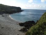 White Beach really, really is a hidden gem. By that, I mean it is really, really well hidden. Dinner plate pebbles, nice picnics, CRAZY HORSES and some pretty good fishing.
Never EVER Stop Chasing Your Dreams.

ANGLESEY
MONOPOLY


© Copyright William Gerwyn Anglesey-Hidden-Gem.com 2009-2023
© Copyright William Gerwyn Anglesey-Hidden-Gem.com 2009-2023